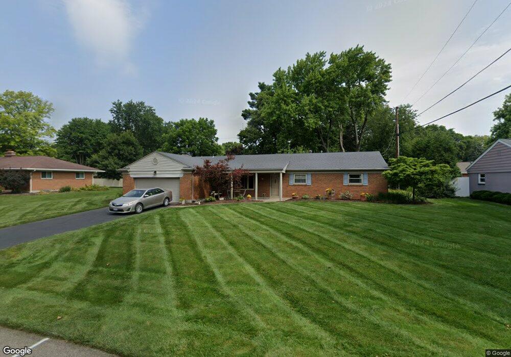
111 Ashford Dr Dayton, OH 45459
Woodbourne-Hyde Park NeighborhoodEstimated Value: $305,000 - $330,000
3
Beds
3
Baths
1,763
Sq Ft
$179/Sq Ft
Est. Value
About This Home
This home is located at 111 Ashford Dr, Dayton, OH 45459 and is currently estimated at $315,376, approximately $178 per square foot. 111 Ashford Dr is a home located in Montgomery County with nearby schools including Primary Village North, John Hole Elementary, and Hadley E Watts Middle School.
Ownership History
Date
Name
Owned For
Owner Type
Purchase Details
Closed on
Apr 25, 1997
Sold by
Thompson Ann Watson
Bought by
Delk Susan M
Current Estimated Value
Purchase Details
Closed on
Jan 29, 1997
Sold by
Holland Charlotte L
Bought by
Thompson Ann Watson
Create a Home Valuation Report for This Property
The Home Valuation Report is an in-depth analysis detailing your home's value as well as a comparison with similar homes in the area
Home Values in the Area
Average Home Value in this Area
Purchase History
| Date | Buyer | Sale Price | Title Company |
|---|---|---|---|
| Delk Susan M | $109,500 | Midwest Abstract Company | |
| Thompson Ann Watson | $115,000 | -- |
Source: Public Records
Tax History Compared to Growth
Tax History
| Year | Tax Paid | Tax Assessment Tax Assessment Total Assessment is a certain percentage of the fair market value that is determined by local assessors to be the total taxable value of land and additions on the property. | Land | Improvement |
|---|---|---|---|---|
| 2024 | $5,398 | $87,540 | $14,830 | $72,710 |
| 2023 | $5,398 | $87,540 | $14,830 | $72,710 |
| 2022 | $4,910 | $62,980 | $10,670 | $52,310 |
| 2021 | $4,924 | $62,980 | $10,670 | $52,310 |
| 2020 | $4,917 | $62,980 | $10,670 | $52,310 |
| 2019 | $4,553 | $52,100 | $10,670 | $41,430 |
| 2018 | $4,067 | $52,100 | $10,670 | $41,430 |
| 2017 | $4,024 | $52,100 | $10,670 | $41,430 |
| 2016 | $3,967 | $48,410 | $10,670 | $37,740 |
| 2015 | $3,903 | $48,410 | $10,670 | $37,740 |
| 2014 | $3,903 | $48,410 | $10,670 | $37,740 |
| 2012 | -- | $43,740 | $10,770 | $32,970 |
Source: Public Records
Map
Nearby Homes
- 129 Lamp Lighter Trail
- 160 Ashford Dr
- 187 Cheltenham Dr
- 190 Winchcombe Dr
- 152 Cheltenham Dr
- 341 Cardigan Rd
- 40 Nicholson Ct Unit 4
- 24 Nicholson Ct Unit 10
- 5416 Landau Dr Unit 7
- 5416 Landau Dr Unit 5
- 5380 Landau Dr Unit 40
- 5328 Landau Dr Unit 49
- 5328 Landau Dr
- 215 Colonial Ln
- 5016 Far Hills Ave
- 194 Brookmount Rd
- 5290 Wheaton St
- 101 Enid Ave
- 321 Princewood Ave
- 4824 Far Hills Ave
- 121 Ashford Dr
- 101 Ashford Dr
- 120 Cardigan Rd
- 100 Cardigan Rd
- 140 Cardigan Rd
- 110 Ashford Dr
- 100 Ashford Dr
- 120 Ashford Dr
- 131 Ashford Dr
- 130 Ashford Dr
- 119 Cardigan Rd
- 5620 Waterloo Rd
- 160 Cardigan Rd
- 5645 Waterloo Rd
- 139 Cardigan Rd
- 5610 Waterloo Rd
- 5630 Waterloo Rd
- 101 Cardigan Rd
- 141 Ashford Dr
- 109 Winchcombe Dr