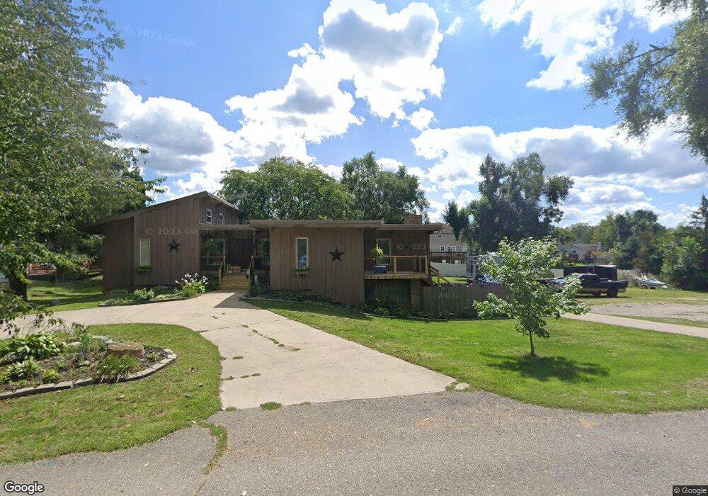
111 Bingham Dr Unit BINGHAM DR Brooklyn, MI 49230
Estimated Value: $290,000 - $462,000
3
Beds
2
Baths
1,877
Sq Ft
$188/Sq Ft
Est. Value
About This Home
This home is located at 111 Bingham Dr Unit BINGHAM DR, Brooklyn, MI 49230 and is currently estimated at $352,837, approximately $187 per square foot. 111 Bingham Dr Unit BINGHAM DR is a home located in Jackson County with nearby schools including Columbia Lower Elementary School, Columbia Upper Elementary School, and Columbia Central Jr./Sr. High School.
Ownership History
Date
Name
Owned For
Owner Type
Purchase Details
Closed on
Jan 14, 2016
Sold by
Colson Investments Llc
Bought by
Horton Scott and Horton Denise
Current Estimated Value
Purchase Details
Closed on
May 16, 2014
Sold by
Lrc Investments Llc
Bought by
Horton Scott
Home Financials for this Owner
Home Financials are based on the most recent Mortgage that was taken out on this home.
Original Mortgage
$171,830
Interest Rate
4.34%
Mortgage Type
FHA
Purchase Details
Closed on
Dec 17, 2013
Sold by
Lrc Investments Llc
Bought by
Lrc Investments Llc and Colson Investment Llc
Purchase Details
Closed on
Sep 25, 2012
Sold by
Bank Of America Na
Bought by
Federal National Mortgage Association
Create a Home Valuation Report for This Property
The Home Valuation Report is an in-depth analysis detailing your home's value as well as a comparison with similar homes in the area
Purchase History
| Date | Buyer | Sale Price | Title Company |
|---|---|---|---|
| Horton Scott | $6,250 | Bell Title Company | |
| Horton Scott | $175,000 | Land Title | |
| Lrc Investments Llc | -- | Land Title Agency | |
| Federal National Mortgage Association | -- | None Available |
Source: Public Records
Mortgage History
| Date | Status | Borrower | Loan Amount |
|---|---|---|---|
| Previous Owner | Horton Scott | $171,830 |
Source: Public Records
Tax History Compared to Growth
Tax History
| Year | Tax Paid | Tax Assessment Tax Assessment Total Assessment is a certain percentage of the fair market value that is determined by local assessors to be the total taxable value of land and additions on the property. | Land | Improvement |
|---|---|---|---|---|
| 2025 | $2,531 | $137,300 | $0 | $0 |
| 2024 | $17 | $131,400 | $0 | $0 |
| 2023 | $1,580 | $119,200 | $0 | $0 |
| 2022 | $2,297 | $104,200 | $0 | $0 |
| 2021 | $2,268 | $100,000 | $0 | $0 |
| 2020 | $2,243 | $98,000 | $0 | $0 |
| 2019 | $2,188 | $83,100 | $0 | $0 |
| 2018 | $2,139 | $78,600 | $0 | $0 |
| 2017 | $2,028 | $76,500 | $0 | $0 |
Source: Public Records
Map
Nearby Homes
- VL Carlysle Dr
- 000 Hewitt Rd
- 133 Bingham Dr
- 224 Ambler Dr
- 207 Ambler Dr
- VL Kirkley Dr
- 200 Barbara Dr
- 0 Lot 44 & 45 Wilkshire Dr Unit 25044305
- 99 Nottingham Dr
- 119 Nottingham Dr
- 112 Abbott Ln
- 227 Riviera Dr
- 154 Golfview Dr
- 0 Cement City Rd Unit 50195056
- 6416 Kelley Rd
- 7943 Cement City Rd
- 6770 Cement City Rd
- 2217 Shady Ln
- 12695 Dearmyer Rd
- 215 Somerset Dr
- 111 Bingham Dr
- 109 Bingham Dr
- 115 Bingham Dr
- 106 Andover Ln
- 106 Andover Ln Unit ANDOVER LN
- 119 Bingham Dr
- 108 Andover Ln
- 103 Carlysle Dr
- 646 Po Box
- 118 Bingham Dr
- 111 Hawthorne Dr
- 103 Andover Ln
- 113 Hawthorne Dr
- 105 Carlysle Dr
- 109 Hawthorne Dr
- 107 Hawthorne Dr
- 115 Hawthorne Dr
- 120 Bingham Dr
- 109 Andover Ln
- 107 Lot 254 Carlysle