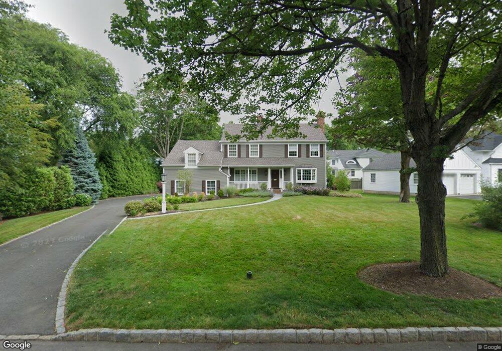
111 Blackburn Rd Summit, NJ 07901
Estimated Value: $1,384,000 - $2,295,000
Studio
--
Bath
2,628
Sq Ft
$720/Sq Ft
Est. Value
About This Home
This home is located at 111 Blackburn Rd, Summit, NJ 07901 and is currently estimated at $1,891,528, approximately $719 per square foot. 111 Blackburn Rd is a home located in Union County with nearby schools including L C Johnson Summit Middle School, Summit Sr High School, and Oak Knoll School of the Holy Child.
Ownership History
Date
Name
Owned For
Owner Type
Purchase Details
Closed on
May 30, 2013
Sold by
Kennedy Timothy H and Kennedy Deborah A
Bought by
Kennedy Deborah A
Current Estimated Value
Home Financials for this Owner
Home Financials are based on the most recent Mortgage that was taken out on this home.
Original Mortgage
$600,000
Interest Rate
3.25%
Mortgage Type
Adjustable Rate Mortgage/ARM
Create a Home Valuation Report for This Property
The Home Valuation Report is an in-depth analysis detailing your home's value as well as a comparison with similar homes in the area
Home Values in the Area
Average Home Value in this Area
Purchase History
| Date | Buyer | Sale Price | Title Company |
|---|---|---|---|
| Kennedy Deborah A | -- | None Available |
Source: Public Records
Mortgage History
| Date | Status | Borrower | Loan Amount |
|---|---|---|---|
| Previous Owner | Kennedy Deborah A | $600,000 |
Source: Public Records
Tax History
| Year | Tax Paid | Tax Assessment Tax Assessment Total Assessment is a certain percentage of the fair market value that is determined by local assessors to be the total taxable value of land and additions on the property. | Land | Improvement |
|---|---|---|---|---|
| 2025 | $25,744 | $591,000 | $224,200 | $366,800 |
| 2024 | $25,573 | $591,000 | $224,200 | $366,800 |
| 2023 | $25,573 | $591,000 | $224,200 | $366,800 |
| 2022 | $25,313 | $591,000 | $224,200 | $366,800 |
| 2021 | $25,513 | $591,000 | $224,200 | $366,800 |
| 2020 | $25,768 | $591,000 | $224,200 | $366,800 |
| 2019 | $25,797 | $591,000 | $224,200 | $366,800 |
| 2018 | $25,632 | $591,000 | $224,200 | $366,800 |
| 2017 | $25,260 | $578,700 | $224,200 | $354,500 |
| 2016 | $24,890 | $578,700 | $224,200 | $354,500 |
| 2015 | $24,404 | $578,700 | $224,200 | $354,500 |
| 2014 | $23,773 | $567,100 | $224,200 | $342,900 |
Source: Public Records
Map
Nearby Homes
- 709 Springfield Ave Unit One
- 709 Springfield Ave Unit 4
- 709 Springfield Ave Unit 2
- 709 Springfield Ave Unit 3
- 4 Parkview Terrace
- 67 Tulip St
- 61 Tulip St
- 64 Tulip St
- 105 Larned Rd
- 40 Prospect St
- 25 Division Ave
- 69 Elm St
- 62 Mountain Ave
- 22 Brook Hollow Ln
- 20 Pittsford Way
- 49 Norwood Ave
- 25 Bedford Rd
- 11 Mount Vernon Ave
- 65 Seven Oaks Dr
- 1 Irving Place
- 115 Blackburn Rd
- 42 Blackburn Place
- 51 Pine Grove Ave
- 36 Blackburn Place
- 44 Blackburn Place
- 119 Blackburn Rd
- 2 Colt Rd
- 38 Blackburn Place
- 46 Blackburn Place
- 65 Pine Grove Ave
- 123 Blackburn Rd
- 1 Colt Rd
- 4 Colt Rd
- 101 Blackburn Rd
- 125 Blackburn Rd
- 52 Blackburn Place
- 42 Pine Grove Ave
- 41 Blackburn Place
- 69 Pine Grove Ave
- 45 Blackburn Place
Your Personal Tour Guide
Ask me questions while you tour the home.