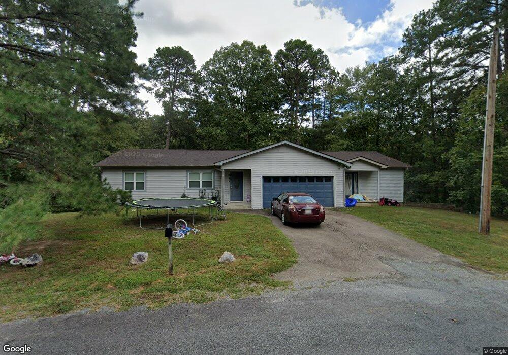
111 Cedar Hill Dr Hot Springs National Park, AR 71913
Estimated Value: $243,000 - $327,000
--
Bed
2
Baths
2,039
Sq Ft
$134/Sq Ft
Est. Value
About This Home
This home is located at 111 Cedar Hill Dr, Hot Springs National Park, AR 71913 and is currently estimated at $273,091, approximately $133 per square foot. 111 Cedar Hill Dr is a home located in Hot Spring County with nearby schools including Malvern Elementary School, Wilson Intermediate School, and Malvern Junior High School.
Ownership History
Date
Name
Owned For
Owner Type
Purchase Details
Closed on
Sep 28, 2021
Sold by
Teresa Pilcher
Bought by
Smith Turner Tie Co Llc
Current Estimated Value
Purchase Details
Closed on
Nov 3, 1995
Bought by
Mcka Billy W
Purchase Details
Closed on
Sep 27, 1994
Bought by
Golf Lakes Builders
Create a Home Valuation Report for This Property
The Home Valuation Report is an in-depth analysis detailing your home's value as well as a comparison with similar homes in the area
Home Values in the Area
Average Home Value in this Area
Purchase History
| Date | Buyer | Sale Price | Title Company |
|---|---|---|---|
| Smith Turner Tie Co Llc | $100,000 | None Listed On Document | |
| Tucker Lumber Co Llc | $100,000 | None Listed On Document | |
| Mcka Billy W | $75,000 | -- | |
| Golf Lakes Builders | $50,000 | -- |
Source: Public Records
Mortgage History
| Date | Status | Borrower | Loan Amount |
|---|---|---|---|
| Previous Owner | Golf Lakes Builders | $0 | |
| Previous Owner | Golf Lakes Builders | $0 |
Source: Public Records
Tax History Compared to Growth
Tax History
| Year | Tax Paid | Tax Assessment Tax Assessment Total Assessment is a certain percentage of the fair market value that is determined by local assessors to be the total taxable value of land and additions on the property. | Land | Improvement |
|---|---|---|---|---|
| 2025 | $1,520 | $30,310 | $1,600 | $28,710 |
| 2024 | $1,640 | $30,310 | $1,600 | $28,710 |
| 2023 | $1,520 | $30,310 | $1,600 | $28,710 |
| 2022 | $1,633 | $30,310 | $1,600 | $28,710 |
| 2021 | $1,563 | $30,310 | $1,600 | $28,710 |
| 2020 | $1,430 | $26,415 | $1,760 | $24,655 |
| 2019 | $1,055 | $26,415 | $1,760 | $24,655 |
| 2018 | $1,080 | $26,415 | $1,760 | $24,655 |
| 2017 | $974 | $26,415 | $1,760 | $24,655 |
| 2016 | $1,232 | $26,415 | $1,760 | $24,655 |
| 2015 | $980 | $28,520 | $1,540 | $26,980 |
| 2014 | $980 | $28,520 | $1,540 | $26,980 |
Source: Public Records
Map
Nearby Homes
- Lot 1092 Cedar Hill Dr
- 105 Flintwood Ct
- 343 Arlington Point
- 21 Springbrook Dr
- 249 Springbrook Dr
- Lot 1060 Hawaii Ct
- 1016 Arlington Point
- Lot 859 Morningside Dr
- 28 Edgemont Dr
- 28A Edgemont Dr
- lot 2993 Ivy Hill Ct
- Lot 1008 Independence Dr
- Lot 936 Angler Ct
- Lot 1132A Edgehill Ct
- lot 1152A Edgehill Ct
- Lots 552 & 553 Winterhaven Dr
- 337 Arlington Dr
- Lot 1612 Independence Dr
- Lot 825 Independence Dr
- 825 Independence Dr
- 115 Cedar Hill Dr
- 117 Cedar Hill Dr
- LOT 906 Cedar Hill Dr
- 116 Cedar Hill Dr
- 124 Kahiki Point
- 000 Cedar Hill Dr
- 112 Kahiki Point
- 0 Kahiki Point Unit 102 Makaha Pt
- 111 Flintwood Ct
- 100 Royal Trune Ct
- 123 Springbrook Dr
- 76 Morningside Dr
- Lot 58 Morningside Dr
- 58 Morningside Dr
- 344 Arlington Dr
- 101 Morningside Dr
- Lot 57 Morningside Dr
- 57 Morningside Dr
- 86 Springbrook Dr
- 97 Springbrook Dr