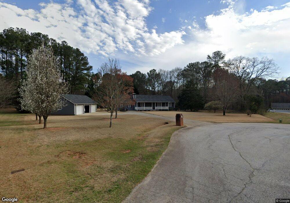
111 Cherokee Place Locust Grove, GA 30248
Estimated Value: $310,000 - $320,124
3
Beds
2
Baths
2,076
Sq Ft
$151/Sq Ft
Est. Value
About This Home
This home is located at 111 Cherokee Place, Locust Grove, GA 30248 and is currently estimated at $313,281, approximately $150 per square foot. 111 Cherokee Place is a home located in Henry County with nearby schools including New Hope Elementary School, Locust Grove Middle School, and Locust Grove High School.
Ownership History
Date
Name
Owned For
Owner Type
Purchase Details
Closed on
Jul 18, 2003
Sold by
Pate James G
Bought by
Shockley Joseph D and Shockley Paula
Current Estimated Value
Home Financials for this Owner
Home Financials are based on the most recent Mortgage that was taken out on this home.
Original Mortgage
$114,800
Outstanding Balance
$48,476
Interest Rate
5.17%
Mortgage Type
New Conventional
Estimated Equity
$264,805
Purchase Details
Closed on
Feb 28, 1994
Sold by
Read T Paul and Read Angela K
Bought by
Pate James G
Home Financials for this Owner
Home Financials are based on the most recent Mortgage that was taken out on this home.
Original Mortgage
$77,713
Interest Rate
7.04%
Mortgage Type
FHA
Create a Home Valuation Report for This Property
The Home Valuation Report is an in-depth analysis detailing your home's value as well as a comparison with similar homes in the area
Home Values in the Area
Average Home Value in this Area
Purchase History
| Date | Buyer | Sale Price | Title Company |
|---|---|---|---|
| Shockley Joseph D | $143,500 | -- | |
| Pate James G | $78,900 | -- |
Source: Public Records
Mortgage History
| Date | Status | Borrower | Loan Amount |
|---|---|---|---|
| Open | Shockley Joseph D | $114,800 | |
| Previous Owner | Pate James G | $77,713 |
Source: Public Records
Tax History Compared to Growth
Tax History
| Year | Tax Paid | Tax Assessment Tax Assessment Total Assessment is a certain percentage of the fair market value that is determined by local assessors to be the total taxable value of land and additions on the property. | Land | Improvement |
|---|---|---|---|---|
| 2025 | $1,014 | $133,712 | $16,000 | $117,712 |
| 2024 | $1,014 | $129,120 | $16,000 | $113,120 |
| 2023 | $1,366 | $128,320 | $14,800 | $113,520 |
| 2022 | $1,363 | $106,560 | $14,800 | $91,760 |
| 2021 | $864 | $86,400 | $14,800 | $71,600 |
| 2020 | $2,476 | $76,760 | $12,000 | $64,760 |
| 2019 | $2,402 | $73,760 | $12,000 | $61,760 |
| 2018 | $2,289 | $69,040 | $10,800 | $58,240 |
| 2016 | $2,005 | $57,600 | $10,000 | $47,600 |
| 2015 | $1,886 | $53,080 | $10,000 | $43,080 |
| 2014 | $1,757 | $49,400 | $10,000 | $39,400 |
Source: Public Records
Map
Nearby Homes
- 121, 125, 129 Case Dr
- 1126 Old Jackson Rd
- 995 Old Jackson Rd
- 281 Laney Dr
- 100 Harbin Trail
- 215 Laney Rd
- 143 Kimbell Farm Dr
- 767 Old Jackson Rd
- 125 Laney Ct
- 705 S Bethany Rd
- 175 Laney Ct Unit 1
- 125 Karen Dr
- 218 Baxter Ln
- 225 Laney Ct
- 521 Deadwood Trail
- 601 Amerigo Ct
- S S Laney Rd
- 151 River Park Cir
- 1000 Coan Dr
- 461 Old Jackson Rd
- 115 Cherokee Place
- 95 Creek Dr
- 1030 Old Jackson Rd
- 110 Cherokee Place
- 20 Apache Ct
- 1040 Old Jackson Rd
- 105 Creek Dr
- 98 Cherokee Place
- 100 Cherokee Place
- 1050 Old Jackson Rd
- 117 Case Dr
- 0 Apache Ct Unit 7087315
- 0 Apache Ct Unit 7037147
- 0 Apache Ct
- 990 Old Jackson Rd
- 113 Case Dr
- 100 Creek Dr
- 0 Creek Dr Unit 8658430
- 0 Creek Dr Unit 9069883
- 109 Case Dr