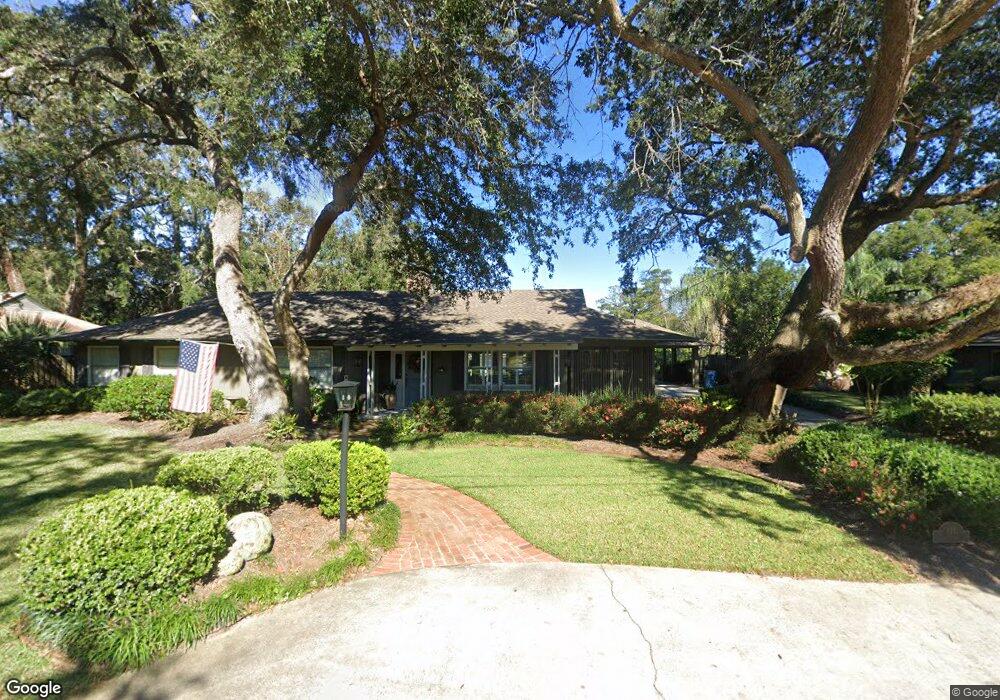
111 Coke St Saint Simons Island, GA 31522
Estimated Value: $779,000 - $1,123,000
3
Beds
3
Baths
2,940
Sq Ft
$321/Sq Ft
Est. Value
About This Home
This home is located at 111 Coke St, Saint Simons Island, GA 31522 and is currently estimated at $944,565, approximately $321 per square foot. 111 Coke St is a home located in Glynn County with nearby schools including St. Simons Elementary School, Glynn Middle School, and Glynn Academy.
Ownership History
Date
Name
Owned For
Owner Type
Purchase Details
Closed on
Oct 11, 2011
Sold by
Holland Robert M
Bought by
Temples Emmy Parker
Current Estimated Value
Home Financials for this Owner
Home Financials are based on the most recent Mortgage that was taken out on this home.
Original Mortgage
$494,097
Outstanding Balance
$340,226
Interest Rate
4.3%
Mortgage Type
New Conventional
Estimated Equity
$604,339
Purchase Details
Closed on
Aug 1, 2006
Sold by
Langston James Polk
Bought by
Holland Robert M and Sumner Sherril L
Create a Home Valuation Report for This Property
The Home Valuation Report is an in-depth analysis detailing your home's value as well as a comparison with similar homes in the area
Home Values in the Area
Average Home Value in this Area
Purchase History
| Date | Buyer | Sale Price | Title Company |
|---|---|---|---|
| Temples Emmy Parker | $440,000 | -- | |
| Holland Robert M | $400,000 | -- |
Source: Public Records
Mortgage History
| Date | Status | Borrower | Loan Amount |
|---|---|---|---|
| Open | Temples Emmy Parker | $494,097 | |
| Closed | Holland Robert M | $0 |
Source: Public Records
Tax History Compared to Growth
Tax History
| Year | Tax Paid | Tax Assessment Tax Assessment Total Assessment is a certain percentage of the fair market value that is determined by local assessors to be the total taxable value of land and additions on the property. | Land | Improvement |
|---|---|---|---|---|
| 2025 | $8,152 | $325,040 | $117,000 | $208,040 |
| 2024 | $6,233 | $248,520 | $105,320 | $143,200 |
| 2023 | $6,232 | $248,520 | $105,320 | $143,200 |
| 2022 | $6,358 | $248,520 | $105,320 | $143,200 |
| 2021 | $5,460 | $206,320 | $65,520 | $140,800 |
| 2020 | $4,472 | $166,480 | $53,840 | $112,640 |
| 2019 | $4,472 | $166,480 | $53,840 | $112,640 |
| 2018 | $4,227 | $157,120 | $44,480 | $112,640 |
| 2017 | $4,227 | $157,120 | $44,480 | $112,640 |
| 2016 | $3,445 | $138,320 | $44,480 | $93,840 |
| 2015 | $3,459 | $138,320 | $44,480 | $93,840 |
| 2014 | $3,459 | $138,320 | $44,480 | $93,840 |
Source: Public Records
Map
Nearby Homes
- 109 Ingham St
- 712 Hamilton Landing Dr
- 1301 Mariners Cir
- 804 Mariners Cir
- 1003 Mariners Cir
- 803 Mariners Cir
- 801 Mariners Cir
- 510 Mariners Cir
- 1603 Mariners Cir
- 509 Mariners Cir
- 45 Gascoigne Ave
- 105 Gascoigne Ave Unit 302
- 505 Mariners Cir
- 110 Davison Ln
- 1804 Mariners Cir
- 258 Saint James Ave
- 1907 Mariners Cir
- 303 Mariners Cir
- 105 Hawkins Island Cir
- LOT 18 Canopy Ct
- 111 Coke Street (Lakefront)
- 113 Coke St
- 112 Coke St
- 116 Coke St
- 114 Coke St
- 115 Coke St
- 109 Coke St
- 403 Whitefield Ave
- 110 Coke St
- 120 Coke St
- 104 George T Morris Cir
- 405 Whitefield Ave
- 106 George T Morris Cir
- 107 Coke St
- 117 Asbury St
- 115 Asbury St
- 303 Whitefield Ave
- 108 Coke St
- 119 Asbury St
- 407 Whitefield Ave