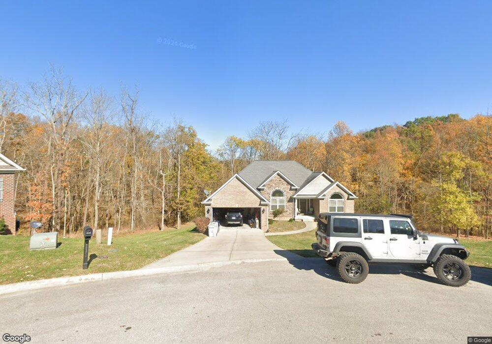
111 Doe Ct Georgetown, KY 40324
Estimated Value: $422,000 - $469,000
3
Beds
2
Baths
2,000
Sq Ft
$221/Sq Ft
Est. Value
About This Home
This home is located at 111 Doe Ct, Georgetown, KY 40324 and is currently estimated at $441,867, approximately $220 per square foot. 111 Doe Ct is a home located in Scott County with nearby schools including Northern Elementary School, Creekside Elementary School, and Royal Spring Middle School.
Ownership History
Date
Name
Owned For
Owner Type
Purchase Details
Closed on
Sep 13, 2011
Sold by
P & N Properties Llc
Bought by
Humphrey Jeffrey W and Humphrey Nicole R
Current Estimated Value
Home Financials for this Owner
Home Financials are based on the most recent Mortgage that was taken out on this home.
Original Mortgage
$243,998
Outstanding Balance
$168,202
Interest Rate
4.4%
Mortgage Type
New Conventional
Estimated Equity
$273,665
Purchase Details
Closed on
Jan 31, 2011
Sold by
Peebee Llc
Bought by
P & N Properties Llc
Create a Home Valuation Report for This Property
The Home Valuation Report is an in-depth analysis detailing your home's value as well as a comparison with similar homes in the area
Home Values in the Area
Average Home Value in this Area
Purchase History
| Date | Buyer | Sale Price | Title Company |
|---|---|---|---|
| Humphrey Jeffrey W | $287,057 | None Available | |
| P & N Properties Llc | $32,500 | None Available |
Source: Public Records
Mortgage History
| Date | Status | Borrower | Loan Amount |
|---|---|---|---|
| Open | Humphrey Jeffrey W | $243,998 |
Source: Public Records
Tax History Compared to Growth
Tax History
| Year | Tax Paid | Tax Assessment Tax Assessment Total Assessment is a certain percentage of the fair market value that is determined by local assessors to be the total taxable value of land and additions on the property. | Land | Improvement |
|---|---|---|---|---|
| 2024 | $3,041 | $338,100 | $0 | $0 |
| 2023 | $2,757 | $304,100 | $60,000 | $244,100 |
| 2022 | $2,513 | $295,600 | $35,000 | $260,600 |
| 2021 | $2,592 | $295,600 | $35,000 | $260,600 |
| 2020 | $2,466 | $287,057 | $35,000 | $252,057 |
| 2019 | $2,505 | $287,057 | $0 | $0 |
| 2018 | $2,491 | $287,057 | $0 | $0 |
| 2017 | $2,503 | $287,057 | $0 | $0 |
| 2016 | $2,311 | $287,064 | $0 | $0 |
| 2015 | $2,297 | $287,100 | $0 | $0 |
| 2014 | $2,192 | $286,900 | $0 | $0 |
| 2011 | $206 | $28,331 | $0 | $0 |
Source: Public Records
Map
Nearby Homes
- 111 Blackberry Ln
- 107 Blackberry Ln
- 115 Blackberry Ln
- 117 Blackberry Ln
- 119 Blackberry Ln
- 124 Blackberry Ridge Ct
- 121 Blackberry Ln
- 1 Mallard Point Dr
- 205 Mallard Point Ct
- 101 Sheldrake Ct
- 112 Blue Bill Ct
- 107 Pinnacle Point
- 126 Hickory Grove Ct
- 129 Hickory Grove Ct
- 105 Pinnacle Point
- 103 Pinnacle Point
- 106 Pinnacle Point
- 101 Pinnacle Point
- 122 Hickory Grove Ct
- 118 Hickory Grove Ct