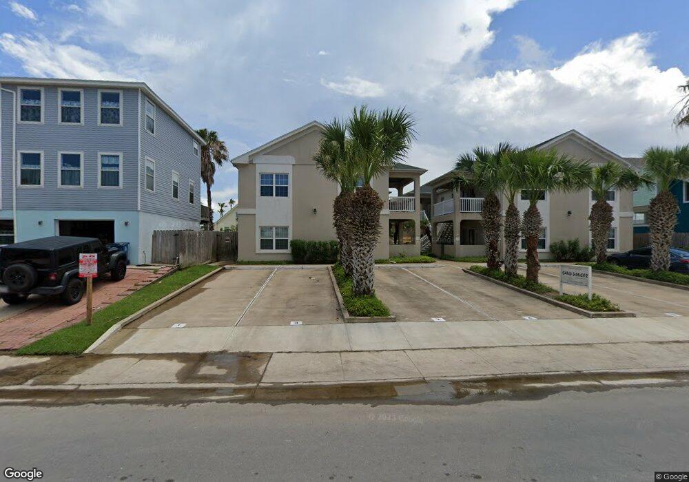
111 E Polaris Dr Unit 8 South Padre Island, TX 78597
Estimated Value: $281,655 - $349,000
2
Beds
2
Baths
882
Sq Ft
$362/Sq Ft
Est. Value
About This Home
This home is located at 111 E Polaris Dr Unit 8, South Padre Island, TX 78597 and is currently estimated at $319,414, approximately $362 per square foot. 111 E Polaris Dr Unit 8 is a home located in Cameron County with nearby schools including Garriga Elementary School, Derry Elementary School, and Port Isabel Junior High School.
Ownership History
Date
Name
Owned For
Owner Type
Purchase Details
Closed on
Jun 28, 2017
Sold by
Conlon Jennifer A and Gallo Guillermo F
Bought by
Barrera Arthur Richard and Barrera Joan
Current Estimated Value
Home Financials for this Owner
Home Financials are based on the most recent Mortgage that was taken out on this home.
Original Mortgage
$114,750
Outstanding Balance
$60,854
Interest Rate
4.02%
Mortgage Type
New Conventional
Estimated Equity
$258,560
Purchase Details
Closed on
Apr 6, 2004
Sold by
First Spectrum Ltd
Bought by
Conlon Jennifer A
Home Financials for this Owner
Home Financials are based on the most recent Mortgage that was taken out on this home.
Original Mortgage
$131,310
Interest Rate
5.59%
Mortgage Type
Purchase Money Mortgage
Create a Home Valuation Report for This Property
The Home Valuation Report is an in-depth analysis detailing your home's value as well as a comparison with similar homes in the area
Home Values in the Area
Average Home Value in this Area
Purchase History
| Date | Buyer | Sale Price | Title Company |
|---|---|---|---|
| Barrera Arthur Richard | -- | None Available | |
| Conlon Jennifer A | -- | Southern Texas Title Co |
Source: Public Records
Mortgage History
| Date | Status | Borrower | Loan Amount |
|---|---|---|---|
| Open | Barrera Arthur Richard | $114,750 | |
| Previous Owner | Conlon Jennifer A | $131,310 |
Source: Public Records
Tax History Compared to Growth
Tax History
| Year | Tax Paid | Tax Assessment Tax Assessment Total Assessment is a certain percentage of the fair market value that is determined by local assessors to be the total taxable value of land and additions on the property. | Land | Improvement |
|---|---|---|---|---|
| 2025 | $4,658 | $285,260 | $56,250 | $229,010 |
| 2024 | $4,658 | $285,260 | $56,250 | $229,010 |
| 2023 | $4,891 | $285,260 | $56,250 | $229,010 |
| 2022 | $4,783 | $252,402 | $43,750 | $208,652 |
| 2021 | $2,991 | $148,705 | $32,813 | $115,892 |
| 2020 | $3,036 | $149,959 | $32,813 | $117,146 |
| 2019 | $3,064 | $148,396 | $31,250 | $117,146 |
| 2018 | $3,088 | $149,650 | $31,250 | $118,400 |
| 2017 | $2,819 | $137,688 | $31,250 | $106,438 |
| 2016 | $2,842 | $138,803 | $31,250 | $107,553 |
| 2015 | $2,815 | $139,918 | $31,250 | $108,668 |
Source: Public Records
Map
Nearby Homes
- 103 E Verna Jean Dr
- 116 E Polaris Dr Unit 305
- 116 E Polaris Dr Unit 307
- 104 E Verna Jean Dr Unit 201
- 104 E Verna Jean Dr Unit 102
- 5200 Padre Blvd Unit 1-3
- 110 E Verna Jean Dr Unit 109
- 130-132 E Aries Dr Unit 19-20
- 103 E Georgia Ruth Dr
- 106 W Polaris Dr
- 102 E Capricorn Dr Unit A3
- 5100 Laguna Blvd Unit 3
- 5100 Laguna Blvd Unit 2
- 5100 Laguna Blvd Unit 4
- 5100 Laguna Blvd Unit 1
- 125 E Georgia Ruth Dr Unit 202
- 125 E Georgia Ruth Dr Unit 106F
- 125 E Georgia Ruth Dr Unit 102 B
- 125 E Georgia Ruth Dr Unit 204
- 118 E Capricorn Dr Unit 26
- 111 E Polaris Dr
- 111 E Polaris Dr Unit 2
- 111 E Polaris Dr Unit 3
- 111 E Polaris Dr Unit 6
- 111 E Polaris Dr Unit 7
- 111 E Polaris Dr Unit 1
- 104 E Polaris Dr Unit 102
- 104 E Polaris Dr Unit 5
- 104 E Polaris Dr Unit 7
- 104 E Polaris Dr
- 104 E Polaris Dr Unit 9
- 104 E Polaris Dr Unit 1
- 104 E Polaris Dr Unit 3
- 104 E Polaris Dr Unit 8
- 104 E Polaris Dr Unit 10
- 0 E Polaris Dr Unit 3 92811
- 106 E Polaris Dr
- 107 E Polaris Dr
- 0 E Polaris Dr
- 108 E Polaris Dr