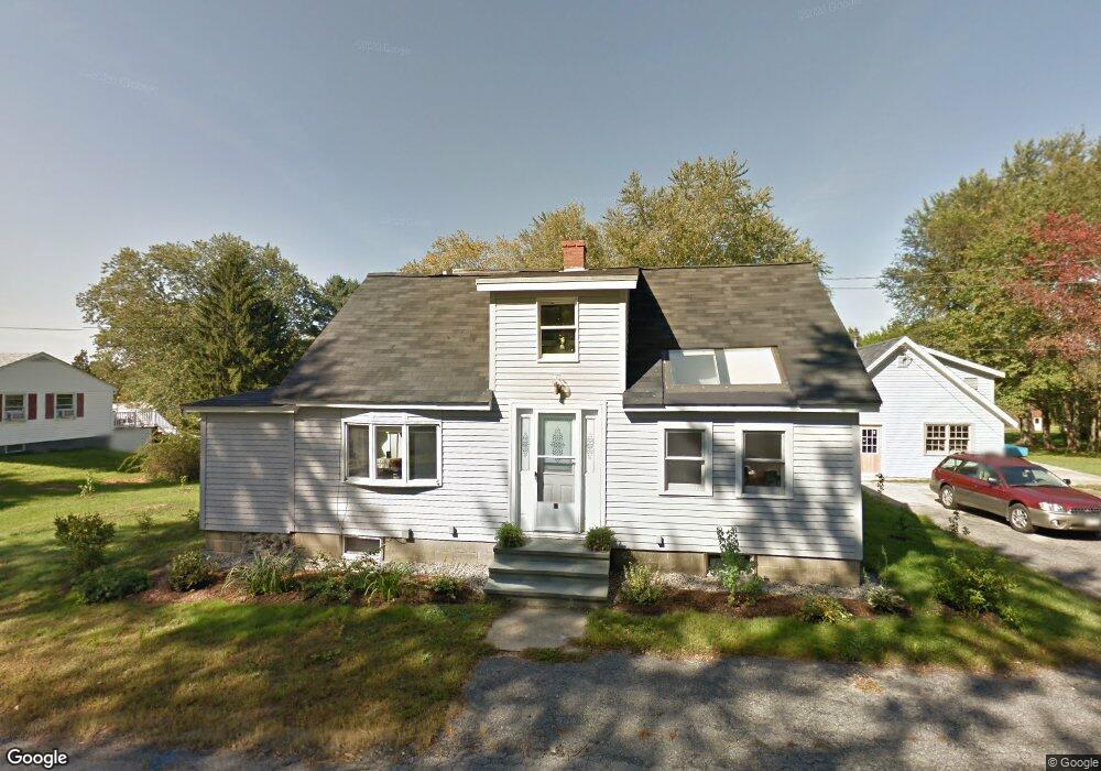
111 Fore Rd Eliot, ME 03903
South Eliot NeighborhoodEstimated Value: $494,000 - $724,000
3
Beds
2
Baths
1,972
Sq Ft
$306/Sq Ft
Est. Value
About This Home
This home is located at 111 Fore Rd, Eliot, ME 03903 and is currently estimated at $603,098, approximately $305 per square foot. 111 Fore Rd is a home located in York County with nearby schools including Marshwood High School and Seacoast Waldorf School.
Ownership History
Date
Name
Owned For
Owner Type
Purchase Details
Closed on
Apr 29, 2011
Sold by
Gorneau Gerard J
Bought by
Poulin Susan R and Carlisle Gordon B
Current Estimated Value
Home Financials for this Owner
Home Financials are based on the most recent Mortgage that was taken out on this home.
Original Mortgage
$130,000
Outstanding Balance
$89,843
Interest Rate
4.76%
Mortgage Type
Purchase Money Mortgage
Estimated Equity
$513,255
Create a Home Valuation Report for This Property
The Home Valuation Report is an in-depth analysis detailing your home's value as well as a comparison with similar homes in the area
Home Values in the Area
Average Home Value in this Area
Purchase History
| Date | Buyer | Sale Price | Title Company |
|---|---|---|---|
| Poulin Susan R | -- | -- |
Source: Public Records
Mortgage History
| Date | Status | Borrower | Loan Amount |
|---|---|---|---|
| Open | Poulin Susan R | $130,000 |
Source: Public Records
Tax History Compared to Growth
Tax History
| Year | Tax Paid | Tax Assessment Tax Assessment Total Assessment is a certain percentage of the fair market value that is determined by local assessors to be the total taxable value of land and additions on the property. | Land | Improvement |
|---|---|---|---|---|
| 2024 | $3,870 | $326,600 | $114,400 | $212,200 |
| 2023 | $3,730 | $304,500 | $108,500 | $196,000 |
| 2022 | $3,588 | $296,500 | $108,500 | $188,000 |
| 2021 | $3,476 | $281,200 | $103,600 | $177,600 |
| 2020 | $3,553 | $241,700 | $98,700 | $143,000 |
| 2019 | $3,553 | $241,700 | $98,700 | $143,000 |
| 2018 | $2,265 | $241,700 | $98,700 | $143,000 |
| 2017 | $3,456 | $241,700 | $98,700 | $143,000 |
| 2016 | $3,396 | $241,700 | $98,700 | $143,000 |
| 2015 | $3,384 | $241,700 | $98,700 | $143,000 |
| 2014 | $3,334 | $241,600 | $98,700 | $142,900 |
| 2013 | $3,182 | $241,600 | $98,700 | $142,900 |
Source: Public Records
Map
Nearby Homes
- 0 Franks Fort Island Unit 1631886
- 18 Governor Hill Rd
- 27 Wentworth Terrace
- 33 Little Bay Dr
- 956 Main St
- 18 Little Bay Dr
- 0 Cote Dr
- 1708 State Rd
- SLIP 15 Little Bay Marina
- 71 Shipwright Way
- 10 Shipwright Way
- 850 Main St
- 18 Shipping Ln
- Slip B18 Little Bay
- 708 River Rd Unit 2
- 708 River Rd Unit 3
- 41 Clearwater Dr
- TBD Cedar Rd
- 10 Pasture Hill Dr
- 8 Caslyn Dr
- 0 River Rd Unit map 51 lot 34
- 0 River Rd Unit 845555
- 0 River Rd Unit 845547
- 0 River Rd Unit 793896
- 0 River Rd Unit 721408
- 0 River Rd Unit 473835
- 0 River Rd Unit 857314
- 0 River Rd Unit 665671
- 0 River Rd Unit 916183
- 0 River Rd Unit 961604
- 0 River Rd Unit 1082051
- 0 River Rd Unit 1261744
- 0 River Rd Unit 1311875
- 0 River Rd Unit 1347651
- 0 River Rd Unit 4033571
- 0 River Rd Unit 4689473
- 0 River Rd Unit 2794719
- 0 River Rd Unit 4220048
- 0 River Rd Unit 2751836
- 105 Fore Rd