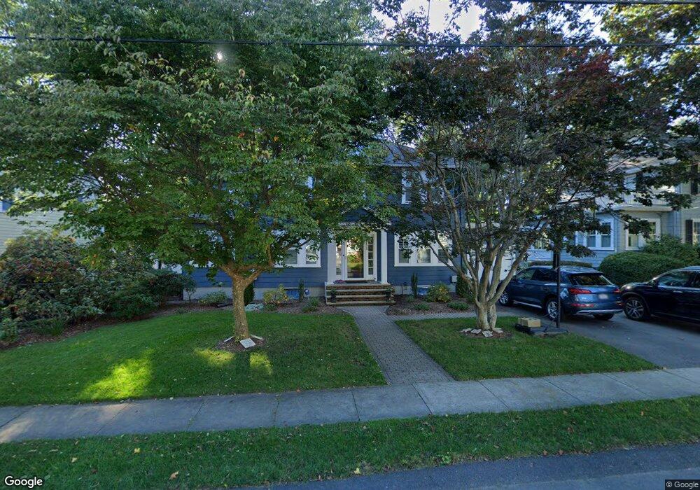
111 Hawthorn Ave Needham, MA 02492
Estimated Value: $1,551,738 - $1,707,000
4
Beds
3
Baths
2,546
Sq Ft
$631/Sq Ft
Est. Value
About This Home
This home is located at 111 Hawthorn Ave, Needham, MA 02492 and is currently estimated at $1,605,935, approximately $630 per square foot. 111 Hawthorn Ave is a home located in Norfolk County with nearby schools including Mitchell Elementary School, High Rock Middle School, and Pollard Middle School.
Ownership History
Date
Name
Owned For
Owner Type
Purchase Details
Closed on
Jul 31, 2009
Sold by
Hutcheson Joseph C and Hutcheson Karen K
Bought by
Maffeo John C and Maffeo Nicole M
Current Estimated Value
Home Financials for this Owner
Home Financials are based on the most recent Mortgage that was taken out on this home.
Original Mortgage
$615,600
Outstanding Balance
$405,855
Interest Rate
5.43%
Mortgage Type
Purchase Money Mortgage
Estimated Equity
$1,200,080
Create a Home Valuation Report for This Property
The Home Valuation Report is an in-depth analysis detailing your home's value as well as a comparison with similar homes in the area
Home Values in the Area
Average Home Value in this Area
Purchase History
We collect this data history from publicly available records. To have your information removed, we recommend requesting removal directly through your county’s website.
| Date | Buyer | Sale Price | Title Company |
|---|---|---|---|
| Maffeo John C | $769,500 | -- |
Source: Public Records
Mortgage History
We collect this data history from publicly available records. To have your information removed, we recommend requesting removal directly through your county’s website.
| Date | Status | Borrower | Loan Amount |
|---|---|---|---|
| Open | Maffeo John C | $615,600 |
Source: Public Records
Tax History
| Year | Tax Paid | Tax Assessment Tax Assessment Total Assessment is a certain percentage of the fair market value that is determined by local assessors to be the total taxable value of land and additions on the property. | Land | Improvement |
|---|---|---|---|---|
| 2025 | $13,421 | $1,266,100 | $770,700 | $495,400 |
| 2024 | $12,752 | $1,018,500 | $567,400 | $451,100 |
| 2023 | $12,778 | $979,900 | $567,400 | $412,500 |
| 2022 | $12,017 | $898,800 | $502,100 | $396,700 |
| 2021 | $11,711 | $898,800 | $502,100 | $396,700 |
| 2020 | $11,485 | $919,500 | $503,600 | $415,900 |
| 2019 | $10,515 | $848,700 | $457,800 | $390,900 |
| 2018 | $10,083 | $848,700 | $457,800 | $390,900 |
| 2017 | $9,544 | $802,700 | $457,800 | $344,900 |
| 2016 | $9,263 | $802,700 | $457,800 | $344,900 |
| 2015 | $9,062 | $802,700 | $457,800 | $344,900 |
| 2014 | $8,362 | $718,400 | $381,500 | $336,900 |
Source: Public Records
Map
Nearby Homes
- 52 Beaufort Ave
- 277 Brookline St
- 60 Tudor Rd
- 238 Harris Ave
- 22 Edwardel Rd
- 131 Fair Oaks Park
- 18 Avon Cir
- 19 Oakland Ave Unit 19
- 19 Oakland Ave
- 173 Fairfield St
- 28 Green St
- 490 Webster St
- 23 Cheney St
- 883 Greendale Ave
- 29 Parker Rd
- 969 Greendale Ave Unit 969
- 969 Greendale Ave
- 52 Longacre Rd
- 42 Woodbine Cir
- 447 Hillside Ave
- 117 Hawthorn Ave
- 105 Hawthorn Ave
- 121 Hawthorn Ave
- 99 Hawthorn Ave
- 114 Hawthorn Ave
- 57 Washington Ave
- 51 Washington Ave
- 110 Hawthorn Ave
- 25 Sargent St
- 63 Washington Ave
- 122 Hawthorn Ave
- 104 Hawthorn Ave
- 67 Washington Ave
- 93 Hawthorn Ave
- 45 Washington Ave
- 123 Beaufort Ave
- 98 Hawthorn Ave
- 115 Beaufort Ave
- 71 Washington Ave
- 133 Hawthorn Ave
Your Personal Tour Guide
Ask me questions while you tour the home.