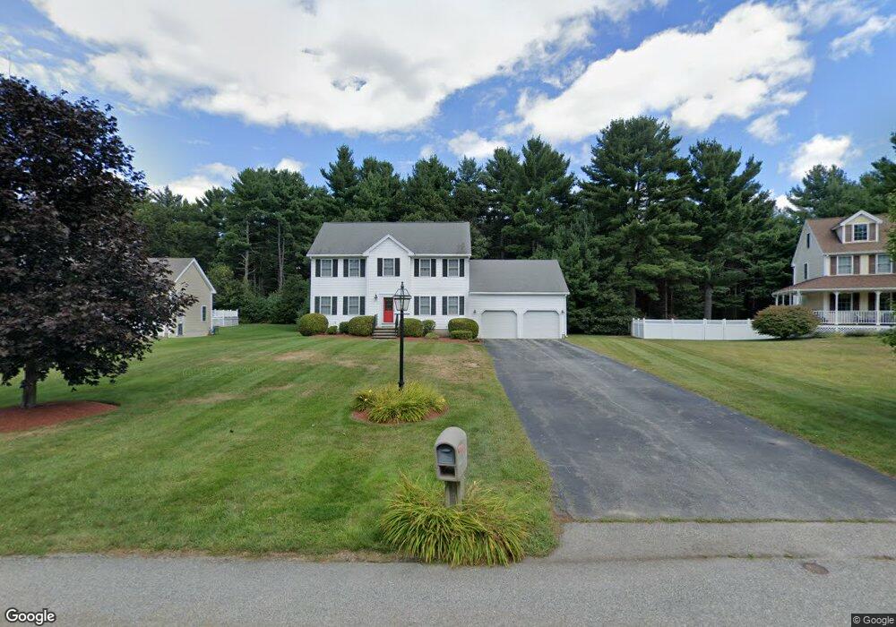
111 Jennies Way Tewksbury, MA 01876
Estimated Value: $843,130 - $888,000
3
Beds
3
Baths
2,016
Sq Ft
$432/Sq Ft
Est. Value
About This Home
This home is located at 111 Jennies Way, Tewksbury, MA 01876 and is currently estimated at $870,533, approximately $431 per square foot. 111 Jennies Way is a home located in Middlesex County with nearby schools including Heath-Brook Elementary School.
Ownership History
Date
Name
Owned For
Owner Type
Purchase Details
Closed on
Mar 10, 2000
Sold by
Concordia Homes Inc
Bought by
Kerins Robert D and Nevel Rita M
Current Estimated Value
Home Financials for this Owner
Home Financials are based on the most recent Mortgage that was taken out on this home.
Original Mortgage
$229,000
Interest Rate
8.18%
Mortgage Type
Purchase Money Mortgage
Create a Home Valuation Report for This Property
The Home Valuation Report is an in-depth analysis detailing your home's value as well as a comparison with similar homes in the area
Home Values in the Area
Average Home Value in this Area
Purchase History
| Date | Buyer | Sale Price | Title Company |
|---|---|---|---|
| Kerins Robert D | $299,000 | -- |
Source: Public Records
Mortgage History
| Date | Status | Borrower | Loan Amount |
|---|---|---|---|
| Open | Kerins Robert D | $157,163 | |
| Closed | Kerins Robert D | $229,000 | |
| Closed | Kerins Robert D | $230,000 | |
| Closed | Kerins Robert D | $229,000 |
Source: Public Records
Tax History Compared to Growth
Tax History
| Year | Tax Paid | Tax Assessment Tax Assessment Total Assessment is a certain percentage of the fair market value that is determined by local assessors to be the total taxable value of land and additions on the property. | Land | Improvement |
|---|---|---|---|---|
| 2025 | $9,496 | $718,300 | $325,700 | $392,600 |
| 2024 | $9,299 | $694,500 | $310,100 | $384,400 |
| 2023 | $9,017 | $639,500 | $281,800 | $357,700 |
| 2022 | $8,705 | $572,700 | $245,200 | $327,500 |
| 2021 | $8,501 | $540,800 | $223,200 | $317,600 |
| 2020 | $8,183 | $512,400 | $212,100 | $300,300 |
| 2019 | $7,312 | $461,600 | $201,900 | $259,700 |
| 2018 | $6,892 | $427,300 | $201,900 | $225,400 |
| 2017 | $6,902 | $423,200 | $201,900 | $221,300 |
| 2016 | $6,622 | $405,000 | $201,900 | $203,100 |
| 2015 | $6,440 | $393,400 | $198,500 | $194,900 |
| 2014 | $6,165 | $382,700 | $201,900 | $180,800 |
Source: Public Records
Map
Nearby Homes
- 93 Vale St
- 22 Carleton Rd
- 71 Apache Way Unit 71
- 177 Apache Way Unit 177
- 110 Royal Crest Cir
- 127 Caddy Ct
- 107 Eagle Dr Unit 107
- 93 Fairway Dr
- 1 Summer St
- 20 Oakland Ave
- 5 Kensington Way Unit 5
- 3 Adelman Rd
- 8 McDonald Rd
- 5 Oak St
- 16 Eagle Dr
- 12 Lockwood Rd
- 14 Regis Rd
- 15 Pinewood Rd
- 32 Decarolis Dr
- 18 Dale St Unit 4G
- 115 Jennies Way
- 109 Jennies Way
- 121 Jennies Way
- 105 Jennies Way
- 100 Jennies Way
- 110 Jennies Way
- 125 Jennies Way
- 101 Jennies Way
- 90 Jennies Way
- 99 Jennies Way
- 135 Jennies Way
- 130 Jennies Way
- 80 Jennies Way
- 70 Jennies Way
- 95 Jennies Way
- 139 Jennies Way
- 91 Jennies Way
- 60 Jennies Way
- 141 Jennies Way
- 89 Jennies Way