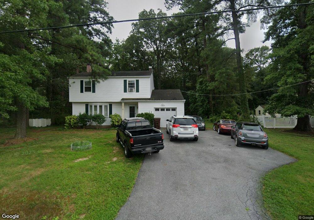
111 Kentmorr Rd Stevensville, MD 21666
Estimated Value: $404,000 - $530,000
--
Bed
3
Baths
1,588
Sq Ft
$290/Sq Ft
Est. Value
About This Home
This home is located at 111 Kentmorr Rd, Stevensville, MD 21666 and is currently estimated at $460,332, approximately $289 per square foot. 111 Kentmorr Rd is a home located in Queen Anne's County with nearby schools including Matapeake Elementary School, Matapeake Middle School, and Kent Island High School.
Ownership History
Date
Name
Owned For
Owner Type
Purchase Details
Closed on
May 30, 1984
Sold by
Henning Robert C and Henning Barbara J
Bought by
Merrell Peter W and Merrell Arlene W
Current Estimated Value
Home Financials for this Owner
Home Financials are based on the most recent Mortgage that was taken out on this home.
Original Mortgage
$73,000
Interest Rate
14.08%
Create a Home Valuation Report for This Property
The Home Valuation Report is an in-depth analysis detailing your home's value as well as a comparison with similar homes in the area
Home Values in the Area
Average Home Value in this Area
Purchase History
| Date | Buyer | Sale Price | Title Company |
|---|---|---|---|
| Merrell Peter W | $77,000 | -- |
Source: Public Records
Mortgage History
| Date | Status | Borrower | Loan Amount |
|---|---|---|---|
| Closed | Merrell Peter W | $73,000 |
Source: Public Records
Tax History Compared to Growth
Tax History
| Year | Tax Paid | Tax Assessment Tax Assessment Total Assessment is a certain percentage of the fair market value that is determined by local assessors to be the total taxable value of land and additions on the property. | Land | Improvement |
|---|---|---|---|---|
| 2025 | $2,368 | $326,800 | $0 | $0 |
| 2024 | $2,281 | $305,600 | $0 | $0 |
| 2023 | $2,214 | $284,400 | $151,500 | $132,900 |
| 2022 | $2,106 | $280,733 | $0 | $0 |
| 2021 | $2,401 | $277,067 | $0 | $0 |
| 2020 | $2,401 | $273,400 | $147,600 | $125,800 |
| 2019 | $1,892 | $251,433 | $0 | $0 |
| 2018 | $2,161 | $229,467 | $0 | $0 |
| 2017 | $2,050 | $207,500 | $0 | $0 |
| 2016 | -- | $207,500 | $0 | $0 |
| 2015 | $1,033 | $207,500 | $0 | $0 |
| 2014 | $1,033 | $231,900 | $0 | $0 |
Source: Public Records
Map
Nearby Homes
- 114 Queens Colony High Rd
- 0 Reynolds Ave
- 0 Allen Ave
- 303 Queens Colony High Rd
- 511 Chesapeake Ave
- 312 Queens Colony High Rd
- 206 Columbia Ln
- 410 5 Farms Dr
- 227 Queen Anne Club Dr
- 303 Queen Anne Club Dr
- 412 Five Farms Dr
- 312 Columbia Ln
- Lot 7 Maple Rd
- 103 Chesapeake Estates Dr
- 116 Mallard Dr
- 0 Chesapeake Estates Dr
- 122 Mallard Dr
- 100 Eareckson Ln
- 124 Eareckson Ln
- 1709 Batts Neck Rd
- 115 Kentmorr Rd
- 101 Kentmorr Rd
- 108 Kentmorr Rd
- 119 Kentmorr Rd
- 114 Kentmorr Rd
- 2702 Romancoke Rd
- 123 Kentmorr Rd
- 120 Kentmorr Rd
- 203 Kentmorr Rd
- 200 Kentmorr Rd
- 207 Kentmorr Rd
- 100 Wineland Way
- 211 Kentmorr Rd
- 101 Emory Cir
- 215 Kentmorr Rd
- 218 Kentmorr Rd
- 217 Kentmorr Rd
- 105 Emory Cir
- 104 Queens Colony High Rd
- 102 Queens Colony High Rd