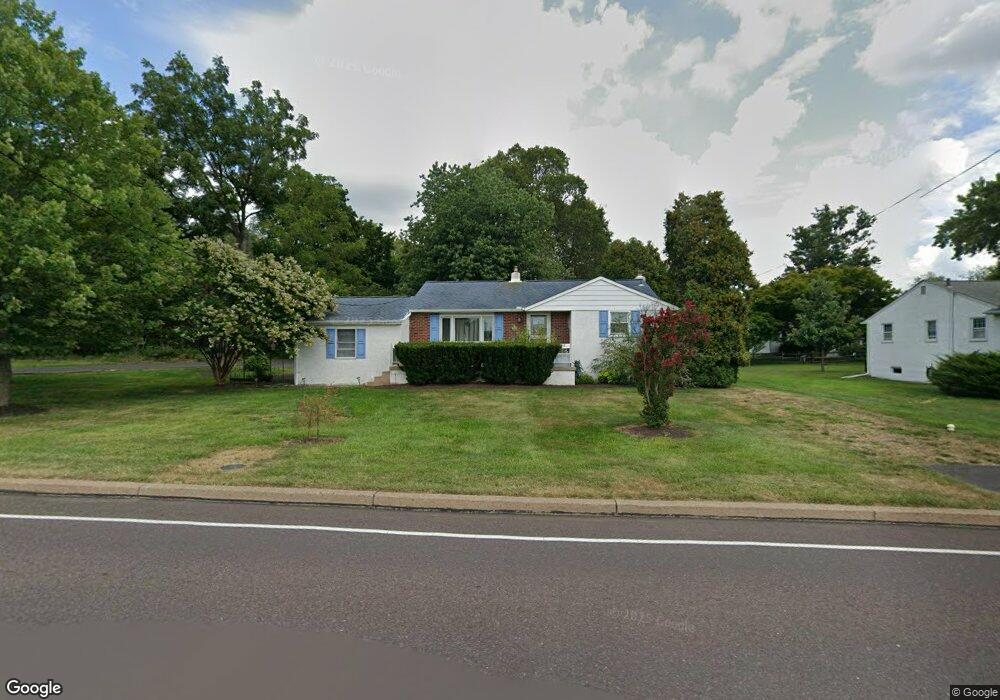
111 Knapp Rd Unit 71 Lansdale, PA 19446
Estimated Value: $432,000 - $517,000
3
Beds
2
Baths
1,551
Sq Ft
$303/Sq Ft
Est. Value
About This Home
This home is located at 111 Knapp Rd Unit 71, Lansdale, PA 19446 and is currently estimated at $470,306, approximately $303 per square foot. 111 Knapp Rd Unit 71 is a home located in Montgomery County with nearby schools including Knapp Elementary School, Penndale Middle School, and North Penn Senior High School.
Ownership History
Date
Name
Owned For
Owner Type
Purchase Details
Closed on
Mar 22, 2005
Sold by
Not Provided
Bought by
Not Provided
Current Estimated Value
Home Financials for this Owner
Home Financials are based on the most recent Mortgage that was taken out on this home.
Original Mortgage
$135,000
Interest Rate
5.64%
Mortgage Type
New Conventional
Purchase Details
Closed on
May 19, 1997
Sold by
Schroding Charles F and Schroding Doris L
Bought by
Johnson Joseph M
Create a Home Valuation Report for This Property
The Home Valuation Report is an in-depth analysis detailing your home's value as well as a comparison with similar homes in the area
Home Values in the Area
Average Home Value in this Area
Purchase History
| Date | Buyer | Sale Price | Title Company |
|---|---|---|---|
| Not Provided | -- | First American Title Ins Co | |
| Johnson Joseph M | $123,000 | -- |
Source: Public Records
Mortgage History
| Date | Status | Borrower | Loan Amount |
|---|---|---|---|
| Closed | Not Provided | $135,000 |
Source: Public Records
Tax History Compared to Growth
Tax History
| Year | Tax Paid | Tax Assessment Tax Assessment Total Assessment is a certain percentage of the fair market value that is determined by local assessors to be the total taxable value of land and additions on the property. | Land | Improvement |
|---|---|---|---|---|
| 2025 | $4,494 | $120,460 | $39,150 | $81,310 |
| 2024 | $4,494 | $120,460 | $39,150 | $81,310 |
| 2023 | $4,287 | $120,460 | $39,150 | $81,310 |
| 2022 | $4,137 | $120,460 | $39,150 | $81,310 |
| 2021 | $3,889 | $120,460 | $39,150 | $81,310 |
| 2020 | $3,787 | $120,460 | $39,150 | $81,310 |
| 2019 | $3,716 | $120,460 | $39,150 | $81,310 |
| 2018 | $599 | $120,460 | $39,150 | $81,310 |
| 2017 | $3,557 | $120,460 | $39,150 | $81,310 |
| 2016 | $3,510 | $120,460 | $39,150 | $81,310 |
| 2015 | $3,351 | $120,460 | $39,150 | $81,310 |
| 2014 | $3,351 | $120,460 | $39,150 | $81,310 |
Source: Public Records
Map
Nearby Homes
- 1014 Lansdale Ave
- 141 Wentworth Dr
- 825 Monticello Place
- 1103 Lansdale Ave
- 1114 W Thomas Rd
- 1107 Lansdale Ave
- 502 Williamsburg Rd
- 111 Country Ln
- 964 Knapp Rd
- 873 Lombardy Dr
- 323 Edgewood Ave
- 1204 Vilsmeier Rd
- 446 E Main St
- 107 David Ln
- 3103 Hemmingway Dr
- 200 E 5th St
- 130 E 5th St
- 124 E 5th St
- 235 E 2nd St
- 529 N Chestnut St
- 113 Knapp Rd
- 903 Beechwood Dr
- 115 Knapp Rd
- 905 Beechwood Dr Unit 47
- Lot3 Knapp Rd
- 106 Knapp Rd
- 909 Beechwood Dr
- 902 Beechwood Dr
- 907 Beechwood Dr
- 904 Sycamore Dr
- 647 Knoll Dr
- 626 Knapp Rd Unit 2
- 626 Knapp Rd
- 901 Lansdale Ave
- 911 Beechwood Dr
- Lot 3 Lansdale Ave
- 906 Sycamore Dr
- 905 Sycamore Dr
- 121 Knapp Rd
- 618 Knapp Rd