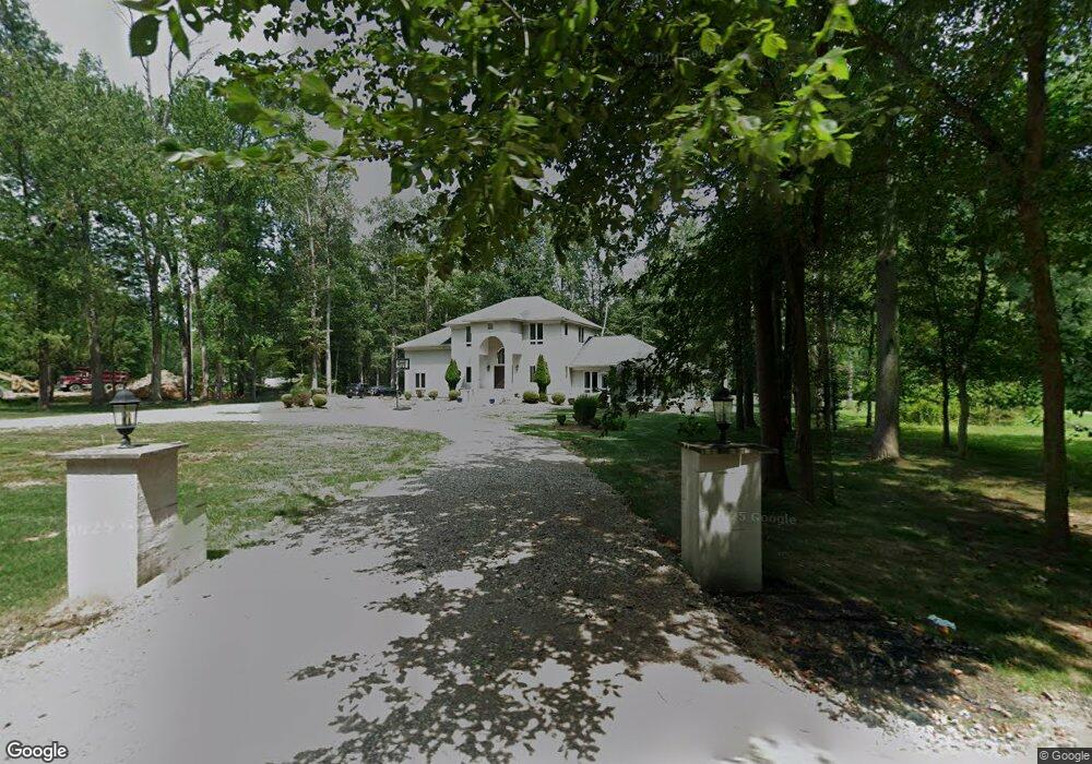
111 Major Rd Monmouth Junction, NJ 08852
Estimated Value: $816,000 - $1,253,000
5
Beds
4
Baths
3,796
Sq Ft
$274/Sq Ft
Est. Value
About This Home
This home is located at 111 Major Rd, Monmouth Junction, NJ 08852 and is currently estimated at $1,038,330, approximately $273 per square foot. 111 Major Rd is a home located in Middlesex County with nearby schools including Brooks Crossing Elementary School, Crossroads North Middle School, and South Brunswick High School.
Ownership History
Date
Name
Owned For
Owner Type
Purchase Details
Closed on
May 25, 2001
Sold by
Martin Patricia
Bought by
Syed Saeed
Current Estimated Value
Home Financials for this Owner
Home Financials are based on the most recent Mortgage that was taken out on this home.
Original Mortgage
$182,400
Outstanding Balance
$68,360
Interest Rate
7.08%
Estimated Equity
$969,970
Purchase Details
Closed on
Dec 6, 1996
Sold by
Severini Paul
Bought by
Martin Robert and Martin Patricia
Home Financials for this Owner
Home Financials are based on the most recent Mortgage that was taken out on this home.
Original Mortgage
$40,000
Interest Rate
7.83%
Create a Home Valuation Report for This Property
The Home Valuation Report is an in-depth analysis detailing your home's value as well as a comparison with similar homes in the area
Home Values in the Area
Average Home Value in this Area
Purchase History
| Date | Buyer | Sale Price | Title Company |
|---|---|---|---|
| Syed Saeed | $192,000 | -- | |
| Martin Robert | $162,500 | -- |
Source: Public Records
Mortgage History
| Date | Status | Borrower | Loan Amount |
|---|---|---|---|
| Open | Syed Saeed | $182,400 | |
| Previous Owner | Martin Robert | $40,000 |
Source: Public Records
Tax History Compared to Growth
Tax History
| Year | Tax Paid | Tax Assessment Tax Assessment Total Assessment is a certain percentage of the fair market value that is determined by local assessors to be the total taxable value of land and additions on the property. | Land | Improvement |
|---|---|---|---|---|
| 2025 | $16,028 | $296,700 | $77,400 | $219,300 |
| 2024 | $15,452 | $296,700 | $77,400 | $219,300 |
| 2023 | $15,452 | $296,700 | $77,400 | $219,300 |
| 2022 | $14,992 | $296,700 | $77,400 | $219,300 |
| 2021 | $11,539 | $296,700 | $77,400 | $219,300 |
| 2020 | $15,084 | $296,700 | $77,400 | $219,300 |
| 2019 | $15,221 | $296,700 | $77,400 | $219,300 |
| 2018 | $14,722 | $296,700 | $77,400 | $219,300 |
| 2017 | $14,701 | $296,700 | $77,400 | $219,300 |
| 2016 | $14,547 | $296,700 | $77,400 | $219,300 |
| 2015 | $14,102 | $296,700 | $77,400 | $219,300 |
| 2014 | $13,874 | $296,700 | $77,400 | $219,300 |
Source: Public Records
Map
Nearby Homes
- 147 Major Rd
- 9 Kearns Place Unit 3805
- 22 Witch Hazel Ct Unit 2
- 32 Magnolia Ct
- 586 Ridge Rd
- 209 Gambocz Ct
- 21 Regal Dr
- 6143 Cedar Ct
- 53 Regal Dr
- 15 Old Ridge Rd
- 5192 Beech Ct
- 5071 Beech Ct
- 7041 Elm Ct
- 1106 Hickory Ct
- 1111 Hickory Ct
- 1312 Juniper Ct
- 2002 Sandlewood Ct
- 4031 Bayberry Ct
- 23 Woodland Way
- 3011 Cypress Ct
- 109 Major Rd
- 119 Major Rd
- 115 Major Rd
- 121 Major Rd
- 107 Major Rd
- 147-151 Major Rd
- 0 Major Rd
- 00 Major Rd
- 106 Falcongate Dr
- 105 Falcongate Dr
- 107 Falcongate Dr
- 104 Falcongate Dr
- 103 Falcongate Dr
- 103 Falcongate Dr Unit 103
- 102 Falcongate Dr
- 108 Falcongate Dr
- 101 Falcongate Dr
- 113 Northumberland Way
- 113 Northumberland Way
- 201 Falcongate Dr