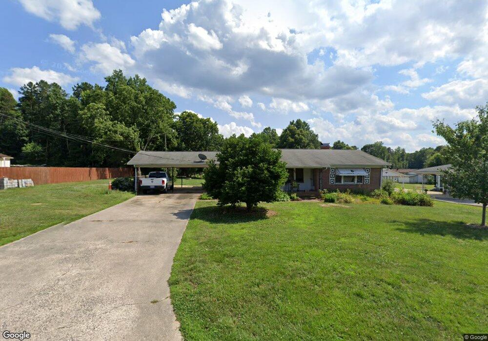
111 Maple St Locust, NC 28097
Estimated Value: $228,000 - $319,000
2
Beds
2
Baths
1,252
Sq Ft
$219/Sq Ft
Est. Value
About This Home
This home is located at 111 Maple St, Locust, NC 28097 and is currently estimated at $274,097, approximately $218 per square foot. 111 Maple St is a home located in Stanly County with nearby schools including Locust Elementary School, West Stanly Middle School, and West Stanly High School.
Ownership History
Date
Name
Owned For
Owner Type
Purchase Details
Closed on
Sep 30, 2015
Sold by
Afre 1 Llc
Bought by
Smith Stephen W and Smith Karen B
Current Estimated Value
Purchase Details
Closed on
Dec 15, 2014
Sold by
Armstrong Thomas W and Armstrong Marla J
Bought by
Afre 1 Llc and Armstrong Family Limited Liability Partn
Purchase Details
Closed on
Dec 7, 2011
Sold by
Smith Landon D and Smith Ambert N
Bought by
Smith Landon D and Estate Of Ray Lee Burris
Create a Home Valuation Report for This Property
The Home Valuation Report is an in-depth analysis detailing your home's value as well as a comparison with similar homes in the area
Home Values in the Area
Average Home Value in this Area
Purchase History
| Date | Buyer | Sale Price | Title Company |
|---|---|---|---|
| Smith Stephen W | $135,000 | Attorney | |
| Afre 1 Llc | -- | None Available | |
| Armstrong Marla J | -- | None Available | |
| Smith Landon D | $60,000 | None Available |
Source: Public Records
Tax History
| Year | Tax Paid | Tax Assessment Tax Assessment Total Assessment is a certain percentage of the fair market value that is determined by local assessors to be the total taxable value of land and additions on the property. | Land | Improvement |
|---|---|---|---|---|
| 2025 | $1,762 | $191,514 | $40,879 | $150,635 |
| 2024 | $1,141 | $104,636 | $24,155 | $80,481 |
| 2023 | $1,261 | $104,636 | $24,155 | $80,481 |
| 2022 | $1,250 | $104,636 | $24,155 | $80,481 |
| 2021 | $1,240 | $104,636 | $24,155 | $80,481 |
| 2020 | $1,117 | $89,201 | $21,182 | $68,019 |
| 2019 | $501 | $89,201 | $21,182 | $68,019 |
| 2018 | $1,008 | $89,201 | $21,182 | $68,019 |
| 2017 | $1,008 | $89,201 | $21,182 | $68,019 |
| 2016 | $936 | $82,818 | $19,696 | $63,122 |
| 2015 | $1,053 | $82,818 | $19,696 | $63,122 |
| 2014 | $1,095 | $82,818 | $19,696 | $63,122 |
Source: Public Records
Map
Nearby Homes
- 117 Danita Dr
- 117 Battery Dr
- 319 N Central Ave
- 205 Amber Glen Dr
- 201 Amber Glen Dr
- 211 Amber Glen Dr
- 217 Amber Glen Dr
- 166 Battery Dr
- 221 Amber Glen Dr
- 225 Amber Glen Dr
- 229 Amber Glen Dr
- 233 Amber Glen Dr
- 237 Amber Glen Dr
- 288 Harrison Ln
- 241 Amber Glen Dr
- 245 Amber Glen Dr
- 213 Delancy St
- 249 Amber Glen Dr
- 230 Battery Dr
- 617 Ardsley Dr
Your Personal Tour Guide
Ask me questions while you tour the home.