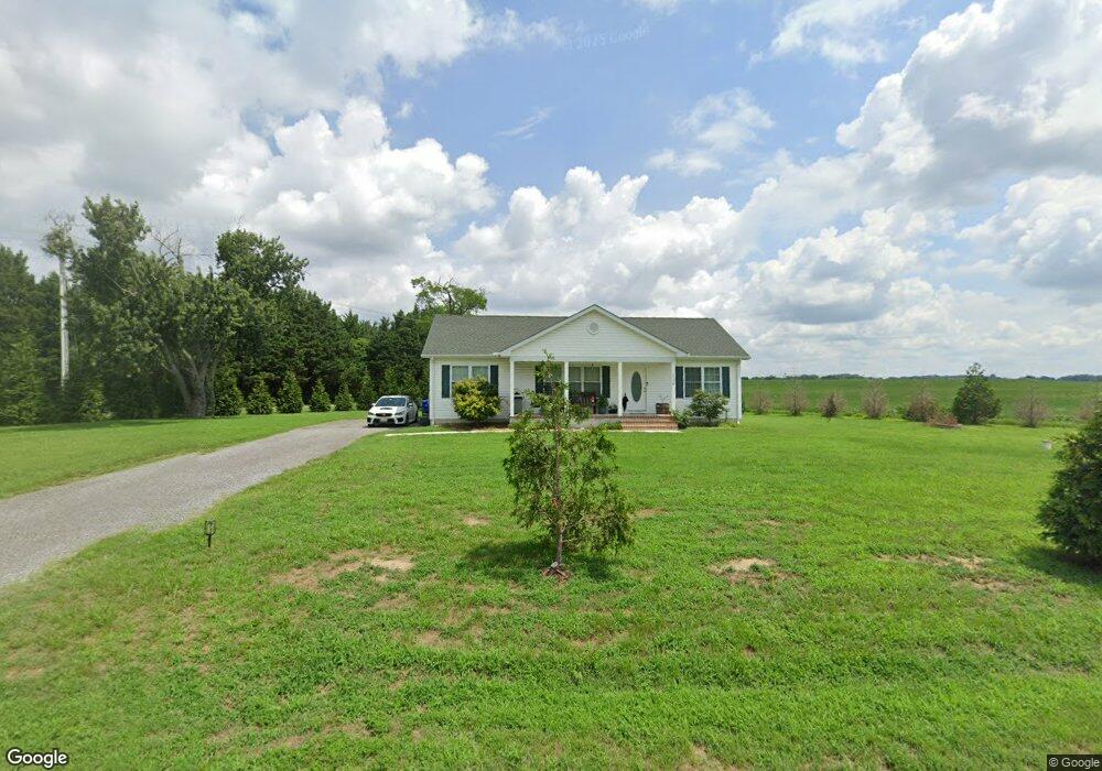
111 Mason Branch Rd Queen Anne, MD 21657
Estimated Value: $320,516 - $426,000
--
Bed
--
Bath
1,344
Sq Ft
$271/Sq Ft
Est. Value
About This Home
This home is located at 111 Mason Branch Rd, Queen Anne, MD 21657 and is currently estimated at $364,879, approximately $271 per square foot. 111 Mason Branch Rd is a home located in Queen Anne's County with nearby schools including Centreville Elementary School, Kennard Elementary School, and Centreville Middle School.
Ownership History
Date
Name
Owned For
Owner Type
Purchase Details
Closed on
Sep 30, 2020
Sold by
Borradaile Anthony E and Borradaile Daneya D
Bought by
Nicholson George
Current Estimated Value
Purchase Details
Closed on
Mar 2, 2018
Sold by
Pipes And Fins Constrction Llc
Bought by
Borradalle Anthony E and Borradalle Daney D
Home Financials for this Owner
Home Financials are based on the most recent Mortgage that was taken out on this home.
Original Mortgage
$237,405
Interest Rate
4.15%
Mortgage Type
New Conventional
Purchase Details
Closed on
Jun 30, 2016
Sold by
Dean Howard Michael
Bought by
Pipes & Fins Construction Llc
Purchase Details
Closed on
Apr 11, 2014
Sold by
Dean Howard Michael and Estate Of Aldy Dean Jr
Bought by
Dean Howard Michael
Create a Home Valuation Report for This Property
The Home Valuation Report is an in-depth analysis detailing your home's value as well as a comparison with similar homes in the area
Home Values in the Area
Average Home Value in this Area
Purchase History
| Date | Buyer | Sale Price | Title Company |
|---|---|---|---|
| Nicholson George | $265,000 | Brilliant Title | |
| Borradalle Anthony E | $249,900 | Charter Title Llc | |
| Pipes & Fins Construction Llc | $35,000 | Liberty Title & Escrow Co | |
| Dean Howard Michael | -- | None Available |
Source: Public Records
Mortgage History
| Date | Status | Borrower | Loan Amount |
|---|---|---|---|
| Previous Owner | Borradalle Anthony E | $237,405 |
Source: Public Records
Tax History Compared to Growth
Tax History
| Year | Tax Paid | Tax Assessment Tax Assessment Total Assessment is a certain percentage of the fair market value that is determined by local assessors to be the total taxable value of land and additions on the property. | Land | Improvement |
|---|---|---|---|---|
| 2025 | $2,488 | $257,800 | $87,800 | $170,000 |
| 2024 | $2,438 | $252,467 | $0 | $0 |
| 2023 | $2,388 | $247,133 | $0 | $0 |
| 2022 | $2,338 | $241,800 | $87,800 | $154,000 |
| 2021 | $2,375 | $241,367 | $0 | $0 |
| 2020 | $2,371 | $240,933 | $0 | $0 |
| 2019 | $2,307 | $240,500 | $87,800 | $152,700 |
| 2018 | $2,292 | $239,000 | $0 | $0 |
| 2017 | $1,035 | $99,200 | $0 | $0 |
| 2016 | -- | $101,700 | $0 | $0 |
| 2015 | $1,337 | $101,700 | $0 | $0 |
| 2014 | $1,337 | $101,700 | $0 | $0 |
Source: Public Records
Map
Nearby Homes
- 113 Paulowina Rd
- 408 Laurens Way
- 129 Thicket Ct
- 107 Thicket Ct
- 219 Songbird Ln
- 104 Gadd Dr
- 12615 Eveland Rd
- 0 Neighbors Rd
- 1801 Starr Rd
- 1724 Starr Rd
- 116 Pasture Ct
- Merion Plan at Meadow Creek
- Windermere Plan at Meadow Creek
- Doral Plan at Meadow Creek
- Sawgrass Plan at Meadow Creek
- Pinehurst Plan at Meadow Creek
- Congressional Plan at Meadow Creek
- 415 Twin Meadows Farm Ln
- 104 Pasture Ct
- 325 Twin Meadows Farm Ln
- 2108 Ruthsburg Rd
- 2109 Ruthsburg Rd
- 2103 Ruthsburg Rd
- 2119 Ruthsburg Rd
- 2005 Ruthsburg Rd
- 111 Jarman Branch Dr
- 115 Jarman Branch Dr
- 107 Jarman Branch Dr
- 103 Jarman Branch Dr
- 101 Jarman Branch Dr
- 119 Jarman Branch Dr
- 123 Jarman Branch Dr
- 2132 Ruthsburg Rd
- 116 Jarman Branch Dr
- 127 Jarman Branch Dr
- 112 Jarman Branch Dr
- 120 Jarman Branch Dr
- 2001 Ruthsburg Rd
- 108 Jarman Branch Dr
- 104 Jarman Branch Dr