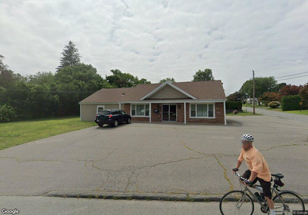
111 Middle Rd Acushnet, MA 02743
Coury Heights NeighborhoodEstimated Value: $425,424
Studio
--
Bath
2,176
Sq Ft
$196/Sq Ft
Est. Value
About This Home
This home is located at 111 Middle Rd, Acushnet, MA 02743 and is currently estimated at $425,424, approximately $195 per square foot. 111 Middle Rd is a home located in Bristol County with nearby schools including Acushnet Elementary School, Albert F Ford Middle School, and Alma del Mar Charter School.
Ownership History
Date
Name
Owned For
Owner Type
Purchase Details
Closed on
Nov 24, 2020
Sold by
Ferreira Pedro M and Ferreira Sandra
Bought by
Bar-Hai Eliav and Bar-Hai Jacquelynne
Current Estimated Value
Purchase Details
Closed on
Sep 26, 2013
Sold by
Kostka Milton W
Bought by
Ferreira Pedro M and Ferreira Sandra
Purchase Details
Closed on
Feb 23, 1993
Sold by
Alin Rt
Bought by
Kostka Milton W and Kostka Ann S
Purchase Details
Closed on
Aug 5, 1991
Sold by
Silva Isabel
Bought by
Alin Rlty Corp
Create a Home Valuation Report for This Property
The Home Valuation Report is an in-depth analysis detailing your home's value as well as a comparison with similar homes in the area
Home Values in the Area
Average Home Value in this Area
Purchase History
| Date | Buyer | Sale Price | Title Company |
|---|---|---|---|
| Bar-Hai Eliav | $300,000 | None Available | |
| Ferreira Pedro M | $155,000 | -- | |
| Kostka Milton W | $45,000 | -- | |
| Kostka Milton W | $45,000 | -- | |
| Alin Rlty Corp | $100,000 | -- | |
| Alin Rlty Corp | $100,000 | -- |
Source: Public Records
Mortgage History
| Date | Status | Borrower | Loan Amount |
|---|---|---|---|
| Previous Owner | Alin Rlty Corp | $40,000 | |
| Previous Owner | Alin Rlty Corp | $20,000 |
Source: Public Records
Tax History
| Year | Tax Paid | Tax Assessment Tax Assessment Total Assessment is a certain percentage of the fair market value that is determined by local assessors to be the total taxable value of land and additions on the property. | Land | Improvement |
|---|---|---|---|---|
| 2025 | $56 | $370,300 | $132,000 | $238,300 |
| 2024 | $5,486 | $340,100 | $124,200 | $215,900 |
| 2023 | $5,374 | $316,500 | $116,400 | $200,100 |
| 2022 | $5,094 | $296,500 | $108,700 | $187,800 |
| 2021 | $5,163 | $289,100 | $100,900 | $188,200 |
| 2020 | $5,189 | $289,100 | $100,900 | $188,200 |
| 2019 | $5,020 | $275,800 | $90,000 | $185,800 |
| 2018 | $5,045 | $272,700 | $86,900 | $185,800 |
| 2017 | $5,004 | $272,700 | $86,900 | $185,800 |
| 2016 | $4,953 | $266,300 | $85,400 | $180,900 |
| 2015 | $4,751 | $259,900 | $85,400 | $174,500 |
Source: Public Records
Map
Nearby Homes
- 27 Meadow Ln
- 23 Coury Dr
- 15 Ball St
- 7 Hamlin St
- 65 Armsby St
- 279 Adelaide St
- 1027 Kenmore St
- 1077 Shelburne St
- 2800 Acushnet Ave
- 34 Chicopee St
- 14 Caswell St
- 0 Church Dutton & Chaffee Unit 73371719
- 209 Jarry St
- 1056 Victoria St Unit A-13
- 868 Ashley Blvd
- 257 Lawrence St
- 506 Hawes St
- 23 Oliveira Ave
- 11 Boylston St
- 25 Pershing Ave
- 6 Middlefield Place
- 109 Middle Rd
- 116 Middle Rd
- 112 Middle Rd
- 3 Middlefield Place
- 5 Middlefield Place
- 11 Monmouth St
- 118 Middle Rd
- 7 Harrison St
- 123 Middle Rd
- 100 Middle Rd
- 97 Middle Rd
- 10 Middlefield Place
- 00 Middle Rd
- 5 Northfield Place
- 11 Harrison St
- 5 Charles St
- 7 Monmouth St
- 93 Middle Rd
- 2 Elwood Ln
Your Personal Tour Guide
Ask me questions while you tour the home.