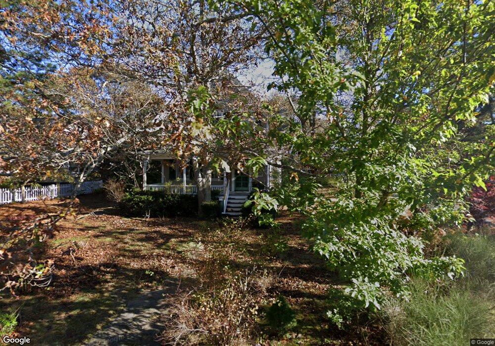
111 Munroe Ave Vineyard Haven, MA 02568
Oak Bluffs NeighborhoodEstimated Value: $1,469,000 - $1,801,000
4
Beds
2
Baths
1,751
Sq Ft
$931/Sq Ft
Est. Value
About This Home
This home is located at 111 Munroe Ave, Vineyard Haven, MA 02568 and is currently estimated at $1,629,886, approximately $930 per square foot. 111 Munroe Ave is a home located in Dukes County with nearby schools including Oak Bluffs Elementary School and Martha's Vineyard Regional High School.
Ownership History
Date
Name
Owned For
Owner Type
Purchase Details
Closed on
Dec 20, 2011
Sold by
Martha Z Bowden Lt
Bought by
Munroe Avenue Realty L
Current Estimated Value
Purchase Details
Closed on
Mar 2, 2010
Sold by
Bowden Martha Z
Bought by
Bowden Tr Martha Z and Bowden John S
Purchase Details
Closed on
Jul 24, 2003
Sold by
John F Zietlow Jr T and Moot Richard E
Bought by
Zietlow Juliet and Bowden Martha
Create a Home Valuation Report for This Property
The Home Valuation Report is an in-depth analysis detailing your home's value as well as a comparison with similar homes in the area
Home Values in the Area
Average Home Value in this Area
Purchase History
| Date | Buyer | Sale Price | Title Company |
|---|---|---|---|
| Munroe Avenue Realty L | -- | -- | |
| Bowden Tr Martha Z | -- | -- | |
| Zietlow Juliet | -- | -- |
Source: Public Records
Tax History Compared to Growth
Tax History
| Year | Tax Paid | Tax Assessment Tax Assessment Total Assessment is a certain percentage of the fair market value that is determined by local assessors to be the total taxable value of land and additions on the property. | Land | Improvement |
|---|---|---|---|---|
| 2025 | $7,955 | $1,575,300 | $917,600 | $657,700 |
| 2024 | $7,644 | $1,461,600 | $833,800 | $627,800 |
| 2023 | $6,722 | $1,273,100 | $724,900 | $548,200 |
| 2022 | $6,776 | $997,900 | $562,100 | $435,800 |
| 2021 | $6,063 | $822,600 | $425,300 | $397,300 |
| 2020 | $5,747 | $772,400 | $405,100 | $367,300 |
| 2019 | $5,751 | $747,800 | $387,700 | $360,100 |
| 2018 | $5,691 | $726,800 | $383,300 | $343,500 |
| 2017 | $5,547 | $680,600 | $373,100 | $307,500 |
| 2016 | $5,349 | $659,500 | $384,700 | $274,800 |
| 2015 | $5,046 | $633,900 | $384,700 | $249,200 |
| 2014 | $5,393 | $690,500 | $395,000 | $295,500 |
Source: Public Records
Map
Nearby Homes
- 6 Brewster Ave
- 16 Atlantic Ave
- 150 E Chop Dr
- 311 E Chop Dr
- 17 John Wesley Ave
- 71 Netock Ave
- 47 E Chop Dr Unit 4
- 47 E Chop Dr Unit 2
- 47 E Chop Dr Unit 3
- 47 E Chop Dr Unit 1
- 47 E Chop Dr
- 47 E Chop Dr Unit 5
- 47 E East Chop Dr Unit 5
- 5 Temahigan Ave Unit 4-139-0
- 12 & 14 Maple Ave
- 23 Laurel Ave
- 47 Winemack St
- 25 Hampson Ave
- 113 Munroe Ave
- 15 Green Ave
- 15 Green Ave
- 25 & 27 Lexington Ave
- 117 Munroe Ave
- 120 Munroe Ave
- 66 Brewster Ave
- 21 Lexington Ave
- 25 & 27 Lexington Ave
- 25 Lexington Ave
- 104 Munroe Ave
- 125 Munroe Ave
- 99 Munroe Ave
- 15 Lexington Ave
- 100 Munroe Ave
- 28 Atlantic Ave
- 67 Madison Ave
- 23 Green Ave
- 25 Green Ave
- 22 Atlantic Ave