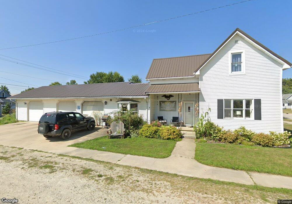
111 N Jay St Rockford, OH 45882
Estimated Value: $112,000 - $175,000
3
Beds
1
Bath
1,254
Sq Ft
$119/Sq Ft
Est. Value
About This Home
This home is located at 111 N Jay St, Rockford, OH 45882 and is currently estimated at $149,670, approximately $119 per square foot. 111 N Jay St is a home located in Mercer County with nearby schools including Parkway Elementary School, Parkway Middle School, and Parkway High School.
Ownership History
Date
Name
Owned For
Owner Type
Purchase Details
Closed on
Apr 10, 2017
Sold by
Hensley James E and Hensley Elizabeth A
Bought by
Hensley Elizabeth A
Current Estimated Value
Home Financials for this Owner
Home Financials are based on the most recent Mortgage that was taken out on this home.
Original Mortgage
$60,541
Outstanding Balance
$50,005
Interest Rate
4.37%
Mortgage Type
FHA
Estimated Equity
$99,665
Purchase Details
Closed on
Jan 17, 2014
Sold by
Vanatta Deborah
Bought by
Hensley James E and Hensley Elizabeth A
Purchase Details
Closed on
Mar 2, 2012
Sold by
Estate Of Robert S Graham
Bought by
Graham Carol A
Create a Home Valuation Report for This Property
The Home Valuation Report is an in-depth analysis detailing your home's value as well as a comparison with similar homes in the area
Purchase History
| Date | Buyer | Sale Price | Title Company |
|---|---|---|---|
| Hensley Elizabeth A | -- | None Available | |
| Hensley James E | $37,120 | Attorney | |
| Graham Carol A | -- | None Available |
Source: Public Records
Mortgage History
| Date | Status | Borrower | Loan Amount |
|---|---|---|---|
| Open | Hensley Elizabeth A | $60,541 |
Source: Public Records
Tax History
| Year | Tax Paid | Tax Assessment Tax Assessment Total Assessment is a certain percentage of the fair market value that is determined by local assessors to be the total taxable value of land and additions on the property. | Land | Improvement |
|---|---|---|---|---|
| 2025 | $1,482 | $41,930 | $7,070 | $34,860 |
| 2024 | $1,484 | $41,930 | $7,070 | $34,860 |
| 2023 | $1,482 | $41,930 | $7,070 | $34,860 |
| 2022 | $1,413 | $32,210 | $5,360 | $26,850 |
| 2021 | $1,396 | $32,310 | $5,360 | $26,950 |
| 2020 | $708 | $32,310 | $5,360 | $26,950 |
| 2019 | $1,094 | $25,870 | $4,550 | $21,320 |
| 2018 | $1,069 | $25,870 | $4,550 | $21,320 |
| 2017 | $1,004 | $25,870 | $4,550 | $21,320 |
| 2016 | $939 | $24,150 | $4,410 | $19,740 |
| 2015 | $897 | $23,280 | $4,410 | $18,870 |
| 2014 | $921 | $23,280 | $4,410 | $18,870 |
| 2013 | $1,054 | $25,310 | $4,800 | $20,510 |
Source: Public Records
Map
Nearby Homes
- 205 Market St
- 306 Front St
- 208 Market St
- 7957 W Bridge St
- 103 Wayne St
- 311 S Main St
- 0 Rockford West Rd Unit Lots 14- 28
- 3579 Rockford West Rd
- 0 Wilson Unit 1037059
- 0 Wilson Unit 306333
- 11164 Erastus Durbin Rd
- 0 Mercer van Wert County Line Rd
- 211 S Liberty St
- 101 S Archer St
- 108 S Ball Rd
- 12029 Dutton Rd
- 7033 State Route 117
- 0 Drake St
- 205 N Main St
- 610 Fort Recovery Rd
- 306 W Columbia St
- 105 N Jay St
- 210 Columbia St Unit LOT 3
- 210 Columbia St
- 208 Columbia St
- 305 Market St
- 301 W Columbia St
- 305 W Columbia St
- 215 Market St
- 307 Market St
- 301 Market St
- 211 W Columbia St
- 312 W Columbia St
- 307 W Columbia St
- 315 Market St
- 206 Columbia St Unit LOT 3
- 206 Columbia St
- 211 Market St
- 207 W Columbia St
- 317 Market St
Your Personal Tour Guide
Ask me questions while you tour the home.