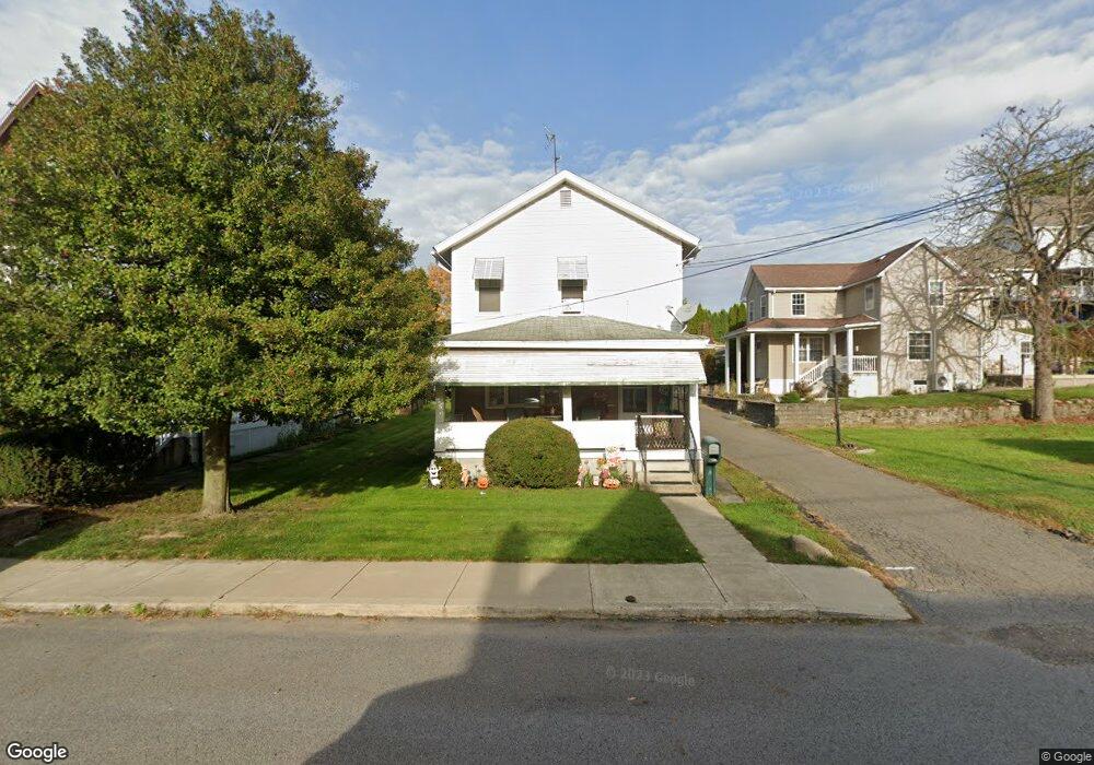
111 N Pond St Taylor, PA 18517
Estimated Value: $124,657 - $236,000
--
Bed
--
Bath
--
Sq Ft
6,752
Sq Ft Lot
About This Home
This home is located at 111 N Pond St, Taylor, PA 18517 and is currently estimated at $197,914. 111 N Pond St is a home located in Lackawanna County with nearby schools including Willard Middle School, Riverside Junior/Senior High School, and Triboro Christian Academy.
Ownership History
Date
Name
Owned For
Owner Type
Purchase Details
Closed on
Mar 28, 2007
Sold by
Laskowski Anna
Bought by
Renaldi Joseph L and Renaldi Lynne
Current Estimated Value
Home Financials for this Owner
Home Financials are based on the most recent Mortgage that was taken out on this home.
Original Mortgage
$55,920
Interest Rate
6.21%
Mortgage Type
New Conventional
Create a Home Valuation Report for This Property
The Home Valuation Report is an in-depth analysis detailing your home's value as well as a comparison with similar homes in the area
Home Values in the Area
Average Home Value in this Area
Purchase History
| Date | Buyer | Sale Price | Title Company |
|---|---|---|---|
| Renaldi Joseph L | $69,900 | American Home Title Agency I |
Source: Public Records
Mortgage History
| Date | Status | Borrower | Loan Amount |
|---|---|---|---|
| Previous Owner | Renaldi Joseph L | $55,920 |
Source: Public Records
Tax History Compared to Growth
Tax History
| Year | Tax Paid | Tax Assessment Tax Assessment Total Assessment is a certain percentage of the fair market value that is determined by local assessors to be the total taxable value of land and additions on the property. | Land | Improvement |
|---|---|---|---|---|
| 2025 | $1,601 | $6,642 | $1,500 | $5,142 |
| 2024 | $1,428 | $6,642 | $1,500 | $5,142 |
| 2023 | $1,428 | $6,642 | $1,500 | $5,142 |
| 2022 | $1,428 | $6,642 | $1,500 | $5,142 |
| 2021 | $1,428 | $6,642 | $1,500 | $5,142 |
| 2020 | $1,400 | $6,642 | $1,500 | $5,142 |
| 2019 | $1,333 | $6,642 | $1,500 | $5,142 |
| 2018 | $1,310 | $6,642 | $1,500 | $5,142 |
| 2017 | $1,272 | $6,642 | $1,500 | $5,142 |
| 2016 | $756 | $6,642 | $1,500 | $5,142 |
| 2015 | -- | $6,642 | $1,500 | $5,142 |
| 2014 | -- | $6,642 | $1,500 | $5,142 |
Source: Public Records
Map
Nearby Homes
- 115 W High St
- Parcel B Davis Ct
- 136 E Grove St
- 701-703 Union St
- 112 E Taylor St
- 0 Cooper St Unit GSBSC255606
- 0 Union St Unit GSBSC251501
- 0 Oak St Unit GSBSC255768
- 103 Davis St
- 448-450 N Main St
- 2932 Penman St
- 736 Oak St
- Lot 02 Sibley Ave
- 3258 Greenwood Ave
- 0 William St Unit GSBSC253642
- 3742 Laurel Ave
- 406 Kane St
- 309 Lowery St
- LOT#16 Reynolds Ave
- Lot# 7 Reynolds Ave
- 105 N Pond St Unit 107
- 207 Church St
- 211 Church St
- 203 Church St
- 201 Church St
- 215 Church St
- 212 Union St
- 208 Union St
- 206 Union St
- 214 Union St
- 216 Union St
- 200 Union St
- 220 Union St Unit 222
- 219 Church St
- 110 N Ridge St
- 114 N Pond St
- 106 N Ridge St Unit 108
- 224 Union St
- 106 N Pond St
- 223 Church St