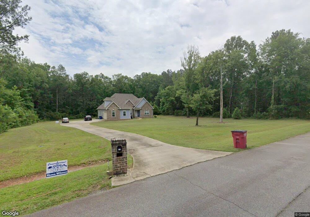
111 NW Pointe Dr Unit 41,42,43 Macon, GA 31220
Estimated Value: $342,000 - $459,696
3
Beds
3
Baths
2,539
Sq Ft
$160/Sq Ft
Est. Value
About This Home
This home is located at 111 NW Pointe Dr Unit 41,42,43, Macon, GA 31220 and is currently estimated at $406,174, approximately $159 per square foot. 111 NW Pointe Dr Unit 41,42,43 is a home located in Bibb County with nearby schools including Skyview Elementary School, Rutland Middle School, and Rutland High School.
Ownership History
Date
Name
Owned For
Owner Type
Purchase Details
Closed on
Dec 29, 2016
Bought by
Wilmore Chauncey K
Current Estimated Value
Home Financials for this Owner
Home Financials are based on the most recent Mortgage that was taken out on this home.
Original Mortgage
$180,000
Interest Rate
4.08%
Mortgage Type
New Conventional
Purchase Details
Closed on
Apr 20, 1996
Sold by
Lieck Robert A
Bought by
Rml Development Co Inc
Create a Home Valuation Report for This Property
The Home Valuation Report is an in-depth analysis detailing your home's value as well as a comparison with similar homes in the area
Home Values in the Area
Average Home Value in this Area
Purchase History
| Date | Buyer | Sale Price | Title Company |
|---|---|---|---|
| Wilmore Chauncey K | $12,500 | -- | |
| Wilmore Chauncey K | $12,500 | -- | |
| Rml Development Co Inc | -- | -- | |
| Rml Development Co Inc | -- | -- |
Source: Public Records
Mortgage History
| Date | Status | Borrower | Loan Amount |
|---|---|---|---|
| Closed | Wilmore Chauncey K | $180,000 |
Source: Public Records
Tax History Compared to Growth
Tax History
| Year | Tax Paid | Tax Assessment Tax Assessment Total Assessment is a certain percentage of the fair market value that is determined by local assessors to be the total taxable value of land and additions on the property. | Land | Improvement |
|---|---|---|---|---|
| 2025 | $4,100 | $173,855 | $12,833 | $161,022 |
| 2024 | $4,238 | $173,855 | $12,833 | $161,022 |
| 2023 | $3,780 | $173,855 | $12,833 | $161,022 |
| 2022 | $4,425 | $134,799 | $17,022 | $117,777 |
| 2021 | $4,038 | $113,276 | $13,618 | $99,658 |
| 2020 | $3,655 | $101,152 | $13,618 | $87,534 |
| 2019 | $3,686 | $101,152 | $13,618 | $87,534 |
| 2018 | $6,244 | $101,152 | $13,618 | $87,534 |
| 2017 | $187 | $6,809 | $6,809 | $0 |
| 2016 | $236 | $6,809 | $6,809 | $0 |
| 2015 | $333 | $6,809 | $6,809 | $0 |
| 2014 | $426 | $8,680 | $8,680 | $0 |
Source: Public Records
Map
Nearby Homes
- 2198 Dennis Rd
- 137 Shady Dale Dr
- 8294 Shelley Trail
- 402 Harbor Cove Dr
- 402 Harbor Cove Dr Unit 32
- 104 Peninsula Ave
- 104 Peninsula Ave Unit LOT 49
- 519 Bluewater Bay Dr
- 112 Peninsula Ave
- 511 Bluewater Bay Dr
- 140 Peninsula Ave
- 156 Peninsula Ave
- Plan 3040 at Barrington Place
- Plan 2700 at Barrington Place
- Plan 2620 at Barrington Place
- Plan 2100 at Barrington Place
- Plan 2316 at Barrington Place
- 1302 Barrington Place Cove
- 1405 Barrington Place Ln
- 1146 Barrington Place Way
- 111 NW Pointe Dr
- 240 NW Pointe Dr
- 112 NW Pointe Dr
- 401 Chris Rd
- 223 NW Pointe Dr
- 223 NW Pointe Dr Unit 40
- 301 Corey Ct
- 304 Corey Ct
- 405 Chris Rd
- 312 Corey Ct
- 400 Chris Rd
- 305 Corey Ct
- 0 Corey Ct
- 233 NW Pointe Dr
- 104 NW Pointe Dr
- 404 Chris Rd
- 227 NW Pointe Dr
- 308 Corey Ct
- 308 Corey Ct Unit 8
- 409 Chris Rd