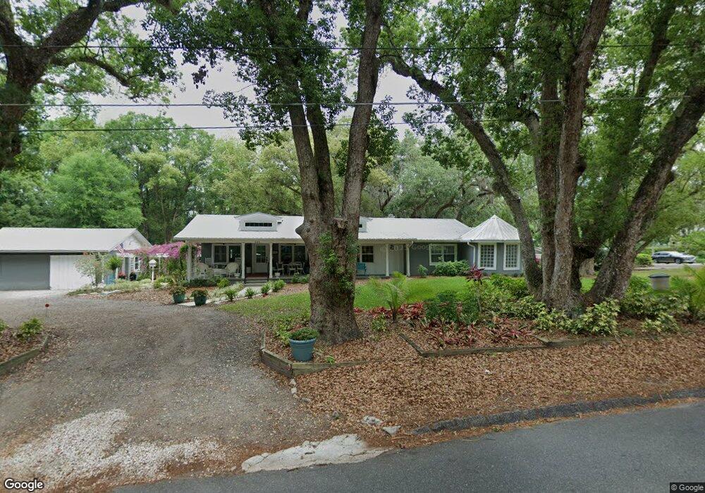
111 Old Eustis Rd Mount Dora, FL 32757
Estimated Value: $431,000 - $476,494
3
Beds
2
Baths
1,608
Sq Ft
$287/Sq Ft
Est. Value
About This Home
This home is located at 111 Old Eustis Rd, Mount Dora, FL 32757 and is currently estimated at $460,874, approximately $286 per square foot. 111 Old Eustis Rd is a home located in Lake County with nearby schools including Triangle Elementary School, Mt. Dora Middle School, and Mt. Dora High School.
Ownership History
Date
Name
Owned For
Owner Type
Purchase Details
Closed on
Aug 6, 2024
Sold by
Gibson Terry Lynn and Gibson Suzanne Marie
Bought by
Terry And Suzanne Gibson Revocable Trust and Gibson
Current Estimated Value
Purchase Details
Closed on
Jan 10, 2017
Sold by
Gibson Terry L and Gibson Suzanne M
Bought by
Gibson Terry L and Gibson Suzanne M
Home Financials for this Owner
Home Financials are based on the most recent Mortgage that was taken out on this home.
Original Mortgage
$127,500
Interest Rate
4.08%
Mortgage Type
New Conventional
Purchase Details
Closed on
Nov 30, 1995
Sold by
Mosteller Gregory V and Mosteller Patricia A
Bought by
Howard William R and Howard Carol C
Home Financials for this Owner
Home Financials are based on the most recent Mortgage that was taken out on this home.
Original Mortgage
$75,000
Interest Rate
7.4%
Create a Home Valuation Report for This Property
The Home Valuation Report is an in-depth analysis detailing your home's value as well as a comparison with similar homes in the area
Home Values in the Area
Average Home Value in this Area
Purchase History
| Date | Buyer | Sale Price | Title Company |
|---|---|---|---|
| Terry And Suzanne Gibson Revocable Trust | $100 | None Listed On Document | |
| Gibson Terry L | $228,000 | Watson Title Services Inc | |
| Howard William R | $84,000 | -- |
Source: Public Records
Mortgage History
| Date | Status | Borrower | Loan Amount |
|---|---|---|---|
| Previous Owner | Gibson Terry L | $127,500 | |
| Previous Owner | Howard William R | $75,000 |
Source: Public Records
Tax History
| Year | Tax Paid | Tax Assessment Tax Assessment Total Assessment is a certain percentage of the fair market value that is determined by local assessors to be the total taxable value of land and additions on the property. | Land | Improvement |
|---|---|---|---|---|
| 2026 | $4,471 | $288,440 | -- | -- |
| 2025 | $4,215 | $280,590 | -- | -- |
| 2024 | $4,215 | $280,590 | -- | -- |
| 2023 | $4,215 | $264,490 | $0 | $0 |
| 2022 | $4,160 | $256,790 | $0 | $0 |
| 2021 | $4,008 | $249,315 | $0 | $0 |
| 2020 | $4,152 | $245,873 | $0 | $0 |
| 2019 | $3,244 | $195,721 | $0 | $0 |
| 2018 | $3,132 | $192,072 | $0 | $0 |
| 2017 | $2,252 | $109,181 | $0 | $0 |
| 2016 | $2,250 | $109,181 | $0 | $0 |
| 2015 | $2,282 | $107,949 | $0 | $0 |
| 2014 | $2,225 | $106,828 | $0 | $0 |
Source: Public Records
Map
Nearby Homes
- 2013 Donnelly Place
- 333 Forest Rd
- 407 Forest Rd
- 2115 Oak Leaf Cir
- 2108 Dogwood Cir
- 2314 Hillside Dr
- 224 August Fern Loop
- 2312 Hillside Dr
- 611 Old Eustis Rd
- 0 E Jackson Ave Unit MFRG5108158
- 600 Old Eustis Rd
- 456 Winter Solstice Ln
- 809 Northside Dr
- 1503 Granite State Ct
- 1765 Hilltop Dr
- 1710 Summer Rose Dr
- 1824 Crestview Dr
- 1630 Crestview Dr
- 690 E Jackson Ave
- 2671 Balmerino Way
- 2107 N Donnelly St
- 131 Old Eustis Rd
- 2114 Stewart Ln
- 221 Old Eustis Rd
- 0 Limit Ave Unit O5531386
- 0 Stewart Ln Unit G4851368
- 0 Stewart Ln Unit MFRT3442541
- 2116 Stewart Ln
- Stewart Ln
- 2110 N Donnelly St
- 2115 Stewart Ln
- 311 Old Eustis Rd
- 2118 Stewart Ln
- 2117 Stewart Ln
- 2024 N Donnelly St
- 2007 Donnelly Place
- 401 Old Eustis Rd
- 2119 Stewart Ln
- 2012 N Donnelly St
- 331 Old Eustis Rd
Your Personal Tour Guide
Ask me questions while you tour the home.