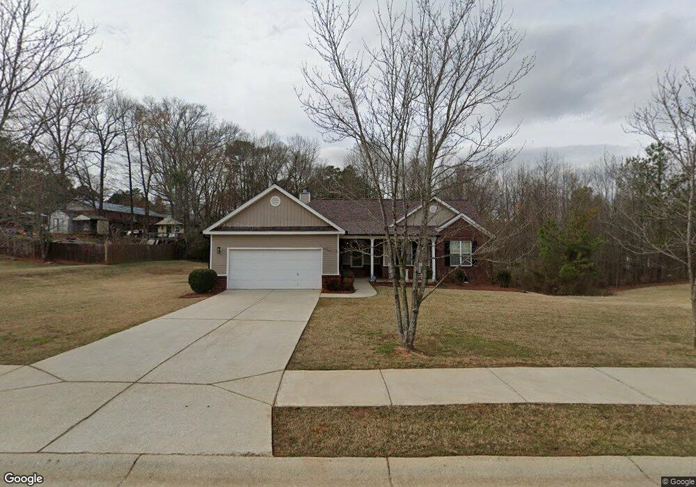
111 Port Ln Athens, GA 30601
Estimated Value: $318,000 - $356,000
3
Beds
2
Baths
1,607
Sq Ft
$211/Sq Ft
Est. Value
About This Home
This home is located at 111 Port Ln, Athens, GA 30601 and is currently estimated at $339,831, approximately $211 per square foot. 111 Port Ln is a home located in Clarke County with nearby schools including Fowler Drive Elementary School, Coile Middle School, and Cedar Shoals High School.
Ownership History
Date
Name
Owned For
Owner Type
Purchase Details
Closed on
Mar 6, 2012
Sold by
Dunn Alma Vincent
Bought by
Dunn Jack Edward
Current Estimated Value
Purchase Details
Closed on
Sep 15, 2005
Sold by
Star Home Builders Inc
Bought by
Dunn Jack and Dunn Alma
Home Financials for this Owner
Home Financials are based on the most recent Mortgage that was taken out on this home.
Original Mortgage
$125,520
Interest Rate
6.75%
Mortgage Type
New Conventional
Purchase Details
Closed on
May 6, 2004
Sold by
Bishop Katie E and Guest James C
Bought by
Star Home Builders Inc
Create a Home Valuation Report for This Property
The Home Valuation Report is an in-depth analysis detailing your home's value as well as a comparison with similar homes in the area
Home Values in the Area
Average Home Value in this Area
Purchase History
| Date | Buyer | Sale Price | Title Company |
|---|---|---|---|
| Dunn Jack Edward | $156,900 | -- | |
| Dunn Jack | $156,900 | -- | |
| Star Home Builders Inc | $26,000 | -- |
Source: Public Records
Mortgage History
| Date | Status | Borrower | Loan Amount |
|---|---|---|---|
| Previous Owner | Dunn Jack | $125,520 | |
| Previous Owner | Dunn Jack | $31,380 |
Source: Public Records
Tax History Compared to Growth
Tax History
| Year | Tax Paid | Tax Assessment Tax Assessment Total Assessment is a certain percentage of the fair market value that is determined by local assessors to be the total taxable value of land and additions on the property. | Land | Improvement |
|---|---|---|---|---|
| 2025 | $3,620 | $133,098 | $12,000 | $121,098 |
| 2024 | $3,620 | $131,578 | $12,000 | $119,578 |
| 2023 | $3,613 | $124,610 | $10,400 | $114,210 |
| 2022 | $2,690 | $94,334 | $10,400 | $83,934 |
| 2021 | $2,374 | $80,458 | $8,800 | $71,658 |
| 2020 | $2,148 | $73,730 | $8,800 | $64,930 |
| 2019 | $2,078 | $71,210 | $8,800 | $62,410 |
| 2018 | $1,698 | $60,018 | $8,800 | $51,218 |
| 2017 | $1,424 | $51,932 | $8,000 | $43,932 |
| 2016 | $1,395 | $51,099 | $8,000 | $43,099 |
| 2015 | $1,357 | $49,902 | $8,000 | $41,902 |
| 2014 | $1,294 | $47,990 | $8,000 | $39,990 |
Source: Public Records
Map
Nearby Homes
- 32 Pine Lane Dr
- 140 Loblolly Dr
- 155 Ashmore Dr
- 156 Connally Cir
- 0 Danielsville Rd Unit 8926755
- 0 Danielsville Rd Unit 979729
- 210 Hull Rd
- 192 Sunny Hills Dr
- 110 Connelly Cir
- 495 Boley Dr
- 6006 Smokey
- 2146 Danielsville Rd
- 0 Old Commerce Rd Unit 10617666
- 136 Bridgewater Cir
- 464 Ruth St
- 455 Ruth St
- 248 Fern Ridge Ct
- 211 North Ave Unit 1333
- 145 Noketchee Dr
- 239 Ruth St Unit 15
- 121 Port Ln
- 240 Cabernet St
- 185 Sayemore Dr
- 110 Port Ln
- 164 Massey Ln
- 175 Sayemore Dr
- 175 Sayemore Dr Unit 177
- 131 Port Ln
- 230 Cabernet St
- 167 Sayemore Dr
- 120 Port Ln
- 165 Sayemore Dr Unit 167
- 165 Sayemore Dr
- 154 Massey Ln
- 171 Massey Ln Unit A&B
- 241 Cabernet St
- 220 Cabernet St
- 180 Sayemore Dr Unit A
- 180 Sayemore Dr Unit 182
- 180 Sayemore Dr