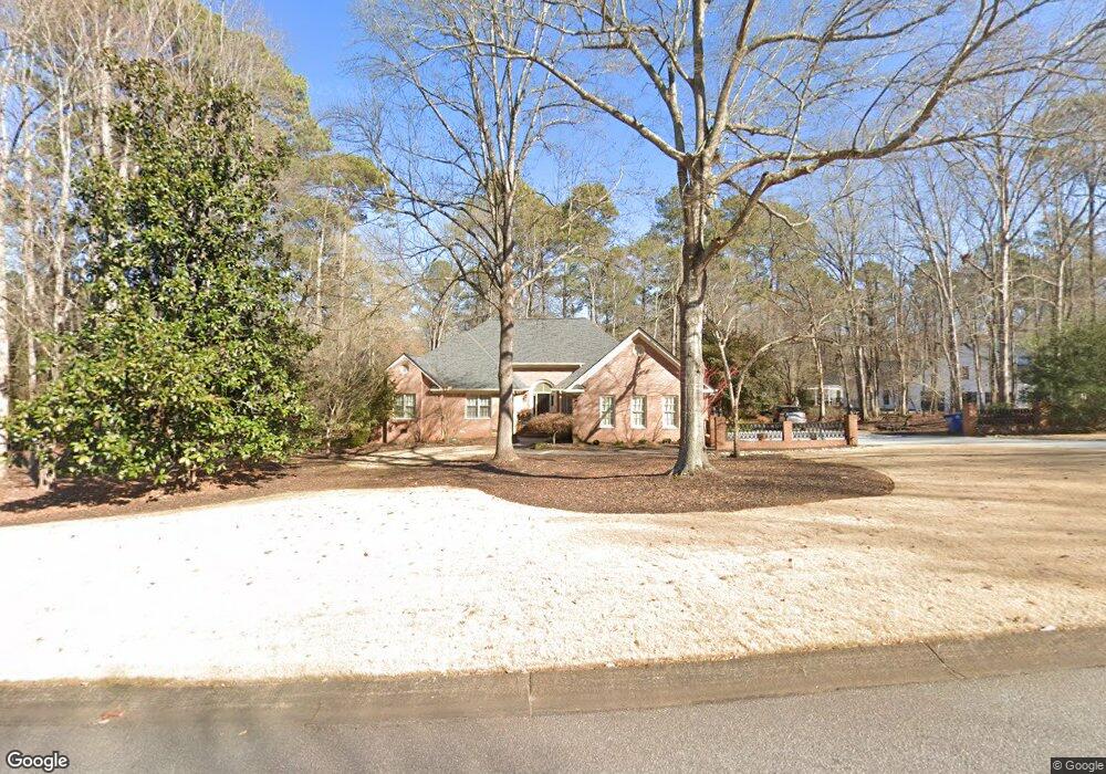
111 River Bottom Cir Athens, GA 30606
Estimated Value: $555,852 - $677,000
Studio
1
Bath
3,424
Sq Ft
$181/Sq Ft
Est. Value
About This Home
This home is located at 111 River Bottom Cir, Athens, GA 30606 and is currently estimated at $618,963, approximately $180 per square foot. 111 River Bottom Cir is a home located in Clarke County with nearby schools including Timothy Elementary School, Clarke Middle School, and Clarke Central High School.
Ownership History
Date
Name
Owned For
Owner Type
Purchase Details
Closed on
Nov 14, 2019
Sold by
Kassay Steve L
Bought by
Kassay Nancy E
Current Estimated Value
Purchase Details
Closed on
Apr 30, 2018
Sold by
Kassay Steve L
Bought by
J Bankston Properties Llc
Purchase Details
Closed on
Jan 14, 2003
Sold by
Walczyk Henry L and Teresa Walcz
Bought by
Kassay Steve L and Kassay Nancy E
Purchase Details
Closed on
Mar 30, 1998
Sold by
Vandyck Marla T
Bought by
Walczyk Henry L and Teresa Walczyk
Purchase Details
Closed on
Jun 30, 1995
Sold by
Vandyck Peter F and Vandyck Maria T
Bought by
Vandyck Maria T
Purchase Details
Closed on
May 26, 1992
Sold by
Alewine Eugene V and Alewine Shirley W
Bought by
Vandyck Peter F and Vandyck Maria T
Purchase Details
Closed on
Feb 28, 1989
Sold by
Sunstream Homes Inc
Bought by
Alewine Eugene V and Alewine Shirley W
Create a Home Valuation Report for This Property
The Home Valuation Report is an in-depth analysis detailing your home's value as well as a comparison with similar homes in the area
Purchase History
| Date | Buyer | Sale Price | Title Company |
|---|---|---|---|
| Kassay Nancy E | $332,072 | -- | |
| J Bankston Properties Llc | $67,000 | -- | |
| Kassay Steve L | $363,000 | -- | |
| Walczyk Henry L | $260,000 | -- | |
| Vandyck Maria T | -- | -- | |
| Vandyck Peter F | $210,000 | -- | |
| Alewine Eugene V | $175,000 | -- |
Source: Public Records
Tax History
| Year | Tax Paid | Tax Assessment Tax Assessment Total Assessment is a certain percentage of the fair market value that is determined by local assessors to be the total taxable value of land and additions on the property. | Land | Improvement |
|---|---|---|---|---|
| 2025 | $4,319 | $238,578 | $26,000 | $212,578 |
| 2024 | $4,319 | $217,024 | $26,000 | $191,024 |
| 2023 | $4,357 | $204,246 | $26,000 | $178,246 |
| 2022 | $4,025 | $167,129 | $26,000 | $141,129 |
| 2021 | $4,006 | $149,682 | $26,000 | $123,682 |
| 2020 | $3,897 | $141,723 | $26,000 | $115,723 |
| 2019 | $3,806 | $132,893 | $26,000 | $106,893 |
| 2018 | $3,805 | $132,829 | $24,000 | $108,829 |
| 2017 | $3,650 | $121,670 | $24,000 | $97,670 |
| 2016 | $3,616 | $119,271 | $24,000 | $95,271 |
| 2015 | $3,622 | $119,688 | $24,000 | $95,688 |
| 2014 | $3,594 | $117,652 | $24,000 | $93,652 |
Source: Public Records
Map
Nearby Homes
- 102 River Bottom Cir
- 212 Huntington Shoals Dr
- 575 Vaughn Rd
- 256 Cherokee Ridge
- 471 Chesterfield Rd
- 272 Chesterfield Rd
- 115 Woodhaven St
- 141 Mountain Laurel Run
- 532 Huntington Rd Unit 7
- 240 W Huntington Rd
- 184 Hillsborough Dr
- 470 Huntington Rd Unit 5
- 400 Providence Rd
- 460 Huntington Rd
- 637 Huntington Rd Unit B1
- 201 Chesterfield Rd
- 105 River Bottom Cir
- 115 River Bottom Cir
- 112 River Bottom Cir
- 101 River Bottom Cir
- 108 River Bottom Cir
- 114 River Bottom Cir
- 106 River Bottom Cir
- 104 River Bottom Cir
- 119 River Bottom Cir
- 116 River Bottom Cir
- 380 Cherokee Ridge
- 118 River Bottom Cir
- 388 Cherokee Ridge
- 372 Cherokee Ridge
- 123 River Bottom Cir
- 364 Cherokee Ridge
- 390 Cherokee Ridge
- 135 River Bottom Cir
- 680 River Bottom Rd
- 125 River Bottom Cir