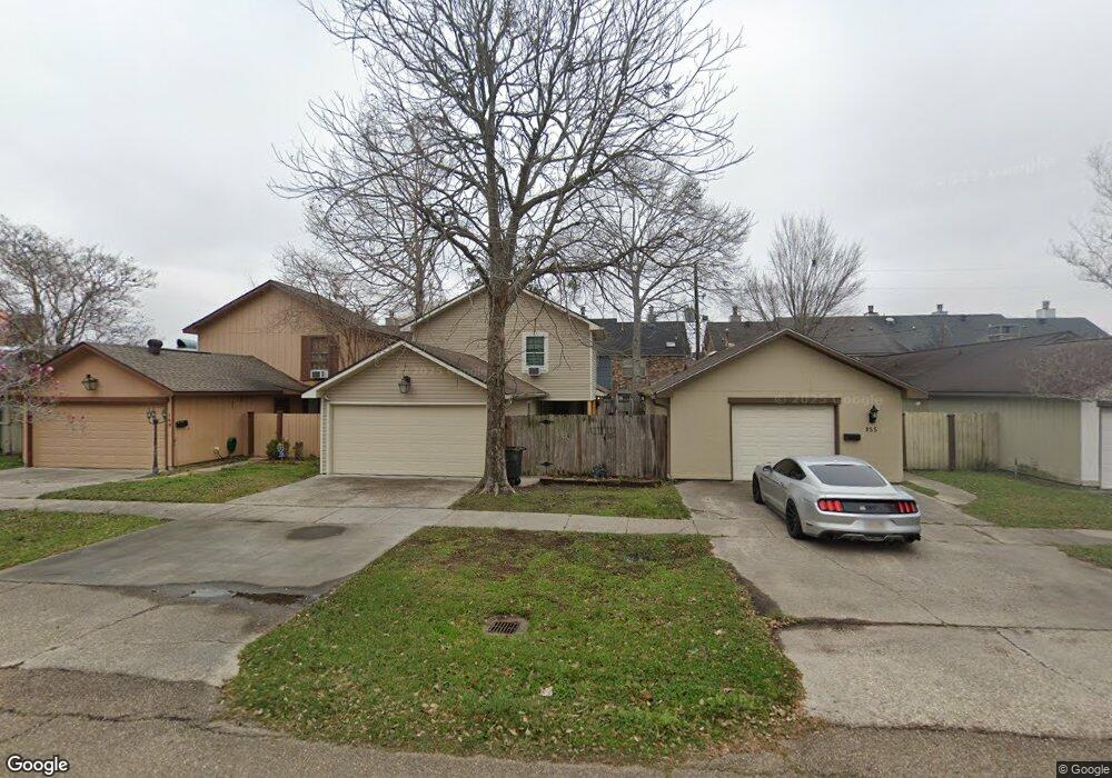
111 Ship Dr Unit 3D Baton Rouge, LA 70806
Mid City South NeighborhoodEstimated Value: $138,000 - $168,000
2
Beds
3
Baths
1,257
Sq Ft
$121/Sq Ft
Est. Value
About This Home
This home is located at 111 Ship Dr Unit 3D, Baton Rouge, LA 70806 and is currently estimated at $152,687, approximately $121 per square foot. 111 Ship Dr Unit 3D is a home located in East Baton Rouge Parish with nearby schools including LaSalle Elementary School, Westdale Middle School, and Tara High School.
Ownership History
Date
Name
Owned For
Owner Type
Purchase Details
Closed on
Jul 26, 2023
Sold by
Franklin Dawson C and Franklin Bridget
Bought by
Johnson Samantha
Current Estimated Value
Home Financials for this Owner
Home Financials are based on the most recent Mortgage that was taken out on this home.
Original Mortgage
$125,878
Outstanding Balance
$122,934
Interest Rate
6.67%
Mortgage Type
FHA
Estimated Equity
$29,753
Purchase Details
Closed on
Aug 11, 2008
Sold by
Federal Home Loan Mortgage Corporation
Bought by
Franklin Dawson C
Home Financials for this Owner
Home Financials are based on the most recent Mortgage that was taken out on this home.
Original Mortgage
$87,480
Interest Rate
6.29%
Mortgage Type
FHA
Purchase Details
Closed on
Oct 6, 2006
Sold by
Hatcher James R
Bought by
Paille Ronald J
Home Financials for this Owner
Home Financials are based on the most recent Mortgage that was taken out on this home.
Original Mortgage
$108,750
Interest Rate
6.47%
Mortgage Type
New Conventional
Create a Home Valuation Report for This Property
The Home Valuation Report is an in-depth analysis detailing your home's value as well as a comparison with similar homes in the area
Home Values in the Area
Average Home Value in this Area
Purchase History
| Date | Buyer | Sale Price | Title Company |
|---|---|---|---|
| Johnson Samantha | $130,000 | None Listed On Document | |
| Franklin Dawson C | $108,000 | -- | |
| Paille Ronald J | $109,850 | -- |
Source: Public Records
Mortgage History
| Date | Status | Borrower | Loan Amount |
|---|---|---|---|
| Open | Johnson Samantha | $125,878 | |
| Previous Owner | Franklin Dawson C | $87,480 | |
| Previous Owner | Paille Ronald J | $108,750 |
Source: Public Records
Tax History Compared to Growth
Tax History
| Year | Tax Paid | Tax Assessment Tax Assessment Total Assessment is a certain percentage of the fair market value that is determined by local assessors to be the total taxable value of land and additions on the property. | Land | Improvement |
|---|---|---|---|---|
| 2024 | $783 | $12,350 | $300 | $12,050 |
| 2023 | $783 | $10,800 | $300 | $10,500 |
| 2022 | $1,415 | $10,800 | $300 | $10,500 |
| 2021 | $1,260 | $10,800 | $300 | $10,500 |
| 2020 | $1,252 | $10,800 | $300 | $10,500 |
| 2019 | $1,308 | $10,800 | $300 | $10,500 |
| 2018 | $1,292 | $10,800 | $300 | $10,500 |
| 2017 | $1,292 | $10,800 | $300 | $10,500 |
| 2016 | $482 | $10,800 | $300 | $10,500 |
| 2015 | $484 | $10,800 | $300 | $10,500 |
| 2014 | $482 | $10,800 | $300 | $10,500 |
| 2013 | -- | $10,800 | $300 | $10,500 |
Source: Public Records
Map
Nearby Homes
- 234 Croydon Ave
- 224 Ocean Dr
- 224 Ocean Dr Unit 107
- 7131 Winthrop Ave
- 7203 Winthrop Ave
- 419 Croydon Ave
- 286 Kenwood Ave
- 7037 Etage Ct
- 418 Kenwood Ave
- 208 Bellewood Dr
- 6947 Government St
- 644 Monet Dr
- 340 Bellewood Dr
- 7234 Goodleaf Way
- 637 Goodridge Way
- Lot 43 Adelia Ln
- 716 Adelia Ln
- 723 Adelia Ln
- 6550-6568 Government St
- 771 Elderflower Alley W
- 111 Ship Dr Unit 1E
- 111 Ship Dr Unit Bldg. 2-A
- 111 Ship Dr Unit Bldg. 2-D
- 111 Ship Dr Unit D
- 111 Ship Dr Unit A
- 111 Ship Dr Unit 1-C
- 111 Ship Dr Unit 2C
- 111 Ship Dr Unit 2E
- 111 Ship Dr Unit 1B
- 111 Ship Dr Unit 1A
- 111 Ship Dr Unit 2A
- 111 Ship Dr Unit 2D
- 111 Ship Dr
- 111 Ship Dr Unit 3C
- 111 Ship Dr Unit 3A
- 111 Ship Dr Unit 3B
- 111 Ship Dr Unit 1D
- 111 Ship Dr
- 111 Ship Dr Unit 4E
- 111 Ship Dr Unit 4A