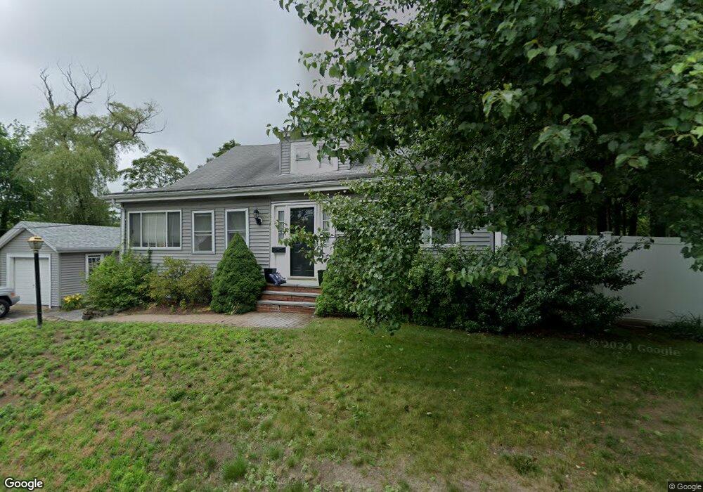
111 Speen St Natick, MA 01760
Estimated Value: $768,754 - $873,000
3
Beds
1
Bath
1,862
Sq Ft
$452/Sq Ft
Est. Value
About This Home
This home is located at 111 Speen St, Natick, MA 01760 and is currently estimated at $842,439, approximately $452 per square foot. 111 Speen St is a home located in Middlesex County with nearby schools including Natick High School, J F Kennedy Middle School, and Johnson Elementary School.
Ownership History
Date
Name
Owned For
Owner Type
Purchase Details
Closed on
May 15, 2000
Sold by
Obrien Thomas L and 0Brien Pauline A
Bought by
Obrien Christopher J and Obrien Lori A
Current Estimated Value
Home Financials for this Owner
Home Financials are based on the most recent Mortgage that was taken out on this home.
Original Mortgage
$140,000
Outstanding Balance
$48,610
Interest Rate
8.21%
Mortgage Type
Purchase Money Mortgage
Estimated Equity
$793,829
Create a Home Valuation Report for This Property
The Home Valuation Report is an in-depth analysis detailing your home's value as well as a comparison with similar homes in the area
Home Values in the Area
Average Home Value in this Area
Purchase History
| Date | Buyer | Sale Price | Title Company |
|---|---|---|---|
| Obrien Christopher J | $187,000 | -- |
Source: Public Records
Mortgage History
| Date | Status | Borrower | Loan Amount |
|---|---|---|---|
| Open | Obrien Christopher J | $140,000 | |
| Previous Owner | Obrien Christopher J | $88,000 |
Source: Public Records
Tax History
| Year | Tax Paid | Tax Assessment Tax Assessment Total Assessment is a certain percentage of the fair market value that is determined by local assessors to be the total taxable value of land and additions on the property. | Land | Improvement |
|---|---|---|---|---|
| 2025 | $8,091 | $676,500 | $418,200 | $258,300 |
| 2024 | $7,899 | $644,300 | $396,200 | $248,100 |
| 2023 | $7,708 | $609,800 | $369,800 | $240,000 |
| 2022 | $7,474 | $560,300 | $334,600 | $225,700 |
| 2021 | $4,939 | $527,400 | $317,000 | $210,400 |
| 2020 | $6,997 | $514,100 | $303,700 | $210,400 |
| 2019 | $0 | $514,100 | $303,700 | $210,400 |
| 2018 | $5,754 | $440,900 | $290,500 | $150,400 |
| 2017 | $5,863 | $434,600 | $286,900 | $147,700 |
| 2016 | $5,524 | $407,100 | $260,900 | $146,200 |
| 2015 | $5,305 | $383,900 | $249,600 | $134,300 |
Source: Public Records
Map
Nearby Homes
- 40 Silver Hill Ln Unit 4
- 26 Wellesley Ave Unit B
- 46 Silver Hill Ln Unit 1
- 36 Silver Hill Ln Unit 21
- 21 Kelsey Rd
- 1 Proctor St
- 3 Silver Hill Ln Unit 6
- 28 Sylvester Rd
- 26 Fairway Cir Unit 26
- 1 Fern St
- 157 Mill St
- 5 Lanes End
- 50 Village Brook Ln Unit 4
- 98 W Central St
- 4 Village Brook Ln
- 16 West St
- 4 Village Rock Ln Unit 9
- 56 Fisher St
- 5 Village Rock Ln Unit 24
- 29 Village Rock Ln Unit 6
- 109 Speen St
- 107 Speen St
- 107 Speen St Unit 107A
- 107 Speen St Unit A
- 106 Speen St
- Lot104/106 Speen St
- 103 Speen St
- 103 Speen St Unit 103
- 103 Speen St Unit B
- 103 Speen St Unit A
- 102 Speen St
- 104 Speen St
- 100 Speen St
- 96 Speen St
- 23 Mill St
- 23 Mill St Unit U23
- 25 Mill St
- 25 Mill St Unit 25
- 92 Speen St
- 21 Mill St