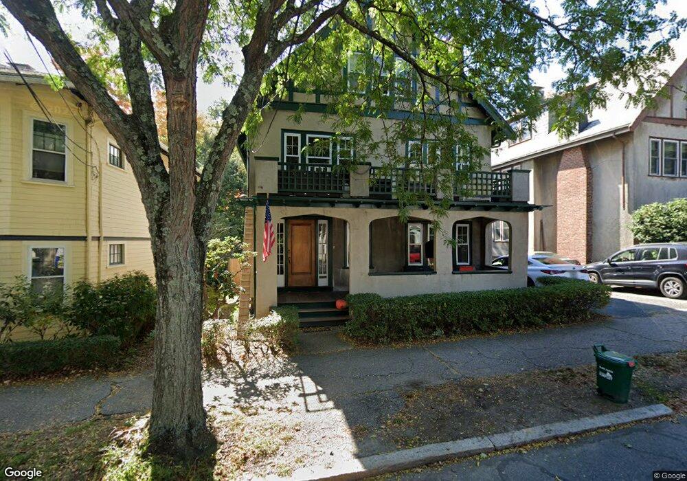
111 Sumner Rd Brookline, MA 02445
Brookline Village NeighborhoodEstimated Value: $1,428,000 - $2,528,000
5
Beds
3
Baths
1,800
Sq Ft
$1,216/Sq Ft
Est. Value
About This Home
This home is located at 111 Sumner Rd, Brookline, MA 02445 and is currently estimated at $2,188,275, approximately $1,215 per square foot. 111 Sumner Rd is a home located in Norfolk County with nearby schools including John D. Runkle School, Brookline High School, and Maimonides School.
Ownership History
Date
Name
Owned For
Owner Type
Purchase Details
Closed on
May 6, 2016
Sold by
Sumner Road Nt
Bought by
Spunt Emily F and Spunt Nathan
Current Estimated Value
Home Financials for this Owner
Home Financials are based on the most recent Mortgage that was taken out on this home.
Original Mortgage
$980,000
Outstanding Balance
$781,416
Interest Rate
3.71%
Mortgage Type
Unknown
Estimated Equity
$1,406,859
Purchase Details
Closed on
Jan 15, 2009
Sold by
Lavelle Marie Q and Lavelle Peter A
Bought by
Lavelle Marie Q and Lavelle Peter A
Create a Home Valuation Report for This Property
The Home Valuation Report is an in-depth analysis detailing your home's value as well as a comparison with similar homes in the area
Home Values in the Area
Average Home Value in this Area
Purchase History
| Date | Buyer | Sale Price | Title Company |
|---|---|---|---|
| Spunt Emily F | $1,400,000 | -- | |
| Lavelle Marie Q | -- | -- |
Source: Public Records
Mortgage History
| Date | Status | Borrower | Loan Amount |
|---|---|---|---|
| Open | Spunt Emily F | $980,000 |
Source: Public Records
Property History
| Date | Event | Price | List to Sale | Price per Sq Ft |
|---|---|---|---|---|
| 10/08/2024 10/08/24 | Off Market | $6,300 | -- | -- |
| 10/08/2024 10/08/24 | Off Market | $6,300 | -- | -- |
| 05/09/2024 05/09/24 | For Rent | $6,300 | 0.0% | -- |
| 06/01/2023 06/01/23 | For Rent | $6,300 | -- | -- |
Tax History
| Year | Tax Paid | Tax Assessment Tax Assessment Total Assessment is a certain percentage of the fair market value that is determined by local assessors to be the total taxable value of land and additions on the property. | Land | Improvement |
|---|---|---|---|---|
| 2025 | $18,742 | $1,898,900 | $1,031,700 | $867,200 |
| 2024 | $18,389 | $1,882,200 | $992,000 | $890,200 |
| 2023 | $16,958 | $1,700,900 | $792,600 | $908,300 |
| 2022 | $16,506 | $1,619,800 | $754,800 | $865,000 |
| 2021 | $15,264 | $1,557,600 | $725,800 | $831,800 |
| 2020 | $14,378 | $1,521,500 | $659,800 | $861,700 |
| 2019 | $13,577 | $1,449,000 | $628,400 | $820,600 |
| 2018 | $12,124 | $1,281,600 | $539,900 | $741,700 |
| 2017 | $11,665 | $1,180,700 | $509,300 | $671,400 |
| 2016 | $11,185 | $1,073,400 | $475,900 | $597,500 |
| 2015 | $10,422 | $975,800 | $444,800 | $531,000 |
| 2014 | $10,245 | $899,500 | $409,100 | $490,400 |
Source: Public Records
Map
Nearby Homes
- 24 Blake Rd
- 140 Sumner Rd Unit 1
- 115 Clark Rd
- 71 Greenough St Unit 71-1
- 371 Walnut St
- 15 Colbourne Crescent Unit 2
- 90 Addington Rd Unit 1
- 90 Addington Rd Unit 2
- 84 Winthrop Rd Unit 1
- 84 Winthrop Rd
- 89 University Rd
- 8 Leverett St Unit 3
- 57 University Rd Unit 3
- 11 Goodwin Place Unit 1
- 11 Goodwin Place Unit 11-1
- 11 Goodwin Place Unit 11-2
- 12 Goodwin Place Unit 12-1
- 12 Goodwin Place Unit 12-2
- 370 Washington St
- 20 Claflin Rd Unit A
- 111 Sumner Rd
- 111 Sumner Rd Unit 2
- 111 Sumner Rd Unit 1
- 111 Sumner Rd Unit Garage
- 115 Sumner Rd
- 115 Sumner Rd
- 115 Sumner Rd Unit 1
- 119 Sumner Rd
- 101 Sumner Rd
- 101 Sumner Rd
- 101 Sumner Rd Unit 1
- 101 Sumner Rd Unit U
- 101 Sumner Rd Unit 2
- 118 Sumner Rd
- 112 Sumner Rd
- 125 Sumner Rd Unit 2
- 125 Sumner Rd Unit 1
- 122 Sumner Rd
- 106 Sumner Rd
- 127 Sumner Rd Unit 2
Your Personal Tour Guide
Ask me questions while you tour the home.