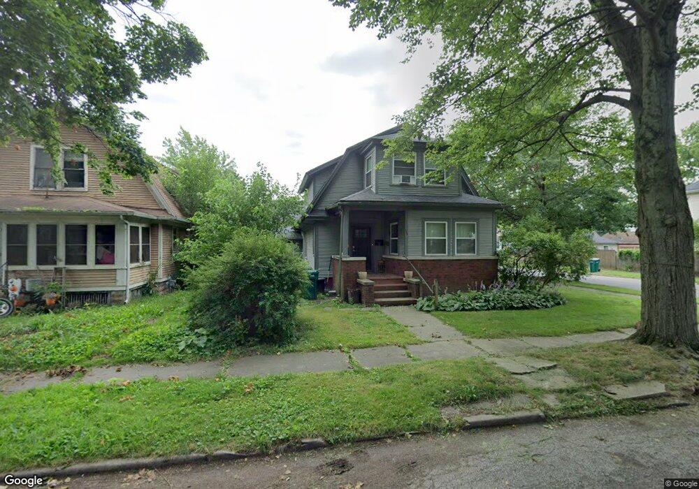
111 Woodward St La Porte, IN 46350
Estimated Value: $156,000 - $237,000
3
Beds
3
Baths
1,984
Sq Ft
$100/Sq Ft
Est. Value
About This Home
This home is located at 111 Woodward St, La Porte, IN 46350 and is currently estimated at $198,017, approximately $99 per square foot. 111 Woodward St is a home located in LaPorte County with nearby schools including Carver Elementary School, Lincoln Elementary School, and Hailmann Elementary School.
Ownership History
Date
Name
Owned For
Owner Type
Purchase Details
Closed on
Oct 7, 2021
Sold by
Swanson Robert E
Bought by
Swanson David S
Current Estimated Value
Purchase Details
Closed on
Sep 4, 2015
Sold by
Suamen Robert E and Suamen David S
Bought by
Suamen Robert E
Purchase Details
Closed on
Oct 15, 2013
Sold by
Swanson Robert E
Bought by
Swanson Robert E and Swanson David S
Create a Home Valuation Report for This Property
The Home Valuation Report is an in-depth analysis detailing your home's value as well as a comparison with similar homes in the area
Home Values in the Area
Average Home Value in this Area
Purchase History
| Date | Buyer | Sale Price | Title Company |
|---|---|---|---|
| Swanson David S | -- | None Listed On Document | |
| Suamen Robert E | -- | None Available | |
| Swanson Robert E | -- | None Available |
Source: Public Records
Tax History Compared to Growth
Tax History
| Year | Tax Paid | Tax Assessment Tax Assessment Total Assessment is a certain percentage of the fair market value that is determined by local assessors to be the total taxable value of land and additions on the property. | Land | Improvement |
|---|---|---|---|---|
| 2024 | $2,807 | $165,500 | $12,900 | $152,600 |
| 2022 | $1,254 | $62,700 | $5,100 | $57,600 |
| 2021 | $1,020 | $51,000 | $4,500 | $46,500 |
| 2020 | $2,568 | $51,000 | $4,500 | $46,500 |
| 2019 | $809 | $101,900 | $10,100 | $91,800 |
| 2018 | $898 | $104,900 | $8,000 | $96,900 |
| 2017 | $846 | $104,300 | $8,000 | $96,300 |
| 2016 | $669 | $70,700 | $8,600 | $62,100 |
| 2014 | $602 | $68,800 | $8,600 | $60,200 |
| 2013 | $602 | $68,800 | $8,600 | $60,200 |
Source: Public Records
Map
Nearby Homes
- 330 Virginia Ave
- 202 Jefferson Ave
- 403 Rose St
- 206 Ohio St
- 208 Norton St
- 906 Linwood Ave
- 910 Scott St
- 107 Lincolnway
- 414 Allen St
- 0 Brighton St Unit NRA542345
- 503 Grove St
- 706 Detroit St
- 205 Lawrence St
- 413 Jefferson Ave
- 602 Plain St
- 810 Virginia Ave
- 807 Division St
- 907 Division St
- 506 Pulaski St
- 916 Ohio St
- 109 Woodward St
- 107 Woodward St
- 307 E Maple Ave
- 201 Woodward St
- 309 E Maple Ave
- 105 Woodward St
- 203 Woodward St
- 308 E Maple Ave
- 112 Woodward St
- 110 Woodward St
- 311 E Maple Ave
- 210 E Maple Ave
- 108 Woodward St
- 205 Woodward St
- 106 Woodward St
- 103 Woodward St
- 101 Woodward St
- 315 E Maple Ave
- 207 Woodward St
- 310 E Maple Ave