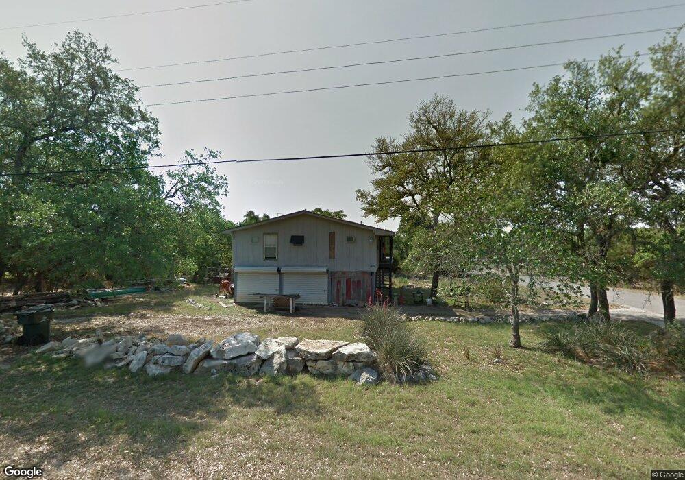
1110 Bob White Dr Spring Branch, TX 78070
Hill Country NeighborhoodEstimated Value: $231,000 - $315,000
--
Bed
--
Bath
1,200
Sq Ft
$226/Sq Ft
Est. Value
About This Home
This home is located at 1110 Bob White Dr, Spring Branch, TX 78070 and is currently estimated at $271,597, approximately $226 per square foot. 1110 Bob White Dr is a home with nearby schools including Rebecca Creek Elementary School, Mt Valley Middle School, and Canyon Lake High School.
Ownership History
Date
Name
Owned For
Owner Type
Purchase Details
Closed on
Oct 29, 2024
Sold by
Deady Eugene F
Bought by
Deady Eugene F and Deady Robert D
Current Estimated Value
Purchase Details
Closed on
Jan 30, 2007
Sold by
Weidner Keith
Bought by
Deady Eugene F
Home Financials for this Owner
Home Financials are based on the most recent Mortgage that was taken out on this home.
Original Mortgage
$58,000
Interest Rate
6.11%
Mortgage Type
Seller Take Back
Purchase Details
Closed on
Mar 1, 2006
Sold by
Moseley Bessie M and Moseley Bessie
Bought by
Weidner Keith
Create a Home Valuation Report for This Property
The Home Valuation Report is an in-depth analysis detailing your home's value as well as a comparison with similar homes in the area
Home Values in the Area
Average Home Value in this Area
Purchase History
| Date | Buyer | Sale Price | Title Company |
|---|---|---|---|
| Deady Eugene F | -- | None Listed On Document | |
| Deady Eugene F | -- | Ltsa | |
| Weidner Keith | -- | New Braunfels Title Co |
Source: Public Records
Mortgage History
| Date | Status | Borrower | Loan Amount |
|---|---|---|---|
| Previous Owner | Deady Eugene F | $58,000 |
Source: Public Records
Tax History Compared to Growth
Tax History
| Year | Tax Paid | Tax Assessment Tax Assessment Total Assessment is a certain percentage of the fair market value that is determined by local assessors to be the total taxable value of land and additions on the property. | Land | Improvement |
|---|---|---|---|---|
| 2025 | $277 | $173,203 | -- | -- |
| 2024 | $277 | $157,457 | -- | -- |
| 2023 | $277 | $143,143 | $0 | $0 |
| 2022 | $718 | $130,130 | -- | -- |
| 2021 | $2,107 | $118,300 | $25,740 | $92,560 |
| 2020 | $2,227 | $124,970 | $21,880 | $103,090 |
| 2019 | $2,073 | $120,220 | $16,870 | $103,350 |
| 2018 | $1,880 | $99,310 | $9,920 | $89,390 |
| 2017 | $1,968 | $104,780 | $9,490 | $95,290 |
| 2016 | $1,959 | $105,600 | $7,770 | $97,830 |
| 2015 | $821 | $94,820 | $7,770 | $87,050 |
| 2014 | $821 | $92,310 | $7,770 | $84,540 |
Source: Public Records
Map
Nearby Homes
- 644 Cashew
- 124 Lookout Ct
- 1229 Bob White Dr
- 1903 Tanglewood Trail
- 1265 Bob White Dr
- 890 Live Oak Dr
- 866 Live Oak Dr
- 1431 Cedar Grove Trail
- 496 Havasu Point
- 500 Havasu Point
- 1475 Echo Meadow Ln
- 799 Mockingbird Cove
- 407 Havasu Point
- 147 Juniper Cir
- 771 Mockingbird Cove
- 420 Havasu Point
- 1556 Rimrock Cove
- 952 Rimrock Cove
- 2421 Hornsby
- 1456 Green Meadow Ln
- 1101 Bob White Dr
- 1025 Cedar Grove Trail
- 1015 Cedar Grove Trail
- 1015 Cedar Grove Trail Unit 1
- 1109 Bob White Dr
- 1144 Bob White Dr
- 1123 Bob White Dr
- 1035 Cedar Grove Trail
- 1272 Bob White Dr
- 2016 Hornsby
- 1145 Bob White Dr
- 1154 Bob White Dr
- 1045 Cedar Grove Trail
- 1049 Bob White Dr
- 0 Cedar Grove Trail Unit 1135743
- 0 Cedar Grove Trail Unit 1397114
- 0 Cedar Grove Trail Unit 1480395
- 0 Cedar Grove Trail Unit 1643467
- 0 Cedar Grove Trail Unit 184627
- 0 Cedar Grove Trail Unit 206125