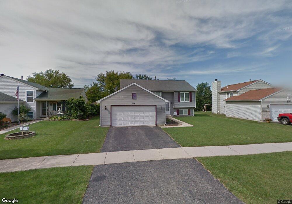
1110 Cardinal Dr Zion, IL 60099
West Zion NeighborhoodEstimated Value: $286,000 - $307,000
4
Beds
2
Baths
1,028
Sq Ft
$286/Sq Ft
Est. Value
About This Home
This home is located at 1110 Cardinal Dr, Zion, IL 60099 and is currently estimated at $293,585, approximately $285 per square foot. 1110 Cardinal Dr is a home located in Lake County with nearby schools including Newport Elementary School, Beach Park Middle School, and Zion-Benton Township High School.
Ownership History
Date
Name
Owned For
Owner Type
Purchase Details
Closed on
Jul 30, 1998
Sold by
Bank Of Waukegan
Bought by
Hamilton Keith K Y C and Hamilton Sharon K
Current Estimated Value
Home Financials for this Owner
Home Financials are based on the most recent Mortgage that was taken out on this home.
Original Mortgage
$141,648
Outstanding Balance
$29,885
Interest Rate
7.05%
Mortgage Type
VA
Estimated Equity
$263,700
Create a Home Valuation Report for This Property
The Home Valuation Report is an in-depth analysis detailing your home's value as well as a comparison with similar homes in the area
Home Values in the Area
Average Home Value in this Area
Purchase History
| Date | Buyer | Sale Price | Title Company |
|---|---|---|---|
| Hamilton Keith K Y C | $147,000 | Chicago Title Insurance Co |
Source: Public Records
Mortgage History
| Date | Status | Borrower | Loan Amount |
|---|---|---|---|
| Open | Hamilton Keith K Y C | $141,648 |
Source: Public Records
Tax History Compared to Growth
Tax History
| Year | Tax Paid | Tax Assessment Tax Assessment Total Assessment is a certain percentage of the fair market value that is determined by local assessors to be the total taxable value of land and additions on the property. | Land | Improvement |
|---|---|---|---|---|
| 2024 | $8,121 | $80,268 | $9,976 | $70,292 |
| 2023 | $8,121 | $71,565 | $8,894 | $62,671 |
| 2022 | $7,487 | $63,381 | $7,299 | $56,082 |
| 2021 | $7,370 | $59,457 | $6,847 | $52,610 |
| 2020 | $7,098 | $55,923 | $6,440 | $49,483 |
| 2019 | $6,895 | $52,094 | $5,999 | $46,095 |
| 2018 | $6,155 | $46,398 | $5,420 | $40,978 |
| 2017 | $6,028 | $43,041 | $5,028 | $38,013 |
| 2016 | $5,565 | $39,071 | $4,564 | $34,507 |
| 2015 | $5,316 | $35,451 | $4,141 | $31,310 |
| 2014 | $4,945 | $34,040 | $3,908 | $30,132 |
| 2012 | $5,402 | $36,251 | $4,162 | $32,089 |
Source: Public Records
Map
Nearby Homes
- 908 Countrywood Dr
- 1302 Lorelei Dr
- 0 9th St
- 1417 Westside Trail
- 4014 Ridge Rd
- 3717 Willow Crest Dr
- 3707 Willow Crest Dr
- 4539 Illinois 173
- 4533 Illinois 173
- 1304 Pelican Ct
- 41320 N Green Bay Rd
- 1916 Sunshine Ct
- 2010 Sunset Ct
- 2031 Dawn Ln
- 1531 Southport Ct
- 43389 N Oakcrest Ln
- 1521 Southport Ct
- 43411 Lynn Dale Dr
- 42008 N Delany Rd
- 1405 Lewis Ave
- 1108 Cardinal Dr
- 1114 Cardinal Dr
- 1106 Cardinal Dr
- 1107 Cardinal Dr
- 1109 Cardinal Dr
- 1116 Cardinal Dr
- 1104 Cardinal Dr
- 1111 Cardinal Dr
- 1102 Cardinal Dr
- 4217 Wren Ln
- 1103 Cardinal Dr
- 4216 Jay Dr
- 1202 Cardinal Dr
- 1100 Cardinal Dr
- 4212 Wren Ln
- 4215 Wren Ln
- 1101 Cardinal Dr
- 1201 Cardinal Dr
- 4214 Jay Dr