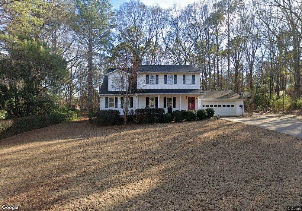
1110 Castle Dr Watkinsville, GA 30677
Estimated Value: $430,071 - $467,000
4
Beds
4
Baths
2,184
Sq Ft
$204/Sq Ft
Est. Value
About This Home
This home is located at 1110 Castle Dr, Watkinsville, GA 30677 and is currently estimated at $446,518, approximately $204 per square foot. 1110 Castle Dr is a home located in Oconee County with nearby schools including Oconee County Elementary School, Oconee County Primary School, and Oconee County Middle School.
Ownership History
Date
Name
Owned For
Owner Type
Purchase Details
Closed on
Jan 24, 2017
Sold by
Ropp William F
Bought by
Gayle
Current Estimated Value
Purchase Details
Closed on
Feb 18, 2005
Sold by
Prudential Relocation Inc
Bought by
Ropp William F
Home Financials for this Owner
Home Financials are based on the most recent Mortgage that was taken out on this home.
Original Mortgage
$136,000
Interest Rate
5.61%
Mortgage Type
New Conventional
Purchase Details
Closed on
Dec 14, 2004
Sold by
Hartz Bradley S
Bought by
Prudential Relocation Inc
Purchase Details
Closed on
Oct 7, 2003
Sold by
Hartz Bradley S
Bought by
Hartz Bradley S
Create a Home Valuation Report for This Property
The Home Valuation Report is an in-depth analysis detailing your home's value as well as a comparison with similar homes in the area
Home Values in the Area
Average Home Value in this Area
Purchase History
| Date | Buyer | Sale Price | Title Company |
|---|---|---|---|
| Gayle | -- | -- | |
| Ropp William F | $170,000 | -- | |
| Prudential Relocation Inc | $181,500 | -- | |
| Hartz Bradley S | -- | -- | |
| Hartz Bradley S | $166,900 | -- |
Source: Public Records
Mortgage History
| Date | Status | Borrower | Loan Amount |
|---|---|---|---|
| Previous Owner | Ropp William F | $136,000 |
Source: Public Records
Tax History Compared to Growth
Tax History
| Year | Tax Paid | Tax Assessment Tax Assessment Total Assessment is a certain percentage of the fair market value that is determined by local assessors to be the total taxable value of land and additions on the property. | Land | Improvement |
|---|---|---|---|---|
| 2024 | $2,463 | $131,648 | $30,000 | $101,648 |
| 2023 | $2,460 | $123,152 | $26,000 | $97,152 |
| 2022 | $2,251 | $104,906 | $22,000 | $82,906 |
| 2021 | $2,272 | $98,159 | $22,000 | $76,159 |
| 2020 | $2,200 | $94,877 | $22,000 | $72,877 |
| 2019 | $2,003 | $86,402 | $16,800 | $69,602 |
| 2018 | $1,848 | $78,029 | $16,800 | $61,229 |
| 2017 | $1,605 | $67,780 | $16,800 | $50,980 |
| 2016 | $1,592 | $67,217 | $16,800 | $50,417 |
| 2015 | $1,555 | $65,510 | $16,000 | $49,510 |
| 2014 | $1,552 | $63,914 | $16,000 | $47,914 |
| 2013 | -- | $65,048 | $18,000 | $47,048 |
Source: Public Records
Map
Nearby Homes
- 2041 Simonton Bridge Rd
- 2061 Simonton Bridge Rd
- 2190 Simonton Bridge Rd
- 1030 Rossiter Ct
- 1040 Rossiter Ct
- 2240 Simonton Bridge Rd
- 1250 Calls Creek Cir
- 1010 Overton Way
- 1061 Riverside Dr
- 1051 Simonton Way
- 1682 River Bank Ln
- 1320 Katie Ln
- 1145 Watson Ln Unit E3
- 1311 Watson Ln Unit E8
- 1171 Watson Ln Unit E4
- 1195 Watson Ln Unit E5
- 1170 Watson Ln Unit F5
- 1120 Castle Dr
- 1080 Castle Dr
- 1131 Castle Dr
- 1161 Broadlands Dr
- 1150 Castle Dr
- 1091 Castle Dr
- 1021 Castle Ct
- 0 Castle Dr Unit 7343355
- 0 Castle Dr Unit 7101337
- 0 Castle Dr Unit 3190103
- 0 Castle Dr Unit 3171429
- 0 Castle Dr Unit 8826589
- 0 Castle Dr Unit 8133861
- 0 Castle Dr Unit 8131986
- 0 Castle Dr Unit 7617907
- 1090 Castle Dr
- 1181 Broadlands Dr
- 1160 Castle Dr
- 1161 Castle Dr
- 1060 Broadlands Dr