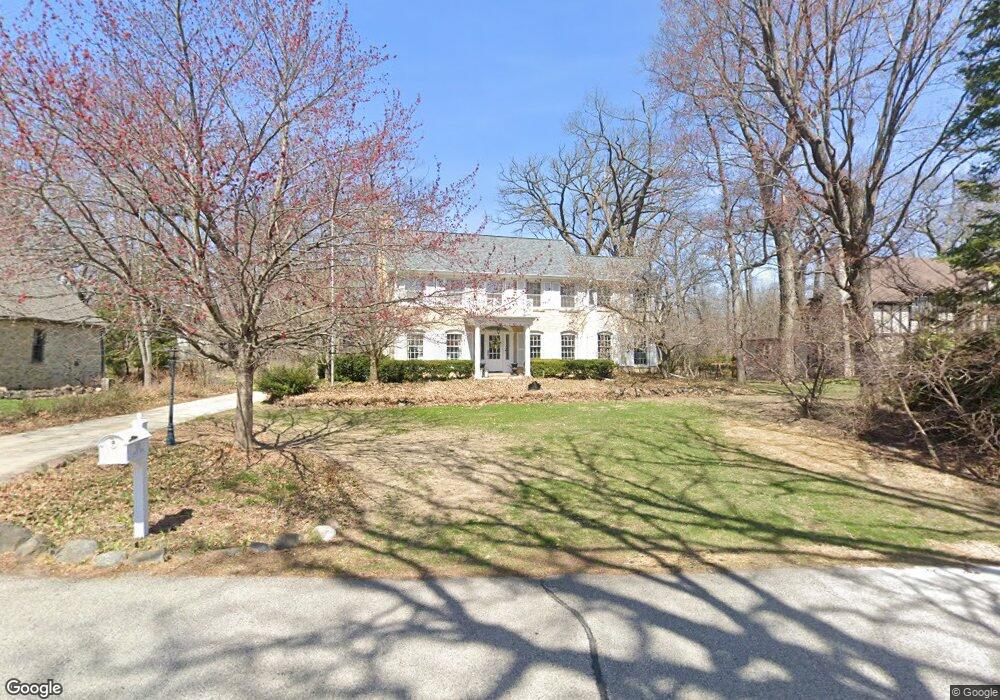
1110 Circle Dr Elm Grove, WI 53122
Estimated Value: $932,416 - $1,645,000
4
Beds
2
Baths
3,296
Sq Ft
$356/Sq Ft
Est. Value
About This Home
This home is located at 1110 Circle Dr, Elm Grove, WI 53122 and is currently estimated at $1,173,604, approximately $356 per square foot. 1110 Circle Dr is a home located in Waukesha County with nearby schools including Tonawanda Elementary School, Pilgrim Park Middle School, and Brookfield East High School.
Ownership History
Date
Name
Owned For
Owner Type
Purchase Details
Closed on
Oct 14, 2004
Sold by
Curtis John E and Curtis Anne Elizabeth
Bought by
Perry Marcus T and Perry Constance F
Current Estimated Value
Home Financials for this Owner
Home Financials are based on the most recent Mortgage that was taken out on this home.
Original Mortgage
$333,700
Outstanding Balance
$167,034
Interest Rate
5.93%
Mortgage Type
Purchase Money Mortgage
Estimated Equity
$1,006,570
Create a Home Valuation Report for This Property
The Home Valuation Report is an in-depth analysis detailing your home's value as well as a comparison with similar homes in the area
Home Values in the Area
Average Home Value in this Area
Purchase History
| Date | Buyer | Sale Price | Title Company |
|---|---|---|---|
| Perry Marcus T | $659,900 | -- |
Source: Public Records
Mortgage History
| Date | Status | Borrower | Loan Amount |
|---|---|---|---|
| Open | Perry Marcus T | $333,700 | |
| Closed | Perry Marcus T | $66,000 |
Source: Public Records
Tax History
| Year | Tax Paid | Tax Assessment Tax Assessment Total Assessment is a certain percentage of the fair market value that is determined by local assessors to be the total taxable value of land and additions on the property. | Land | Improvement |
|---|---|---|---|---|
| 2024 | $10,855 | $850,400 | $164,100 | $686,300 |
| 2023 | $10,983 | $794,200 | $161,100 | $633,100 |
| 2022 | $11,360 | $779,700 | $161,100 | $618,600 |
| 2021 | $11,434 | $690,400 | $161,100 | $529,300 |
| 2020 | $11,919 | $687,900 | $161,100 | $526,800 |
| 2019 | $12,057 | $664,600 | $163,300 | $501,300 |
Source: Public Records
Map
Nearby Homes
- 920 Madera Cir
- 14220 Hillside Rd
- 13335 Watertown Plank Rd Unit 211
- 630 Park Cir
- 840 Terrace Dr
- 13070 W Bluemound Rd Unit 209
- 13050 W Bluemound Rd Unit 303
- 15105 Froedtert Dr
- 14625 Club Dr
- 12990 W Bluemound Rd Unit 202
- 12980 W Bluemound Rd Unit 108
- 1150 Pilgrim Pkwy Unit 1150
- 12855 Stephen Place
- 12805 Stephen Place
- 15305 Cascade Dr
- 175 N Elm Grove Rd Unit D
- 15150 Marilyn Dr Unit A
- 2415 Walnut Grove Ct Unit B
- 2365 Mary Beth Ct
- 12207 W Bluemound Rd
- 1100 Circle Dr
- 1140 Circle Dr
- 14125 Saint George Ct
- 14165 Saint George Ct
- 1020 Kurtis Dr
- 1045 Circle Dr
- 1125 Circle Dr
- 1080 Circle Dr
- 14105 Saint George Ct
- 975 Brinsmere Dr
- 14175 Saint George Ct
- 950 Brinsmere Dr
- 1040 Circle Dr
- 955 Brinsmere Dr
- 1045 Kurtis Dr
- 1025 Kurtis Dr
- 1020 Circle Dr
- 14050 Saint George Ct
- 900 Brinsmere Dr
- 1085 Grandview Dr
Your Personal Tour Guide
Ask me questions while you tour the home.