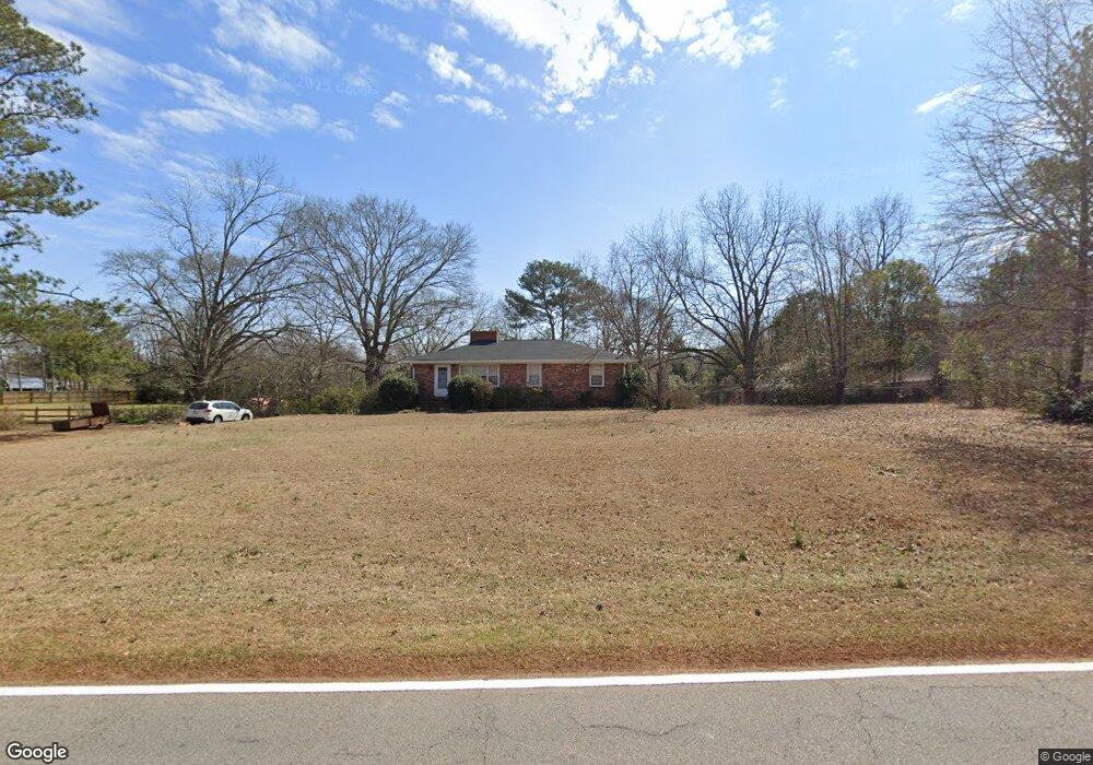
1110 E Mcintosh Rd Griffin, GA 30223
Spalding County NeighborhoodEstimated Value: $168,000 - $224,000
3
Beds
3
Baths
2,059
Sq Ft
$93/Sq Ft
Est. Value
About This Home
This home is located at 1110 E Mcintosh Rd, Griffin, GA 30223 and is currently estimated at $192,337, approximately $93 per square foot. 1110 E Mcintosh Rd is a home located in Spalding County with nearby schools including Atkinson Elementary School, Cowan Road Middle School, and Spalding High School.
Ownership History
Date
Name
Owned For
Owner Type
Purchase Details
Closed on
Feb 27, 2020
Sold by
Campbell Fay Foy Estate
Bought by
Campbell Elizabeth Adell
Current Estimated Value
Purchase Details
Closed on
Aug 27, 1990
Sold by
Campbell Walter E and Campbell Faye F
Bought by
Campbell Faye Foy
Purchase Details
Closed on
Jul 15, 1976
Sold by
Campbell Walter Eugene
Bought by
Campbell Walter E and Campbell Faye F
Purchase Details
Closed on
Jul 7, 1955
Bought by
Campbell Walter Eugene
Create a Home Valuation Report for This Property
The Home Valuation Report is an in-depth analysis detailing your home's value as well as a comparison with similar homes in the area
Home Values in the Area
Average Home Value in this Area
Purchase History
| Date | Buyer | Sale Price | Title Company |
|---|---|---|---|
| Campbell Elizabeth Adell | -- | -- | |
| Campbell Faye Foy | -- | -- | |
| Campbell Walter E | -- | -- | |
| Campbell Walter Eugene | -- | -- |
Source: Public Records
Tax History Compared to Growth
Tax History
| Year | Tax Paid | Tax Assessment Tax Assessment Total Assessment is a certain percentage of the fair market value that is determined by local assessors to be the total taxable value of land and additions on the property. | Land | Improvement |
|---|---|---|---|---|
| 2024 | $1,545 | $44,991 | $9,442 | $35,549 |
| 2023 | $1,545 | $41,803 | $9,442 | $32,361 |
| 2022 | $1,264 | $36,568 | $8,166 | $28,402 |
| 2021 | $1,206 | $34,964 | $8,166 | $26,798 |
| 2020 | $1,276 | $34,964 | $8,166 | $26,798 |
| 2019 | $142 | $34,964 | $8,166 | $26,798 |
| 2018 | $134 | $32,621 | $8,166 | $24,455 |
| 2017 | $134 | $32,621 | $8,166 | $24,455 |
| 2016 | $134 | $32,621 | $8,166 | $24,455 |
| 2015 | $153 | $32,621 | $8,166 | $24,455 |
| 2014 | $1,226 | $32,621 | $8,166 | $24,455 |
Source: Public Records
Map
Nearby Homes
- 204 Custer Cir
- 126 Callie Rd
- 0 Short St Unit 10555372
- 0 Short St Unit 7572526
- 1621 N Hill St
- 1110 N 2nd St
- 1517 Cabin Creek Trail
- 1416 Spellman Ave
- 1324 Spellman Ave
- 607 Lakewood Dr
- 1307 Wildwood Dr
- 103 Cabin Creek Cir
- 418 E Northwoods Dr
- 32 UNIT MUTLIPL Multiple
- 1406 Canterbury Rd
- 0 Jackson Rd Unit 10545729
- 204 Derek Ct
- 221 Lexington Ave
- 1406 N 9th St
- 127 Kennedy Rd
- 1112 E Mcintosh Rd
- 1108 E Mcintosh Rd
- 1114 E Mcintosh Rd
- 1107 E Mcintosh Rd
- 1104 E Mcintosh Rd
- 1103 E Mcintosh Rd
- 1105 E Mcintosh Rd
- 1109 E Mcintosh Rd
- 103 Hammerhawk Rd
- 105 Hammerhawk Rd
- 1111 E Mcintosh Rd
- 1020 E Mcintosh Rd
- 107 Hammerhawk Rd
- 1118 E Mcintosh Rd
- 1015 E Mcintosh Rd
- 109 Hammerhawk Rd
- 1013 E Mcintosh Rd
- 1018 E Mcintosh Rd
- 104 Hammerhawk Rd
- 111 Hammerhawk Rd