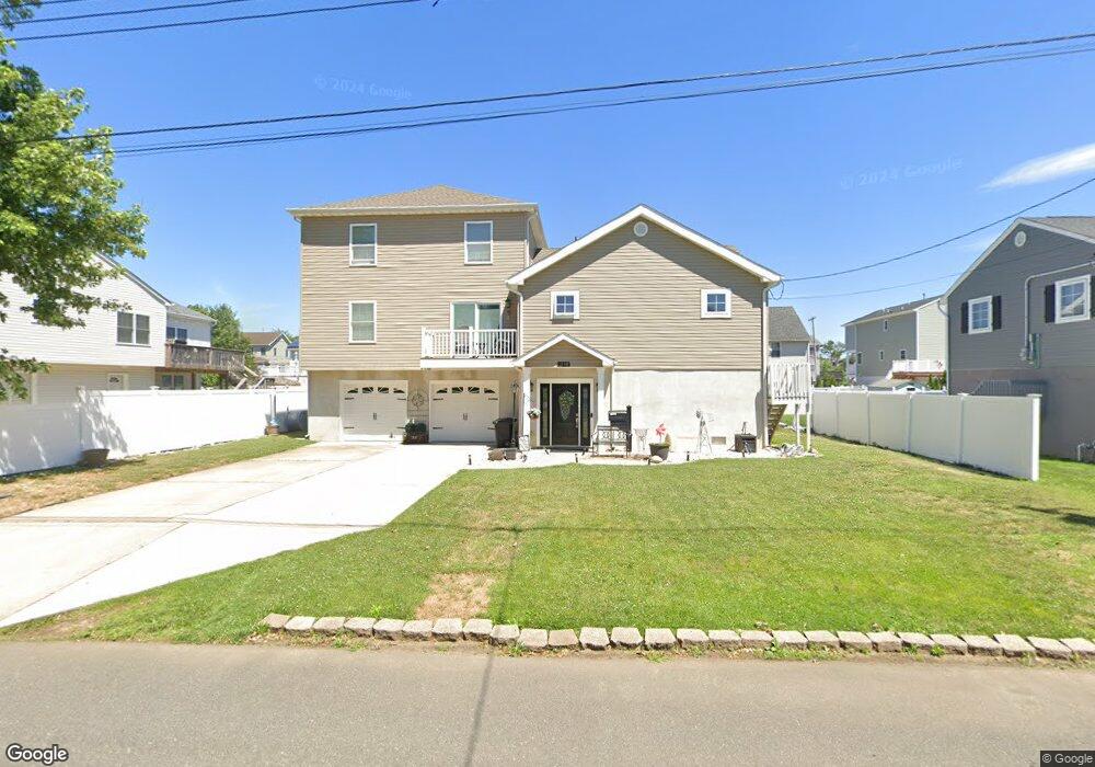
1110 High Ave Union Beach, NJ 07735
Estimated Value: $662,507 - $721,000
3
Beds
2
Baths
2,132
Sq Ft
$324/Sq Ft
Est. Value
About This Home
This home is located at 1110 High Ave, Union Beach, NJ 07735 and is currently estimated at $690,127, approximately $323 per square foot. 1110 High Ave is a home located in Monmouth County with nearby schools including Memorial School, Baytul-Iman Academy, and St. Ann School.
Ownership History
Date
Name
Owned For
Owner Type
Purchase Details
Closed on
Aug 26, 2025
Sold by
Merse Perry R and Merse Frances
Bought by
Merse Frances and Merse Perry R
Current Estimated Value
Home Financials for this Owner
Home Financials are based on the most recent Mortgage that was taken out on this home.
Original Mortgage
$290,000
Outstanding Balance
$290,000
Interest Rate
6.74%
Mortgage Type
New Conventional
Estimated Equity
$400,127
Purchase Details
Closed on
Sep 13, 2004
Sold by
Laberta Carolyn
Bought by
Merse Perry and Merse Frances
Home Financials for this Owner
Home Financials are based on the most recent Mortgage that was taken out on this home.
Original Mortgage
$165,000
Interest Rate
5.8%
Create a Home Valuation Report for This Property
The Home Valuation Report is an in-depth analysis detailing your home's value as well as a comparison with similar homes in the area
Home Values in the Area
Average Home Value in this Area
Purchase History
| Date | Buyer | Sale Price | Title Company |
|---|---|---|---|
| Merse Frances | -- | Obrien Title | |
| Merse Perry | $216,000 | -- |
Source: Public Records
Mortgage History
| Date | Status | Borrower | Loan Amount |
|---|---|---|---|
| Open | Merse Frances | $290,000 | |
| Previous Owner | Merse Perry | $165,000 |
Source: Public Records
Tax History Compared to Growth
Tax History
| Year | Tax Paid | Tax Assessment Tax Assessment Total Assessment is a certain percentage of the fair market value that is determined by local assessors to be the total taxable value of land and additions on the property. | Land | Improvement |
|---|---|---|---|---|
| 2025 | $11,591 | $603,400 | $201,600 | $401,800 |
| 2024 | $11,381 | $562,100 | $175,600 | $386,500 |
| 2023 | $11,381 | $531,800 | $152,700 | $379,100 |
| 2022 | $10,027 | $470,000 | $122,100 | $347,900 |
| 2021 | $10,027 | $425,200 | $111,000 | $314,200 |
| 2020 | $10,177 | $404,500 | $107,600 | $296,900 |
| 2019 | $9,689 | $375,700 | $102,500 | $273,200 |
| 2018 | $9,455 | $352,400 | $87,500 | $264,900 |
| 2017 | $2,093 | $75,000 | $75,000 | $0 |
| 2016 | $2,245 | $80,500 | $80,500 | $0 |
| 2015 | $2,397 | $87,500 | $87,500 | $0 |
| 2014 | $2,678 | $80,600 | $80,600 | $0 |
Source: Public Records
Map
Nearby Homes
- 1213 Highway 36
- 904 Central Ave
- 1217 Union Ave
- 1319 Union Ave
- 650 Washington Ave
- 628 Morningside Ave
- 631 Sydney Ave
- 825 Lorillard Ave
- 715 Park Ave
- 31 Sams Trailer Ct
- 602 Union Ave
- 405 Shore Rd
- 709 Lorillard Ave
- 51 Sams Trailer Ct
- 412 Union Ave
- 521 Columbia Ave
- 525 Washington Ave
- 814 Brook Ave
- 21 Hemlock St
- 535 Lorillard Ave
- 102 Asbury Ave
- 1114 High Ave
- 1109 Harris Ave
- 1107 Harris Ave
- 1111 High Ave
- 1119 Harris Ave
- 1115 High Ave
- 1204 High Ave
- 1117 High Ave
- 1929 Harris Ave
- 1121 Harris Ave
- 156 Asbury Ave
- 1021 Harris Ave
- 1213 High Ave Unit 36
- 1102 Harris Ave
- 1203 High Ave
- 1202 High Ave
- 1106 Harris Ave
- 1112 Harris Ave
- 1009 Harris Ave