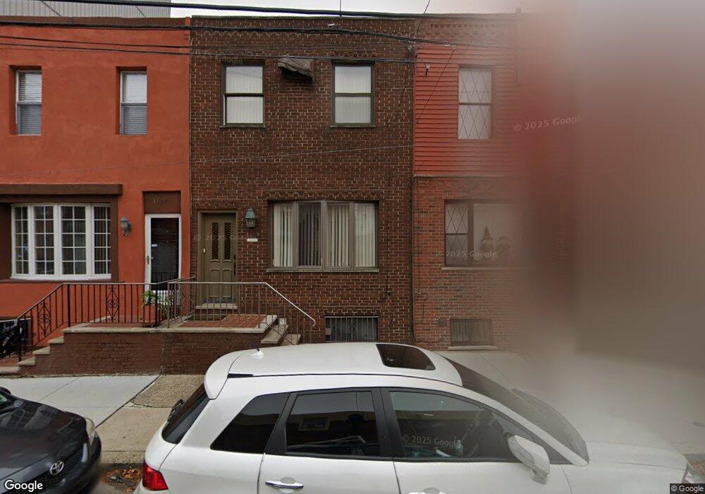
1110 Mckean St Philadelphia, PA 19148
East Passyunk NeighborhoodEstimated Value: $369,659 - $425,000
3
Beds
1
Bath
1,200
Sq Ft
$335/Sq Ft
Est. Value
About This Home
This home is located at 1110 Mckean St, Philadelphia, PA 19148 and is currently estimated at $401,915, approximately $334 per square foot. 1110 Mckean St is a home located in Philadelphia County with nearby schools including South Philadelphia High School, Southwark School, and Our Lady of Hope.
Ownership History
Date
Name
Owned For
Owner Type
Purchase Details
Closed on
Jan 13, 2022
Sold by
Carmen Ditoro
Bought by
Ditoro Olivia
Current Estimated Value
Home Financials for this Owner
Home Financials are based on the most recent Mortgage that was taken out on this home.
Original Mortgage
$150,000
Outstanding Balance
$139,021
Interest Rate
3.55%
Mortgage Type
New Conventional
Estimated Equity
$262,894
Purchase Details
Closed on
May 25, 1978
Bought by
Carmen Di Toro and Carmen Grace
Create a Home Valuation Report for This Property
The Home Valuation Report is an in-depth analysis detailing your home's value as well as a comparison with similar homes in the area
Home Values in the Area
Average Home Value in this Area
Purchase History
| Date | Buyer | Sale Price | Title Company |
|---|---|---|---|
| Ditoro Olivia | $190,000 | Title Services | |
| Carmen Di Toro | $21,500 | -- |
Source: Public Records
Mortgage History
| Date | Status | Borrower | Loan Amount |
|---|---|---|---|
| Open | Ditoro Olivia | $150,000 |
Source: Public Records
Tax History Compared to Growth
Tax History
| Year | Tax Paid | Tax Assessment Tax Assessment Total Assessment is a certain percentage of the fair market value that is determined by local assessors to be the total taxable value of land and additions on the property. | Land | Improvement |
|---|---|---|---|---|
| 2025 | $1,747 | $351,800 | $70,360 | $281,440 |
| 2024 | $1,747 | $351,800 | $70,360 | $281,440 |
| 2023 | $1,747 | $313,400 | $62,680 | $250,720 |
| 2022 | $1,747 | $124,800 | $62,680 | $62,120 |
| 2021 | $1,747 | $0 | $0 | $0 |
| 2020 | $1,747 | $0 | $0 | $0 |
| 2019 | $1,747 | $0 | $0 | $0 |
| 2018 | $1,729 | $0 | $0 | $0 |
| 2017 | $1,747 | $0 | $0 | $0 |
| 2016 | $1,747 | $0 | $0 | $0 |
| 2015 | $12,194 | $0 | $0 | $0 |
| 2014 | -- | $184,600 | $15,998 | $168,602 |
| 2012 | -- | $13,312 | $2,567 | $10,745 |
Source: Public Records
Map
Nearby Homes
- 1936 S Sartain St
- 1120 Emily St
- 1912 S Sartain St
- 1133 Mercy St
- 1034 Mckean St
- 1154 Mercy St
- 1218 Mckean St
- 1105 Snyder Ave
- 1031 Mercy St
- 1037 Snyder Ave
- 1229 Emily St
- 1006 Mckean St
- 1921 S 10th St
- 1116 Cantrell St
- 1106 Cantrell St
- 1133 Winton St
- 1008 Snyder Ave
- 1021 Cantrell St
- 1234 Snyder Ave
- 2015 S Hutchinson St Unit 12
- 1112 Mckean St
- 1114 Mckean St
- 1116 Mckean St
- 1108 Mckean St
- 1118 Mckean St
- 1106 Mckean St
- 1107 Emily St
- 1109 Emily St
- 1105 Emily St
- 1111 Emily St
- 1120 Mckean St
- 1103 Emily St
- 1113 Emily St
- 1101 Emily St
- 1101 Emily St Unit B
- 1101 Emily St Unit A
- 1115 Emily St
- 1122 Mckean St
- 1102 Mckean St
- 1117 Emily St