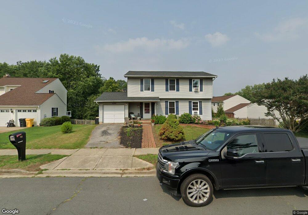
1110 Mermaid Dr Annapolis, MD 21409
Cape Saint Claire NeighborhoodEstimated Value: $564,000 - $650,000
4
Beds
3
Baths
1,870
Sq Ft
$322/Sq Ft
Est. Value
About This Home
This home is located at 1110 Mermaid Dr, Annapolis, MD 21409 and is currently estimated at $602,490, approximately $322 per square foot. 1110 Mermaid Dr is a home located in Anne Arundel County with nearby schools including Cape St. Claire Elementary School, Magothy River Middle School, and Broadneck High School.
Ownership History
Date
Name
Owned For
Owner Type
Purchase Details
Closed on
Feb 10, 2005
Sold by
Adams Celia M
Bought by
Mayhew Randall and Mayhew Kimberly
Current Estimated Value
Home Financials for this Owner
Home Financials are based on the most recent Mortgage that was taken out on this home.
Original Mortgage
$280,000
Outstanding Balance
$147,808
Interest Rate
6.55%
Mortgage Type
Adjustable Rate Mortgage/ARM
Estimated Equity
$454,682
Purchase Details
Closed on
Feb 1, 1999
Sold by
Adams James E
Bought by
Adams Celia M
Purchase Details
Closed on
Jun 6, 1995
Sold by
Turner Elizabeth J
Bought by
Adams Ii James E
Home Financials for this Owner
Home Financials are based on the most recent Mortgage that was taken out on this home.
Original Mortgage
$172,900
Interest Rate
8.2%
Create a Home Valuation Report for This Property
The Home Valuation Report is an in-depth analysis detailing your home's value as well as a comparison with similar homes in the area
Home Values in the Area
Average Home Value in this Area
Purchase History
| Date | Buyer | Sale Price | Title Company |
|---|---|---|---|
| Mayhew Randall | $350,000 | -- | |
| Adams Celia M | -- | -- | |
| Adams Ii James E | $167,900 | -- |
Source: Public Records
Mortgage History
| Date | Status | Borrower | Loan Amount |
|---|---|---|---|
| Open | Mayhew Randall | $280,000 | |
| Closed | Mayhew Randall | $70,000 | |
| Previous Owner | Adams Ii James E | $172,900 | |
| Closed | Adams Celia M | -- |
Source: Public Records
Tax History Compared to Growth
Tax History
| Year | Tax Paid | Tax Assessment Tax Assessment Total Assessment is a certain percentage of the fair market value that is determined by local assessors to be the total taxable value of land and additions on the property. | Land | Improvement |
|---|---|---|---|---|
| 2025 | $4,368 | $488,000 | -- | -- |
| 2024 | $4,368 | $445,100 | $249,000 | $196,100 |
| 2023 | $4,257 | $439,733 | $0 | $0 |
| 2022 | $3,988 | $434,367 | $0 | $0 |
| 2021 | $7,844 | $429,000 | $224,000 | $205,000 |
| 2020 | $3,806 | $413,367 | $0 | $0 |
| 2019 | $3,733 | $397,733 | $0 | $0 |
| 2018 | $3,874 | $382,100 | $181,700 | $200,400 |
| 2017 | $3,502 | $369,967 | $0 | $0 |
| 2016 | -- | $357,833 | $0 | $0 |
| 2015 | -- | $345,700 | $0 | $0 |
| 2014 | -- | $345,200 | $0 | $0 |
Source: Public Records
Map
Nearby Homes
- 1165 Green Holly Ct
- 1167 Green Holly Dr
- 1138 Ramblewood Dr
- 1181 Ramblewood Dr
- 971 Saint Margarets Dr
- 959 Morgan Dr
- 1019 Landon Ln
- 1199 Ramblewood Dr
- 1031 Lake Claire Dr
- 786 Rolling View Dr
- 810 Chestnut Tree Dr
- 975 Phillips Dr
- 1214 Ramblewood Dr
- 1094 Linden Tree Drive - Taft Model
- 1096
- 1247 Ramblewood Dr
- 932 Hilltop Rd
- 1162 Saint George Dr
- 1217 Hampton Rd
- 1219 Hampton Rd