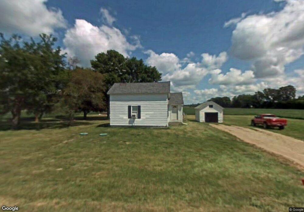
1110 N Grange Rd Fowler, MI 48835
Estimated Value: $201,000 - $279,000
3
Beds
3
Baths
1,510
Sq Ft
$158/Sq Ft
Est. Value
About This Home
This home is located at 1110 N Grange Rd, Fowler, MI 48835 and is currently estimated at $238,902, approximately $158 per square foot. 1110 N Grange Rd is a home located in Clinton County with nearby schools including Waldron Elementary/Middle School, Fowler High School, and St Joseph Elementary School.
Ownership History
Date
Name
Owned For
Owner Type
Purchase Details
Closed on
Nov 19, 2014
Sold by
Community Developers Inc
Bought by
Farley Kenneth L and Farley Amanda L
Current Estimated Value
Home Financials for this Owner
Home Financials are based on the most recent Mortgage that was taken out on this home.
Original Mortgage
$29,600
Outstanding Balance
$22,649
Interest Rate
3.97%
Mortgage Type
Future Advance Clause Open End Mortgage
Estimated Equity
$216,253
Purchase Details
Closed on
Sep 15, 2008
Sold by
Hungerford Helen R
Bought by
Farley Kenneth L and Farley Amanda L
Home Financials for this Owner
Home Financials are based on the most recent Mortgage that was taken out on this home.
Original Mortgage
$84,000
Interest Rate
6.54%
Mortgage Type
Purchase Money Mortgage
Purchase Details
Closed on
May 6, 2008
Sold by
Hungerford Helen R and Hungerford Paul K
Bought by
Hungerford Helen R
Create a Home Valuation Report for This Property
The Home Valuation Report is an in-depth analysis detailing your home's value as well as a comparison with similar homes in the area
Home Values in the Area
Average Home Value in this Area
Purchase History
| Date | Buyer | Sale Price | Title Company |
|---|---|---|---|
| Farley Kenneth L | $37,000 | Midstate | |
| Farley Kenneth L | $105,000 | First American Title Ins Co | |
| Hungerford Helen R | -- | First American Title Ins Co |
Source: Public Records
Mortgage History
| Date | Status | Borrower | Loan Amount |
|---|---|---|---|
| Open | Farley Kenneth L | $29,600 | |
| Previous Owner | Farley Kenneth L | $84,000 |
Source: Public Records
Tax History Compared to Growth
Tax History
| Year | Tax Paid | Tax Assessment Tax Assessment Total Assessment is a certain percentage of the fair market value that is determined by local assessors to be the total taxable value of land and additions on the property. | Land | Improvement |
|---|---|---|---|---|
| 2025 | $2,427 | $75,400 | $18,200 | $57,200 |
| 2024 | $636 | $70,600 | $18,000 | $52,600 |
| 2023 | $603 | $64,500 | $0 | $0 |
| 2022 | $1,319 | $59,800 | $16,000 | $43,800 |
| 2021 | $1,279 | $55,400 | $15,000 | $40,400 |
| 2020 | $1,242 | $54,200 | $15,000 | $39,200 |
| 2019 | $999 | $49,400 | $10,500 | $38,900 |
| 2018 | $976 | $47,500 | $10,500 | $37,000 |
| 2017 | -- | $46,700 | $11,000 | $35,700 |
| 2016 | $953 | $44,200 | $11,000 | $33,200 |
| 2015 | -- | $44,600 | $0 | $0 |
| 2011 | -- | $47,000 | $0 | $0 |
Source: Public Records
Map
Nearby Homes
- 154 S Yates St
- 0 Yates St
- 11255 W Wayne St
- 11138 W 2nd St
- 11040 W Ionia St
- V/L W M21
- 982 Norway Dr
- 10911 E Kent St
- Lot 8 N Wright Rd
- 11670 Jessup Rd
- 781 Hopkins Rd
- 6928 Hubbardston Rd
- 226 Church St
- 306 Russell St
- 8435 E Point Dr
- 1273 E Bridge St
- 1100 Hayes Rd
- 9515 W Moss Rd
- 1170 Liberty
- V/L Stoneybrook Trail
- 1251 N Grange Rd
- 1181 N Grange Rd
- 13980 W M 21
- 13980 Michigan 21
- 1361 N Grange Rd
- 13869 W M 21
- 1460 N Grange Rd
- 13629 Michigan 21
- 13629 W M 21
- 1607 N Grange Rd
- 1620 N Grange Rd
- 1396 S Grange Rd
- 1694 N Grange Rd
- 14250 W M 21
- 1800 N Grange Rd
- 1595 S Grange Rd
- 14674 W Bluewater Hwy
- 1892 N Grange Rd
- 1668 S Grange Rd
- 1744 S Grange Rd