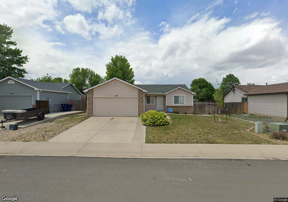
1110 Norma Ct Milliken, CO 80543
Estimated Value: $385,000 - $405,000
3
Beds
2
Baths
1,088
Sq Ft
$360/Sq Ft
Est. Value
About This Home
This home is located at 1110 Norma Ct, Milliken, CO 80543 and is currently estimated at $391,142, approximately $359 per square foot. 1110 Norma Ct is a home located in Weld County with nearby schools including Milliken Elementary School, Milliken Middle School, and Roosevelt High School.
Ownership History
Date
Name
Owned For
Owner Type
Purchase Details
Closed on
Oct 1, 2019
Sold by
Bates Tracy A and Bates Debra M
Bought by
Tracy And Debra Bates Trust
Current Estimated Value
Purchase Details
Closed on
Sep 24, 2004
Sold by
Hud
Bought by
Bates Tracy R and Bates Debbie N
Purchase Details
Closed on
Aug 4, 2004
Sold by
Ullerick Ernerst W and Ullerick Laurel S
Bought by
Hud
Purchase Details
Closed on
Oct 26, 2000
Sold by
Elshop Lori L
Bought by
Ullerick Ernest W and Ullerick Laurel S
Home Financials for this Owner
Home Financials are based on the most recent Mortgage that was taken out on this home.
Original Mortgage
$141,830
Interest Rate
7.89%
Mortgage Type
FHA
Purchase Details
Closed on
Jun 17, 1999
Sold by
Wal Mar Third Llc
Bought by
Elshof Lori L
Create a Home Valuation Report for This Property
The Home Valuation Report is an in-depth analysis detailing your home's value as well as a comparison with similar homes in the area
Home Values in the Area
Average Home Value in this Area
Purchase History
| Date | Buyer | Sale Price | Title Company |
|---|---|---|---|
| Tracy And Debra Bates Trust | -- | None Available | |
| Bates Tracy R | $135,000 | Oxford Title | |
| Hud | $154,911 | -- | |
| Ullerick Ernest W | $143,500 | Land Title Guarantee Company | |
| Elshof Lori L | $28,000 | Land Title |
Source: Public Records
Mortgage History
| Date | Status | Borrower | Loan Amount |
|---|---|---|---|
| Previous Owner | Ullerick Ernest W | $141,830 |
Source: Public Records
Tax History Compared to Growth
Tax History
| Year | Tax Paid | Tax Assessment Tax Assessment Total Assessment is a certain percentage of the fair market value that is determined by local assessors to be the total taxable value of land and additions on the property. | Land | Improvement |
|---|---|---|---|---|
| 2025 | $2,028 | $24,060 | $5,880 | $18,180 |
| 2024 | $2,028 | $24,060 | $5,880 | $18,180 |
| 2023 | $2,071 | $24,440 | $5,410 | $19,030 |
| 2022 | $2,240 | $19,170 | $4,380 | $14,790 |
| 2021 | $2,418 | $19,710 | $4,500 | $15,210 |
| 2020 | $2,174 | $18,100 | $3,580 | $14,520 |
| 2019 | $1,706 | $18,100 | $3,580 | $14,520 |
| 2018 | $1,417 | $14,680 | $2,810 | $11,870 |
| 2017 | $1,418 | $14,680 | $2,810 | $11,870 |
| 2016 | $1,228 | $12,600 | $2,270 | $10,330 |
| 2015 | $1,249 | $12,600 | $2,270 | $10,330 |
| 2014 | $873 | $8,910 | $2,390 | $6,520 |
Source: Public Records
Map
Nearby Homes
- 1130 S Marjorie Ave
- 381 E Mountain Ash St
- 140 E Lilac St
- 280 E Katsura St
- 1530 S Haymaker Dr
- 576 S Honeylocust Ct
- 226 W Forest St
- 218 S Josephine Ave
- 209 S Josephine Ave
- 1576 S Frances Ave
- 105 S Laura Ave
- 0 S Cora Ave
- 1305 S Cattleman Dr
- 208 S Frances Ave
- 103 N Josephine Ave Unit LOT 36
- 113 S Frances Ave
- 0 Broad St Unit RECIR992751
- 0 Broad St Unit RECIR992750
- 381 Bobcat Dr
- 622 Traildust Dr
- 1090 Norma Ct
- 1070 Norma Ct
- 1150 Norma Ct
- 1111 S Olive Ave
- 1131 S Olive Ave
- 1111 Norma Ct
- 1151 S Olive Ave
- 1071 S Olive Ave
- 1091 Norma Ct
- 1131 Norma Ct
- 1170 Norma Ct
- 1071 Norma Ct
- 1191 Norma Ct
- 1151 Norma Ct
- 1171 S Olive Ave
- 261 E Mountain Ash St
- 1171 Norma Ct
- 241 E Mountain Ash St
- 301 E Mountain Ash St
- 221 E Mountain Ash Ct