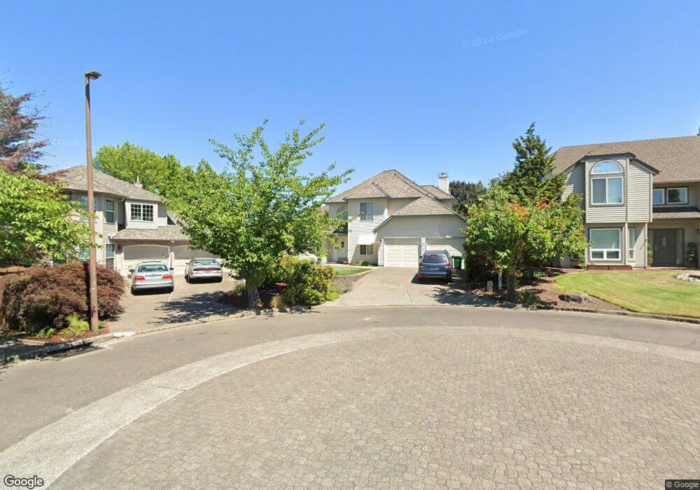
1110 NW 161st Place Beaverton, OR 97006
Five Oaks NeighborhoodEstimated Value: $651,012 - $824,000
3
Beds
3
Baths
2,008
Sq Ft
$357/Sq Ft
Est. Value
About This Home
This home is located at 1110 NW 161st Place, Beaverton, OR 97006 and is currently estimated at $716,503, approximately $356 per square foot. 1110 NW 161st Place is a home located in Washington County with nearby schools including Elmonica Elementary School, Five Oaks Middle School, and Westview High School.
Ownership History
Date
Name
Owned For
Owner Type
Purchase Details
Closed on
Aug 14, 1997
Sold by
West James and West Ruth E
Bought by
Brown Robert D and Brown Patricia Gilmore
Current Estimated Value
Home Financials for this Owner
Home Financials are based on the most recent Mortgage that was taken out on this home.
Original Mortgage
$197,000
Outstanding Balance
$27,295
Interest Rate
7.61%
Estimated Equity
$689,208
Purchase Details
Closed on
Nov 1, 1996
Sold by
West Ruth Ellen
Bought by
West James and West Ruth E
Home Financials for this Owner
Home Financials are based on the most recent Mortgage that was taken out on this home.
Original Mortgage
$49,000
Interest Rate
8.14%
Purchase Details
Closed on
May 17, 1996
Sold by
Waterhouse Homes Associates Ltd
Bought by
West James and West Ruth E
Create a Home Valuation Report for This Property
The Home Valuation Report is an in-depth analysis detailing your home's value as well as a comparison with similar homes in the area
Home Values in the Area
Average Home Value in this Area
Purchase History
| Date | Buyer | Sale Price | Title Company |
|---|---|---|---|
| Brown Robert D | $225,000 | Chicago Title Insurance Co | |
| West James | -- | Stewart Title Company | |
| West James | $61,000 | First American |
Source: Public Records
Mortgage History
| Date | Status | Borrower | Loan Amount |
|---|---|---|---|
| Open | Brown Robert D | $197,000 | |
| Previous Owner | West James | $49,000 |
Source: Public Records
Tax History Compared to Growth
Tax History
| Year | Tax Paid | Tax Assessment Tax Assessment Total Assessment is a certain percentage of the fair market value that is determined by local assessors to be the total taxable value of land and additions on the property. | Land | Improvement |
|---|---|---|---|---|
| 2026 | $8,735 | $426,420 | -- | -- |
| 2025 | $8,735 | $414,000 | -- | -- |
| 2024 | $8,247 | $401,950 | -- | -- |
| 2023 | $8,247 | $390,250 | $0 | $0 |
| 2022 | $7,893 | $390,250 | $0 | $0 |
| 2021 | $7,617 | $367,860 | $0 | $0 |
| 2020 | $7,385 | $357,150 | $0 | $0 |
| 2019 | $7,152 | $346,750 | $0 | $0 |
| 2018 | $6,924 | $336,660 | $0 | $0 |
| 2017 | $6,665 | $326,860 | $0 | $0 |
| 2016 | $6,433 | $317,340 | $0 | $0 |
| 2015 | $6,194 | $308,100 | $0 | $0 |
| 2014 | $6,062 | $299,130 | $0 | $0 |
Source: Public Records
Map
Nearby Homes
- 16223 NW Ashfield Dr
- 2195 NW 160th Ave
- 15705 NW Barkton St
- 122 NW 152nd Ave
- 2474 NW 168th Place
- 17525 NW Shorewood Dr Unit 487
- 1630 NW Eastbrook Ct Unit 439
- 17555 NW Shorewood Dr Unit 497
- 16590 NW Avondale Dr
- 17570 NW Shorewood Dr
- 1551 NW Tanasbrook Ct
- 2453 NW Rogue Valley Terrace
- 17756 NW Lakeway Ct Unit 294
- 1696 NW Rolling Hill Dr Unit 348C
- 2525 NW Rogue Valley Terrace
- 17822 NW Lakeway Ct
- 17629 NW Shady Fir Loop
- 1771 NW 143rd Ave Unit 40
- 17621 NW Shady Fir Loop Unit 65
- 415 NW Kotrik Place
- 1130 NW 161st Place
- 1090 NW 161st Place
- 1060 NW 161st Place
- 1135 NW 161st Place
- 1111 NW Turnberry Terrace
- 1083 NW Turnberry Terrace
- 1095 NW 161st Place
- 1143 NW Turnberry Terrace
- 1115 NW 161st Place
- 1030 NW 161st Place
- 1065 NW 161st Place
- 1023 NW Silverado Dr
- 1035 NW 161st Place
- 1084 NW Katsules Place
- 1070 NW Katsules Place
- 1175 NW Turnberry Terrace
- 1088 NW Turnberry Terrace
- 1098 NW Katsules Place
- 990 NW 161st Terrace
- 973 NW Silverado Dr