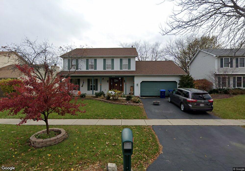
1110 Shoop Dr Geneva, IL 60134
Southwest Geneva NeighborhoodEstimated Value: $510,000 - $534,000
4
Beds
3
Baths
2,500
Sq Ft
$209/Sq Ft
Est. Value
About This Home
This home is located at 1110 Shoop Dr, Geneva, IL 60134 and is currently estimated at $521,896, approximately $208 per square foot. 1110 Shoop Dr is a home located in Kane County with nearby schools including Williamsburg Elementary School, Geneva Community High School, and St. Peter School.
Ownership History
Date
Name
Owned For
Owner Type
Purchase Details
Closed on
Feb 16, 2026
Sold by
Arellano Alfred and Arellano Paula
Bought by
Height Tyler D
Current Estimated Value
Home Financials for this Owner
Home Financials are based on the most recent Mortgage that was taken out on this home.
Original Mortgage
$515,000
Outstanding Balance
$515,000
Interest Rate
6.06%
Mortgage Type
VA
Estimated Equity
$6,896
Purchase Details
Closed on
Sep 9, 2010
Sold by
Montrose Deborah S
Bought by
Arellano Alfred and Arellano Paula
Home Financials for this Owner
Home Financials are based on the most recent Mortgage that was taken out on this home.
Original Mortgage
$190,000
Interest Rate
4.54%
Mortgage Type
New Conventional
Create a Home Valuation Report for This Property
The Home Valuation Report is an in-depth analysis detailing your home's value as well as a comparison with similar homes in the area
Home Values in the Area
Average Home Value in this Area
Purchase History
| Date | Buyer | Sale Price | Title Company |
|---|---|---|---|
| Height Tyler D | $515,000 | Chicago Title | |
| Arellano Alfred | $252,500 | First American Title |
Source: Public Records
Mortgage History
| Date | Status | Borrower | Loan Amount |
|---|---|---|---|
| Open | Height Tyler D | $515,000 | |
| Previous Owner | Arellano Alfred | $190,000 |
Source: Public Records
Tax History
| Year | Tax Paid | Tax Assessment Tax Assessment Total Assessment is a certain percentage of the fair market value that is determined by local assessors to be the total taxable value of land and additions on the property. | Land | Improvement |
|---|---|---|---|---|
| 2024 | $10,144 | $140,297 | $33,506 | $106,791 |
| 2023 | $9,860 | $127,543 | $30,460 | $97,083 |
| 2022 | $9,443 | $118,512 | $28,303 | $90,209 |
| 2021 | $9,164 | $114,107 | $27,251 | $86,856 |
| 2020 | $9,057 | $112,365 | $26,835 | $85,530 |
| 2019 | $9,032 | $110,238 | $26,327 | $83,911 |
| 2018 | $9,027 | $110,238 | $26,327 | $83,911 |
| 2017 | $8,915 | $107,298 | $25,625 | $81,673 |
| 2016 | $8,958 | $105,848 | $25,279 | $80,569 |
| 2015 | -- | $100,635 | $24,034 | $76,601 |
| 2014 | -- | $94,340 | $24,034 | $70,306 |
| 2013 | -- | $94,340 | $24,034 | $70,306 |
Source: Public Records
Map
Nearby Homes
- 2685 Cedar Ave
- Unit 8A Prairie Grove Dr
- Unit 6A Prairie Grove Dr
- Unit 4B Prairie Grove Dr
- Unit 5B Prairie Grove Dr
- Unit 8B Prairie Grove Dr
- Unit 9A Prairie Grove Dr
- Unit 4A Prairie Grove Dr
- Unit 5A Prairie Grove Dr
- Unit 7A Prairie Grove Dr
- Unit 6C Prairie Grove Dr
- Unit 5C Prairie Grove Dr
- Unit 6B Prairie Grove Dr
- Unit 4C Prairie Grove Dr
- Unit 7C Prairie Grove Dr
- 2546 Heritage Ct Unit 2
- 3408 Wild Prairie Ln
- 839 S Randall Rd
- 2782 Miller Rd
- 0N622 Sounders Dr
- 1140 Shoop Dr
- 1100 Shoop Dr
- 1170 Shoop Dr
- 1109 Shoop Dr
- 2740 Fargo Blvd
- 1139 Shoop Dr
- 1200 Shoop Dr
- 2811 Fargo Blvd Unit 2
- 2799 Fargo Blvd
- 2741 Fargo Blvd
- 1210 Shoop Dr
- 1200 Herrington Rd Unit 3
- 2730 Fargo Blvd
- 2731 Fargo Blvd Unit 2
- 1209 Herrington Rd
- 1206 Herrington Rd
- 1021 Stonewood Glen Dr
- 1220 Shoop Dr
- 2786 Coventry Ct
- 2721 Fargo Blvd
Your Personal Tour Guide
Ask me questions while you tour the home.