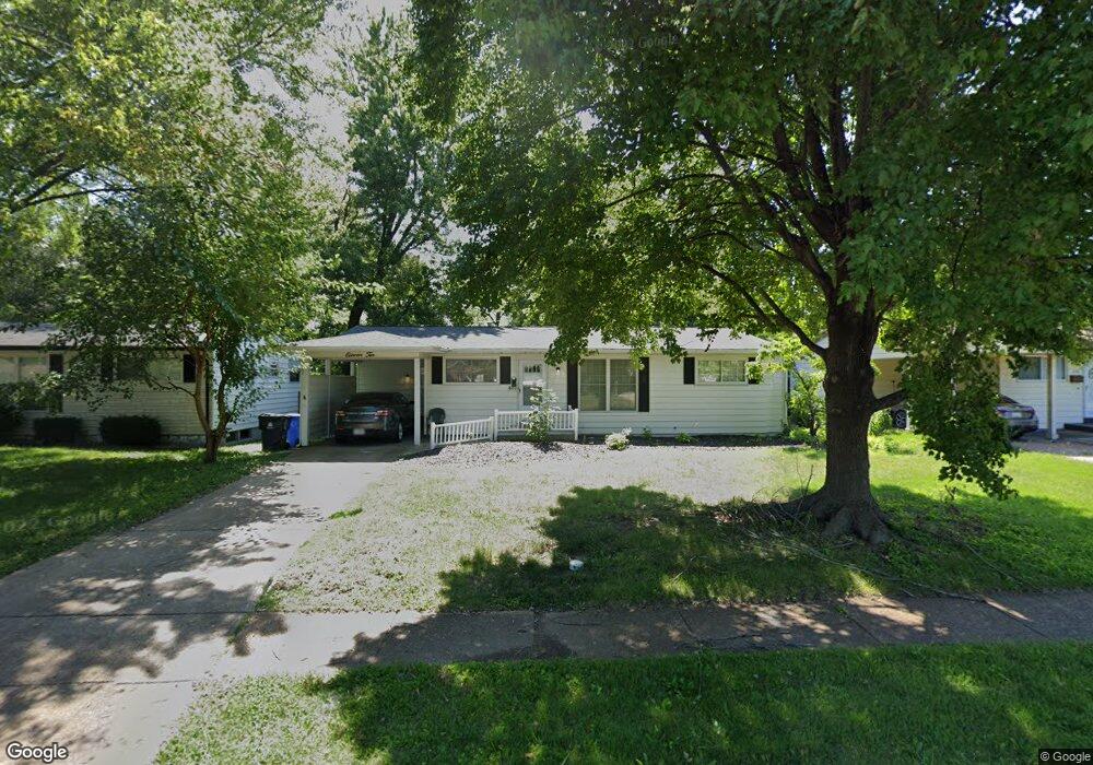
1110 Verlene Dr Florissant, MO 63031
Estimated Value: $175,000 - $212,000
3
Beds
2
Baths
1,188
Sq Ft
$155/Sq Ft
Est. Value
About This Home
This home is located at 1110 Verlene Dr, Florissant, MO 63031 and is currently estimated at $184,285, approximately $155 per square foot. 1110 Verlene Dr is a home located in St. Louis County with nearby schools including Walker Elementary School, Northwest Middle School, and Hazelwood West High School.
Ownership History
Date
Name
Owned For
Owner Type
Purchase Details
Closed on
Aug 3, 2018
Sold by
Rex Residential Property Owner Llc
Bought by
Conrex Residential Property Group 2016
Current Estimated Value
Purchase Details
Closed on
May 24, 2018
Sold by
Venus Properties Lc
Bought by
Kt Holdings Llc
Purchase Details
Closed on
May 8, 2013
Sold by
Johnson Erin M and Johnson Michael
Bought by
Venus Properties Lc
Purchase Details
Closed on
Mar 19, 2002
Sold by
Mcguire Margaret R
Bought by
Johnson Michael and Johnson Erin M
Home Financials for this Owner
Home Financials are based on the most recent Mortgage that was taken out on this home.
Original Mortgage
$95,714
Interest Rate
6.87%
Mortgage Type
FHA
Purchase Details
Closed on
Jun 23, 2000
Sold by
Mcguire Margaret R
Bought by
Mcguire Charles E and Mcguire Carl B
Create a Home Valuation Report for This Property
The Home Valuation Report is an in-depth analysis detailing your home's value as well as a comparison with similar homes in the area
Home Values in the Area
Average Home Value in this Area
Purchase History
| Date | Buyer | Sale Price | Title Company |
|---|---|---|---|
| Conrex Residential Property Group 2016 | -- | Os National Llc | |
| Kt Holdings Llc | -- | Old Republic National Title | |
| Rex Residential Property Owner Llc | $82,000 | Old Republic National Title | |
| Venus Properties Lc | -- | -- | |
| Venus Properties Lc | -- | -- | |
| Johnson Michael | $96,500 | -- | |
| Mcguire Charles E | -- | -- |
Source: Public Records
Mortgage History
| Date | Status | Borrower | Loan Amount |
|---|---|---|---|
| Previous Owner | Johnson Michael | $95,714 |
Source: Public Records
Tax History Compared to Growth
Tax History
| Year | Tax Paid | Tax Assessment Tax Assessment Total Assessment is a certain percentage of the fair market value that is determined by local assessors to be the total taxable value of land and additions on the property. | Land | Improvement |
|---|---|---|---|---|
| 2025 | $2,608 | $31,850 | $5,420 | $26,430 |
| 2024 | $2,608 | $29,180 | $2,770 | $26,410 |
| 2023 | $2,605 | $29,180 | $2,770 | $26,410 |
| 2022 | $2,134 | $21,250 | $3,100 | $18,150 |
| 2021 | $2,079 | $21,250 | $3,100 | $18,150 |
| 2020 | $1,925 | $18,500 | $2,770 | $15,730 |
| 2019 | $1,896 | $18,500 | $2,770 | $15,730 |
| 2018 | $1,646 | $14,740 | $2,790 | $11,950 |
| 2017 | $1,644 | $14,740 | $2,790 | $11,950 |
| 2016 | $1,603 | $14,170 | $2,410 | $11,760 |
| 2015 | $1,569 | $14,170 | $2,410 | $11,760 |
| 2014 | $1,842 | $17,190 | $3,000 | $14,190 |
Source: Public Records
Map
Nearby Homes
- 1150 Verlene Dr
- 1120 Bluebird Dr
- 915 Iris Dr
- 1155 Mullanphy Rd
- 1395 Bluebird Dr
- 890 Tyson Dr
- 2186 Aristocrat Dr
- 1505 Swallow Ln
- 2255 Collier Dr
- 1415 Boulder Dr
- 685 Mullanphy Rd
- 660 Crabapple Ln
- 1075 Lees Ln
- 6 Charlotte Dr
- 25 Hammes Dr
- 1445 Vesper Dr
- 2040 Splendor Dr
- 665 Redwing Dr
- 670 Starlet Dr
- 1700 Patterson Rd
- 1130 Verlene Dr
- 1080 Verlene Dr
- 1125 Bluebird Dr
- 1115 Bluebird Dr
- 1135 Bluebird Dr
- 1115 Verlene Dr
- 1105 Bluebird Dr
- 1085 Verlene Dr
- 1040 Verlene Dr
- 1170 Verlene Dr
- 1065 Verlene Dr
- 1145 Bluebird Dr
- 1800 Don Donna Dr
- 1790 Aspen Dr
- 1045 Verlene Dr
- 1020 Verlene Dr
- 1180 Verlene Dr
- 1806 Don Donna Dr
- 1155 Bluebird Dr
- 1175 Verlene Dr