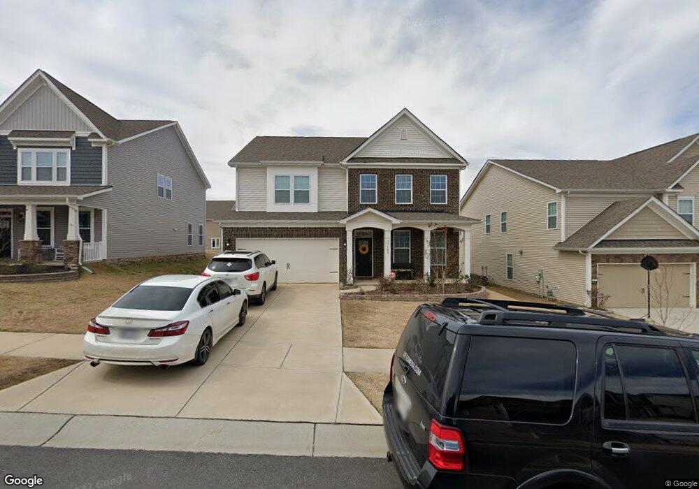
11100 River Oaks Dr NW Unit 379 Concord, NC 28027
Estimated Value: $592,000 - $637,000
5
Beds
3
Baths
3,130
Sq Ft
$194/Sq Ft
Est. Value
About This Home
This home is located at 11100 River Oaks Dr NW Unit 379, Concord, NC 28027 and is currently estimated at $606,445, approximately $193 per square foot. 11100 River Oaks Dr NW Unit 379 is a home located in Cabarrus County with nearby schools including W.R. Odell Elementary School, Harris Road Middle, and Cox Mill High School.
Ownership History
Date
Name
Owned For
Owner Type
Purchase Details
Closed on
Jun 6, 2017
Sold by
Gadd Daniel J and Gadd Ruth D
Bought by
Hilton Bayi and Ortiz Sarah
Current Estimated Value
Home Financials for this Owner
Home Financials are based on the most recent Mortgage that was taken out on this home.
Original Mortgage
$315,400
Interest Rate
4.02%
Mortgage Type
New Conventional
Purchase Details
Closed on
Apr 12, 2012
Sold by
Hilton Bayi and Hilton Sarah
Bought by
Patel Rakeshkumar and Patel Tejal
Home Financials for this Owner
Home Financials are based on the most recent Mortgage that was taken out on this home.
Original Mortgage
$346,400
Interest Rate
2.9%
Mortgage Type
New Conventional
Create a Home Valuation Report for This Property
The Home Valuation Report is an in-depth analysis detailing your home's value as well as a comparison with similar homes in the area
Home Values in the Area
Average Home Value in this Area
Purchase History
| Date | Buyer | Sale Price | Title Company |
|---|---|---|---|
| Hilton Bayi | $332,000 | None Available | |
| Patel Rakeshkumar | $440,000 | None Available |
Source: Public Records
Mortgage History
| Date | Status | Borrower | Loan Amount |
|---|---|---|---|
| Previous Owner | Hilton Bayi | $315,400 | |
| Previous Owner | Patel Rakeshkumar | $346,400 |
Source: Public Records
Tax History Compared to Growth
Tax History
| Year | Tax Paid | Tax Assessment Tax Assessment Total Assessment is a certain percentage of the fair market value that is determined by local assessors to be the total taxable value of land and additions on the property. | Land | Improvement |
|---|---|---|---|---|
| 2025 | $5,763 | $578,650 | $110,000 | $468,650 |
| 2024 | $5,763 | $578,650 | $110,000 | $468,650 |
| 2023 | $4,475 | $366,830 | $70,000 | $296,830 |
| 2022 | $4,475 | $366,830 | $70,000 | $296,830 |
| 2021 | $4,475 | $366,830 | $70,000 | $296,830 |
| 2020 | $4,475 | $366,830 | $70,000 | $296,830 |
| 2019 | $3,812 | $312,490 | $53,000 | $259,490 |
| 2018 | $3,750 | $312,490 | $53,000 | $259,490 |
| 2017 | $3,687 | $312,490 | $53,000 | $259,490 |
Source: Public Records
Map
Nearby Homes
- 10837 Dry Stone Dr
- 1325 Grantwood Ave NW
- 16308 Poplar Tent Rd
- 15700 Poplar Tent Rd
- 10600 Davidson Hwy
- 10684 Skipping Rock Ln NW
- 9691 Moss Plantation Ave NW
- 2275 Laurens Dr
- 2274 Laurens Dr
- 1484 Haverford Rd NW
- 1576 Bay Meadows Ave NW
- 1595 Bay Meadows Ave NW
- 9608 Indian Beech Ave NW
- 9711 Marquette St NW
- 17425 Closest Pin Dr
- 709 Hope St
- 1423 Napa St NW
- 1648 Apple Tree Place NW
- 9593 Valencia Ave NW
- 9611 Marquette St NW
- 11100 River Oaks Dr NW
- 11096 River Oaks Dr NW
- 11096 River Oaks Dr NW Unit 378
- 11104 River Oaks Dr NW
- 11092 River Oaks Dr NW Unit 372
- 11092 River Oaks Dr NW Unit 377
- 11108 River Oaks Dr NW Unit 381
- 1458 Skygrove Place NW
- 1458 Skygrove Place NW Unit 391
- 1454 Skygrove Place NW
- 1462 Skygrove Place NW Unit 392
- 11105 River Oaks Dr NW
- 11101 River Oaks Dr NW
- 11112 River Oaks Dr NW Unit 382
- 11088 River Oaks Dr NW
- 1450 Skygrove Place NW
- 11097 River Oaks Dr NW Unit 361
- 1397 River Oaks Dr NW Unit 257
- 11091 River Oaks Dr NW
- 11091 River Oaks Dr NW Unit 362