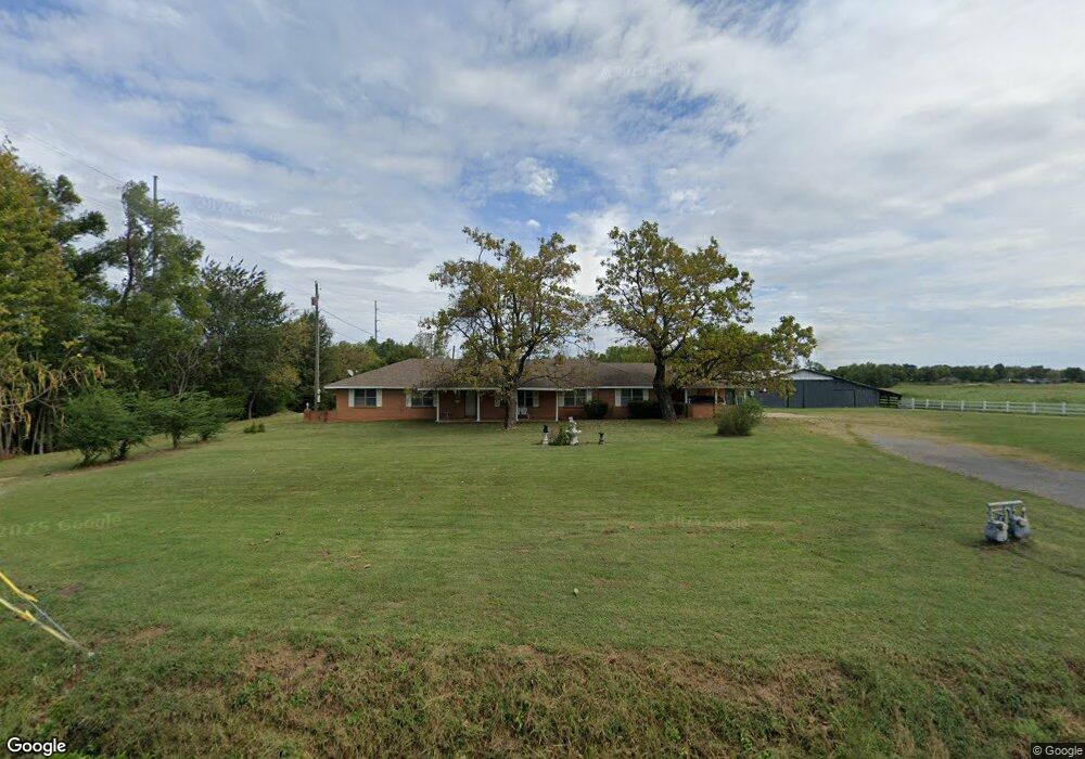
111047 S 4760 Rd Muldrow, OK 74948
Estimated Value: $229,000 - $317,000
3
Beds
3
Baths
2,296
Sq Ft
$123/Sq Ft
Est. Value
About This Home
This home is located at 111047 S 4760 Rd, Muldrow, OK 74948 and is currently estimated at $281,373, approximately $122 per square foot. 111047 S 4760 Rd is a home located in Sequoyah County with nearby schools including Roland Middle School and Roland High School.
Ownership History
Date
Name
Owned For
Owner Type
Purchase Details
Closed on
Feb 9, 2007
Sold by
George Tony F and George Deann
Bought by
George Prte and George Melab F
Current Estimated Value
Purchase Details
Closed on
Sep 12, 2003
Sold by
George Melba and George Pete
Bought by
George Melba Pete and George Toby
Purchase Details
Closed on
Sep 11, 2003
Sold by
Lubbe Virginia A
Bought by
George Melba F
Create a Home Valuation Report for This Property
The Home Valuation Report is an in-depth analysis detailing your home's value as well as a comparison with similar homes in the area
Home Values in the Area
Average Home Value in this Area
Purchase History
| Date | Buyer | Sale Price | Title Company |
|---|---|---|---|
| George Prte | -- | None Available | |
| George Melba Pete | -- | -- | |
| George Melba F | -- | -- |
Source: Public Records
Tax History Compared to Growth
Tax History
| Year | Tax Paid | Tax Assessment Tax Assessment Total Assessment is a certain percentage of the fair market value that is determined by local assessors to be the total taxable value of land and additions on the property. | Land | Improvement |
|---|---|---|---|---|
| 2024 | $1,373 | $14,708 | $2,660 | $12,048 |
| 2023 | $1,309 | $14,008 | $2,660 | $11,348 |
| 2022 | $1,177 | $13,341 | $2,660 | $10,681 |
| 2021 | $1,132 | $12,705 | $2,662 | $10,043 |
| 2020 | $1,156 | $12,705 | $2,662 | $10,043 |
| 2019 | $1,173 | $12,885 | $2,606 | $10,279 |
| 2018 | $1,027 | $12,272 | $2,438 | $9,834 |
| 2017 | $996 | $11,688 | $2,286 | $9,402 |
| 2016 | $936 | $11,131 | $2,140 | $8,991 |
| 2015 | $909 | $11,065 | $2,373 | $8,692 |
| 2014 | $867 | $10,538 | $2,226 | $8,312 |
Source: Public Records
Map
Nearby Homes
- 0 N Cottonwood Rd
- 2000 N Cottonwood Rd
- 111182 S 4760 Rd
- 110907 S 4760 Rd
- 320 Neal Dr
- 111587 S 4760 Rd
- 407 W Ray Fine Blvd
- 405 W Ray Fine Blvd
- 400 W Ray Fine Blvd
- TBD W Ray Fine Blvd
- 404 W Ray Fine Blvd
- 110662 S 4750 Rd
- 113 Cherokee Blvd
- 0000 Cottonwood Rd
- 511 Mayfield Dr
- TBD U S Highway 64
- 505 Mayfield Dr
- 200 S Jeff Ln
- 475495 E 1130 Rd
- 910 James St
- 475962 E 1111 Rd
- 111058 S 4760 Rd
- 111183 S 4760 Rd
- 0 S Cottonwood Rd
- 111158 S 4760 Rd
- 1000 N Cottonwood Rd
- 2904 E Shawntel Smith Blvd
- 475963 E 1111 Rd
- 2900 E Shawntel Smith Blvd
- Tract 3 E 1112 Rd
- 111235 S 4760 Rd
- 111235 S 4759 Rd
- 111234 S 4760 Rd
- 795 W Ray Fine Blvd
- 2809 E Shawntel Smith Blvd
- 111273 S 4760 Rd
- 475803 E 1112 Rd
- 110859 S 4760 Rd
- 111285 S 4760 Rd
- 475855 E 1112 Rd