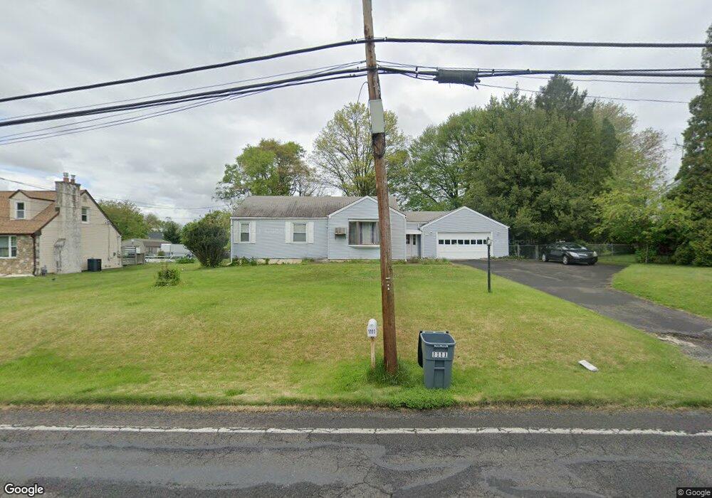
1111 Brownsville Rd Langhorne, PA 19047
Estimated Value: $384,000 - $402,000
2
Beds
1
Bath
1,068
Sq Ft
$367/Sq Ft
Est. Value
About This Home
This home is located at 1111 Brownsville Rd, Langhorne, PA 19047 and is currently estimated at $392,418, approximately $367 per square foot. 1111 Brownsville Rd is a home located in Bucks County with nearby schools including Tawanka Elementary School, Maple Point Middle School, and Neshaminy High School.
Ownership History
Date
Name
Owned For
Owner Type
Purchase Details
Closed on
May 22, 1998
Sold by
Fresolone Marian
Bought by
Casper Richard A and Casper Anne Marie
Current Estimated Value
Home Financials for this Owner
Home Financials are based on the most recent Mortgage that was taken out on this home.
Original Mortgage
$117,000
Outstanding Balance
$22,762
Interest Rate
7.05%
Estimated Equity
$369,656
Purchase Details
Closed on
Aug 28, 1978
Bought by
Fresolone Joseph J and Fresolone Marian
Create a Home Valuation Report for This Property
The Home Valuation Report is an in-depth analysis detailing your home's value as well as a comparison with similar homes in the area
Home Values in the Area
Average Home Value in this Area
Purchase History
| Date | Buyer | Sale Price | Title Company |
|---|---|---|---|
| Casper Richard A | $130,000 | -- | |
| Fresolone Joseph J | $48,000 | -- |
Source: Public Records
Mortgage History
| Date | Status | Borrower | Loan Amount |
|---|---|---|---|
| Open | Casper Richard A | $117,000 |
Source: Public Records
Tax History Compared to Growth
Tax History
| Year | Tax Paid | Tax Assessment Tax Assessment Total Assessment is a certain percentage of the fair market value that is determined by local assessors to be the total taxable value of land and additions on the property. | Land | Improvement |
|---|---|---|---|---|
| 2025 | $4,354 | $20,000 | $5,600 | $14,400 |
| 2024 | $4,354 | $20,000 | $5,600 | $14,400 |
| 2023 | $4,285 | $20,000 | $5,600 | $14,400 |
| 2022 | $4,172 | $20,000 | $5,600 | $14,400 |
| 2021 | $4,172 | $20,000 | $5,600 | $14,400 |
| 2020 | $4,122 | $20,000 | $5,600 | $14,400 |
| 2019 | $4,030 | $20,000 | $5,600 | $14,400 |
| 2018 | $3,956 | $20,000 | $5,600 | $14,400 |
| 2017 | $3,855 | $20,000 | $5,600 | $14,400 |
| 2016 | $3,855 | $20,000 | $5,600 | $14,400 |
| 2015 | $4,045 | $20,000 | $5,600 | $14,400 |
| 2014 | $4,045 | $20,000 | $5,600 | $14,400 |
Source: Public Records
Map
Nearby Homes
- 1210 Brownsville Rd
- 166 N Hawthorne Ave
- 1021 W Maple Ave
- 13 Golf Club Dr
- 225 Playwicki St
- 449 Grand Ave
- 230 Playwicki St
- 257 Wisteria Ave
- 308 W Richardson Ave
- 565 Hulmeville Rd
- 710 Fox Ct
- 523 Turtle Ln
- 1605 Old Lincoln Hwy
- 1420 Super Hwy
- 2816 Avenue E
- 2823 Avenue E
- 1516 Fairview Ave
- 2623 Sunnyside Ave
- 0 Prospect Ave
- 739 Bridgeview Rd
- 1045 Brownsville Rd
- 1123 Brownsville Rd
- 121 N Hawthorne Ave
- 1044 Broadview Ave
- 1108 Broadview Ave
- 1034 Broadview Ave
- 1031 Brownsville Rd
- 111 N Hawthorne Ave
- 131 N Hawthorne Ave
- 1118 Broadview Ave
- 141 N Hawthorne Ave
- 1024 Broadview Ave
- 118 Colonial Dr
- 1114 Brownsville Rd
- 1122 Brownsville Rd
- 159 N Hawthorne Ave
- 1014 Broadview Ave
- 110 Colonial Dr
- 87 S Hawthorne Ave
- 1017 Brownsville Rd