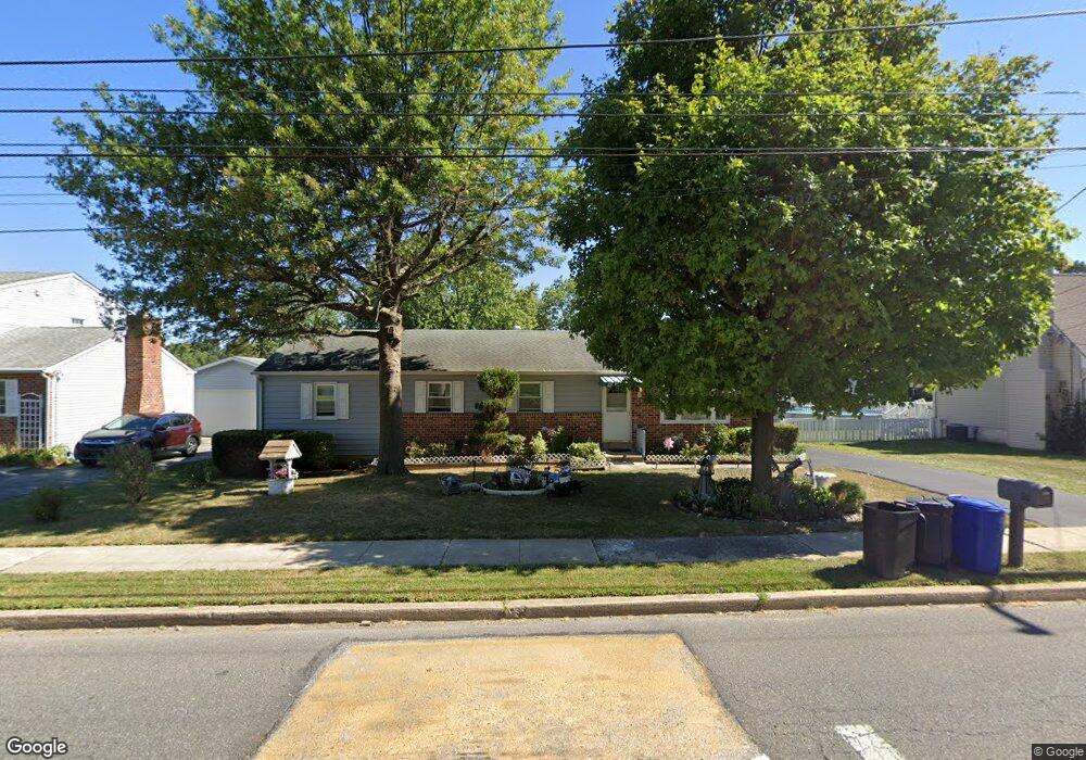
1111 Cherry Tree Rd Aston, PA 19014
Estimated Value: $369,331 - $395,000
3
Beds
3
Baths
1,400
Sq Ft
$275/Sq Ft
Est. Value
About This Home
This home is located at 1111 Cherry Tree Rd, Aston, PA 19014 and is currently estimated at $385,333, approximately $275 per square foot. 1111 Cherry Tree Rd is a home located in Delaware County with nearby schools including Chester Charter School for the Arts.
Ownership History
Date
Name
Owned For
Owner Type
Purchase Details
Closed on
Jul 29, 1994
Sold by
Deantonio Joseph J and Deantonio Karen
Bought by
Rhoads E James and Rhoads Sandra
Current Estimated Value
Home Financials for this Owner
Home Financials are based on the most recent Mortgage that was taken out on this home.
Original Mortgage
$121,400
Interest Rate
7.37%
Mortgage Type
Purchase Money Mortgage
Create a Home Valuation Report for This Property
The Home Valuation Report is an in-depth analysis detailing your home's value as well as a comparison with similar homes in the area
Home Values in the Area
Average Home Value in this Area
Purchase History
| Date | Buyer | Sale Price | Title Company |
|---|---|---|---|
| Rhoads E James | $134,900 | T A Title Insurance Company |
Source: Public Records
Mortgage History
| Date | Status | Borrower | Loan Amount |
|---|---|---|---|
| Closed | Rhoads E James | $121,400 |
Source: Public Records
Tax History
| Year | Tax Paid | Tax Assessment Tax Assessment Total Assessment is a certain percentage of the fair market value that is determined by local assessors to be the total taxable value of land and additions on the property. | Land | Improvement |
|---|---|---|---|---|
| 2025 | $5,424 | $209,030 | $76,530 | $132,500 |
| 2024 | $5,424 | $209,030 | $76,530 | $132,500 |
| 2023 | $5,181 | $209,030 | $76,530 | $132,500 |
| 2022 | $4,996 | $209,030 | $76,530 | $132,500 |
| 2021 | $7,710 | $209,030 | $76,530 | $132,500 |
| 2020 | $5,245 | $128,420 | $36,650 | $91,770 |
| 2019 | $5,144 | $128,420 | $36,650 | $91,770 |
| 2018 | $4,926 | $128,420 | $0 | $0 |
| 2017 | $4,821 | $128,420 | $0 | $0 |
| 2016 | $705 | $128,420 | $0 | $0 |
| 2015 | $719 | $128,420 | $0 | $0 |
| 2014 | $705 | $128,420 | $0 | $0 |
Source: Public Records
Map
Nearby Homes
- 8 Eusden Dr
- 4301 Aston Mills Rd
- 3921 Concord Rd
- 810 Maple Ln
- 565 Applewood Ct
- 708 Heather Ln
- 29 Hoag Ln
- 887 Red Hill Rd
- 414 Dogwood Cir Unit 30
- 4104 Kates Glen
- 43 Morgan Rd
- 70 Weathervane Rd
- 147 Third Ave
- 4701 Pennell Rd Unit A12
- 4701 Pennell Rd Unit J11
- 4701 Pennell Rd Unit F7
- 4701 Pennell Rd Unit H3
- 184 Fifth Ave
- 182 Fifth Ave
- 216 Park Dr
- 1121 Cherry Tree Rd
- 1101 Cherry Tree Rd
- 36 Connie Ln
- 1131 Cherry Tree Rd
- 40 Connie Ln
- 32 Connie Ln
- 44 Connie Ln
- 1141 Cherry Tree Rd
- 1051 Cherry Tree Rd
- 1 Scott Ln
- 48 Connie Ln
- 5 Scott Ln
- 1151 Cherry Tree Rd
- 52 Connie Ln
- 9 Scott Ln
- 37 Connie Ln
- 33 Connie Ln
- 1161 Cherry Tree Rd
- 13 Scott Ln
- 45 Connie Ln
Your Personal Tour Guide
Ask me questions while you tour the home.