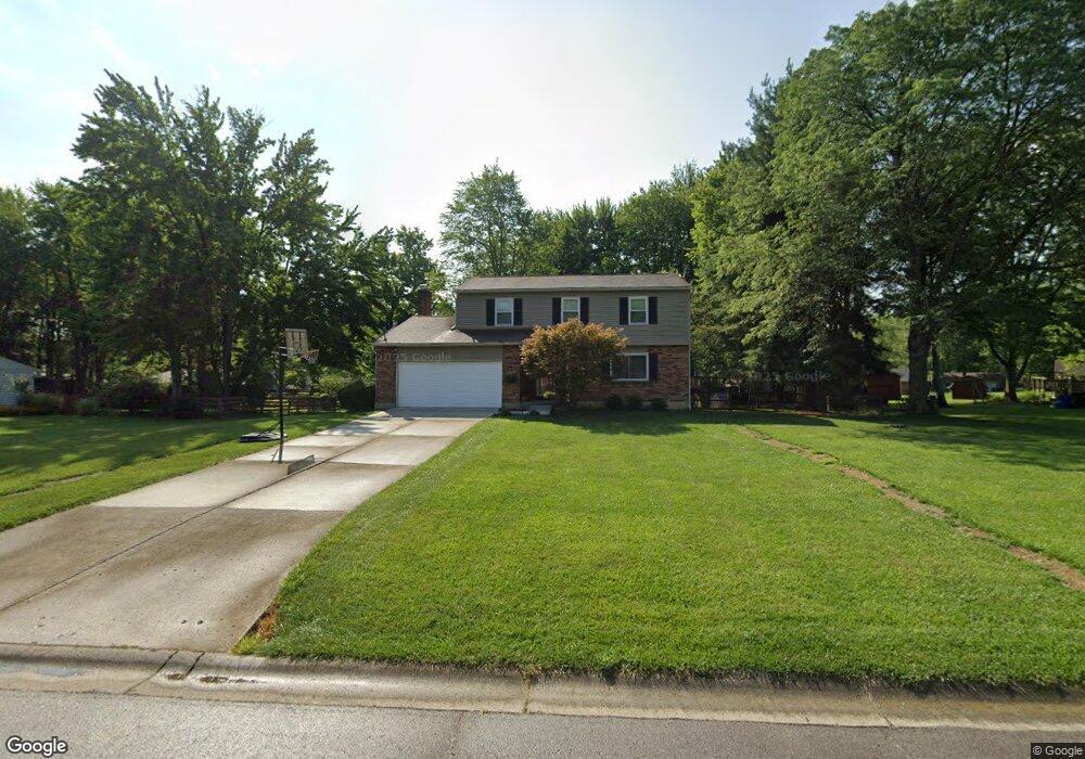
1111 Deerhaven Ct Loveland, OH 45140
Outer Loveland NeighborhoodEstimated Value: $371,945 - $468,000
4
Beds
3
Baths
1,856
Sq Ft
$229/Sq Ft
Est. Value
About This Home
This home is located at 1111 Deerhaven Ct, Loveland, OH 45140 and is currently estimated at $425,736, approximately $229 per square foot. 1111 Deerhaven Ct is a home located in Clermont County with nearby schools including Milford Senior High School, Milford Christian Academy, and St. Andrew - St. Elizabeth Ann Seton School.
Ownership History
Date
Name
Owned For
Owner Type
Purchase Details
Closed on
Apr 7, 1999
Sold by
Maxwell Keith E
Bought by
Ruesink William J
Current Estimated Value
Home Financials for this Owner
Home Financials are based on the most recent Mortgage that was taken out on this home.
Original Mortgage
$130,150
Outstanding Balance
$32,682
Interest Rate
6.94%
Mortgage Type
New Conventional
Estimated Equity
$393,054
Purchase Details
Closed on
Oct 2, 1984
Create a Home Valuation Report for This Property
The Home Valuation Report is an in-depth analysis detailing your home's value as well as a comparison with similar homes in the area
Home Values in the Area
Average Home Value in this Area
Purchase History
| Date | Buyer | Sale Price | Title Company |
|---|---|---|---|
| Ruesink William J | $137,000 | -- | |
| -- | $84,000 | -- |
Source: Public Records
Mortgage History
| Date | Status | Borrower | Loan Amount |
|---|---|---|---|
| Open | Ruesink William J | $130,150 |
Source: Public Records
Tax History Compared to Growth
Tax History
| Year | Tax Paid | Tax Assessment Tax Assessment Total Assessment is a certain percentage of the fair market value that is determined by local assessors to be the total taxable value of land and additions on the property. | Land | Improvement |
|---|---|---|---|---|
| 2024 | $4,104 | $88,700 | $19,430 | $69,270 |
| 2023 | $4,146 | $88,700 | $19,430 | $69,270 |
| 2022 | $2,157 | $67,100 | $14,700 | $52,400 |
| 2021 | $4,111 | $67,100 | $14,700 | $52,400 |
| 2020 | $3,942 | $67,100 | $14,700 | $52,400 |
| 2019 | $3,637 | $58,630 | $12,990 | $45,640 |
| 2018 | $3,638 | $58,630 | $12,990 | $45,640 |
| 2017 | $3,396 | $58,630 | $12,990 | $45,640 |
| 2016 | $3,460 | $50,540 | $11,200 | $39,340 |
| 2015 | $3,168 | $50,540 | $11,200 | $39,340 |
| 2014 | $3,168 | $50,540 | $11,200 | $39,340 |
| 2013 | $3,267 | $50,540 | $12,250 | $38,290 |
Source: Public Records
Map
Nearby Homes
- 6149 Century Farm Dr
- 6141 Brandywine Ct
- 6211 Spires Dr
- 1124 Clover Field Dr
- 1803 Wheatfield Way
- 1064 Weber Rd
- 1113 Clover Field Dr
- 2013 Weber Rd
- 6320 Ashford Dr
- 6211 Cook Rd
- 1140 Weber Rd
- 6077 Branch Hill Guinea Pike
- 5933 Firm Stance Dr
- 6108 Donna Jay Dr
- 1513 Charleston Ln
- 1285 State Rte 28
- 1706 Cottontail Dr
- 6379 Derbyshire Ln
- 1289 Woodville Pike
- 1376 Barre Ln
- 1109 Deerhaven Ct
- 1117 Deerhaven Ct
- 6124 Doe Ct
- 82 Deerhaven Ct
- 1114 Deerhaven Ct
- 6128 Doe Ct
- 1112 Deerhaven Ct
- 6122 Doe Ct
- 1116 Deerhaven Ct
- 6130 Doe Ct
- 1110 Deerhaven Ct
- 6132 Doe Ct
- 1118 Deerhaven Ct
- 6113 Doe Ct
- 6134 Doe Ct
- 1120 Deerhaven Ct
- 6119 Doe Ct
- 6117 Doe Ct
- 1121 Deerhaven Ct
- 1123 Deerhaven Ct