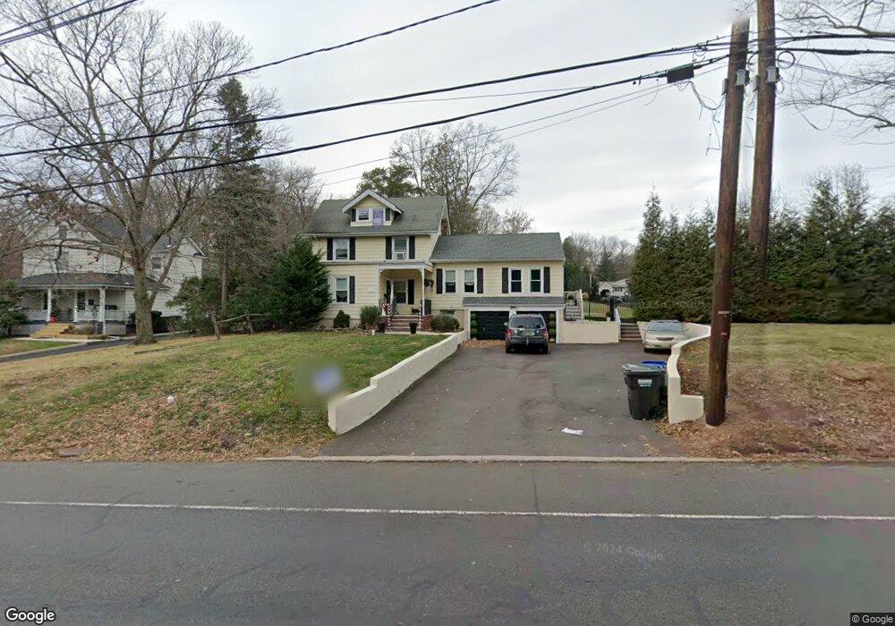
1111 E Broad St Westfield, NJ 07090
Estimated Value: $946,000 - $1,137,000
4
Beds
3
Baths
2,286
Sq Ft
$441/Sq Ft
Est. Value
About This Home
This home is located at 1111 E Broad St, Westfield, NJ 07090 and is currently estimated at $1,008,900, approximately $441 per square foot. 1111 E Broad St is a home located in Union County with nearby schools including Wilson Elementary School, Roosevelt Intermediate School, and Westfield Senior High School.
Ownership History
Date
Name
Owned For
Owner Type
Purchase Details
Closed on
Nov 7, 2011
Sold by
Crawford Christopher M
Bought by
1111 East Broad Street Properties Llc
Current Estimated Value
Home Financials for this Owner
Home Financials are based on the most recent Mortgage that was taken out on this home.
Original Mortgage
$100,000
Interest Rate
3.92%
Mortgage Type
Purchase Money Mortgage
Create a Home Valuation Report for This Property
The Home Valuation Report is an in-depth analysis detailing your home's value as well as a comparison with similar homes in the area
Home Values in the Area
Average Home Value in this Area
Purchase History
| Date | Buyer | Sale Price | Title Company |
|---|---|---|---|
| 1111 East Broad Street Properties Llc | $315,000 | None Available |
Source: Public Records
Mortgage History
| Date | Status | Borrower | Loan Amount |
|---|---|---|---|
| Closed | 1111 East Broad Street Properties Llc | $100,000 |
Source: Public Records
Tax History Compared to Growth
Tax History
| Year | Tax Paid | Tax Assessment Tax Assessment Total Assessment is a certain percentage of the fair market value that is determined by local assessors to be the total taxable value of land and additions on the property. | Land | Improvement |
|---|---|---|---|---|
| 2025 | $13,174 | $585,000 | $430,700 | $154,300 |
| 2024 | $12,905 | $585,000 | $430,700 | $154,300 |
| 2023 | $12,905 | $585,000 | $430,700 | $154,300 |
| 2022 | $12,636 | $585,000 | $430,700 | $154,300 |
| 2021 | $12,654 | $585,000 | $430,700 | $154,300 |
| 2020 | $12,624 | $585,000 | $430,700 | $154,300 |
| 2019 | $12,578 | $585,000 | $430,700 | $154,300 |
| 2018 | $13,704 | $147,400 | $83,000 | $64,400 |
| 2017 | $13,629 | $147,400 | $83,000 | $64,400 |
| 2016 | $13,309 | $147,400 | $83,000 | $64,400 |
| 2015 | $13,043 | $147,400 | $83,000 | $64,400 |
| 2014 | $12,613 | $147,400 | $83,000 | $64,400 |
Source: Public Records
Map
Nearby Homes
- 46 B Sandra Cir Unit 4
- 52b Sandra Cir Unit 2B
- 58 B Sandra Cir Unit 1
- 820 E Broad St
- 529 Benson Place
- 1102 Park Place
- 484 4th Ave Unit 9
- 401 Brookside Place
- 1906 Park Place
- 814 Springfield Ave
- 500 Maple Ct Unit 500
- 21 Spruce St
- 170 New Providence Rd
- 11 Mountainview Dr
- 19 Berkeley Place
- 272 Old Tote Rd
- 8 Venetia Ave
- 318 Myrtle Ave
- 415 Myrtle Ave
- 740 Lawrence Ave