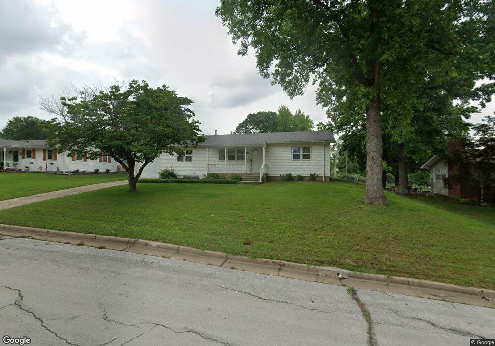
1111 Euclid Blvd Carthage, MO 64836
Estimated Value: $211,000 - $246,000
--
Bed
1
Bath
1,260
Sq Ft
$178/Sq Ft
Est. Value
About This Home
This home is located at 1111 Euclid Blvd, Carthage, MO 64836 and is currently estimated at $224,748, approximately $178 per square foot. 1111 Euclid Blvd is a home located in Jasper County with nearby schools including Carthage High School, St. Ann's Catholic School, and Victory Academy.
Ownership History
Date
Name
Owned For
Owner Type
Purchase Details
Closed on
Jul 21, 2011
Sold by
Samuels Robert
Bought by
Mitchell Maynard and Mitchell Alice
Current Estimated Value
Purchase Details
Closed on
Jun 27, 2007
Sold by
Samuels Debra
Bought by
Samuels Robert
Home Financials for this Owner
Home Financials are based on the most recent Mortgage that was taken out on this home.
Original Mortgage
$102,600
Interest Rate
6.19%
Mortgage Type
Purchase Money Mortgage
Create a Home Valuation Report for This Property
The Home Valuation Report is an in-depth analysis detailing your home's value as well as a comparison with similar homes in the area
Home Values in the Area
Average Home Value in this Area
Purchase History
| Date | Buyer | Sale Price | Title Company |
|---|---|---|---|
| Mitchell Maynard | -- | Abbey | |
| Samuels Robert | -- | Jct |
Source: Public Records
Mortgage History
| Date | Status | Borrower | Loan Amount |
|---|---|---|---|
| Previous Owner | Samuels Robert | $102,600 |
Source: Public Records
Tax History Compared to Growth
Tax History
| Year | Tax Paid | Tax Assessment Tax Assessment Total Assessment is a certain percentage of the fair market value that is determined by local assessors to be the total taxable value of land and additions on the property. | Land | Improvement |
|---|---|---|---|---|
| 2025 | $1,096 | $23,840 | $3,730 | $20,110 |
| 2024 | $1,096 | $21,290 | $3,730 | $17,560 |
| 2023 | $1,096 | $21,290 | $3,730 | $17,560 |
| 2022 | $967 | $18,850 | $3,730 | $15,120 |
| 2021 | $957 | $18,850 | $3,730 | $15,120 |
| 2020 | $928 | $17,520 | $3,730 | $13,790 |
| 2019 | $929 | $17,520 | $3,730 | $13,790 |
| 2018 | $890 | $16,820 | $0 | $0 |
| 2017 | $892 | $16,820 | $0 | $0 |
| 2016 | $889 | $16,820 | $0 | $0 |
| 2015 | $822 | $16,820 | $0 | $0 |
| 2014 | $822 | $16,820 | $0 | $0 |
Source: Public Records
Map
Nearby Homes
- xxxx Lilac Ln
- 1131 Belle Air Place
- 1647 Glenwood Place
- 1012 Euclid Blvd
- 839 Euclid Blvd
- 1106 Southern Hills
- 1743 S River St
- 824 Euclid Blvd
- 1328 Sunrise Dr
- 1814 Buena Vista Ave
- 1242 Sheila Ann Dr
- 1244 Glenwood Place
- 1005 E 13th St
- 1230 Sheila Ann Dr
- 702 E Centennial Ave
- 1922 Southwood Ln
- 1448 Quail Place
- 1910 Wynwood Dr
- 2032 Alison St
- 2141 Carrie St
- 1117 Euclid Blvd
- 1105 Euclid Blvd
- 1618 Lilac Ln
- 1621 Pearl St
- 1125 Euclid Blvd
- 1614 Lilac Ln
- 1110 Euclid Blvd
- 1120 Euclid Blvd
- 1100 Euclid Blvd
- 1615 Pearl St
- 1027 Euclid Blvd
- 1608 Lilac Ln
- 1124 Euclid Blvd
- 1026 Euclid Blvd
- 1617 Lilac Ln
- 1605 Pearl St
- 1602 Lilac Ln
- 1019 Euclid Blvd
- 1123 Belle Air Place
- 1207 Euclid Blvd