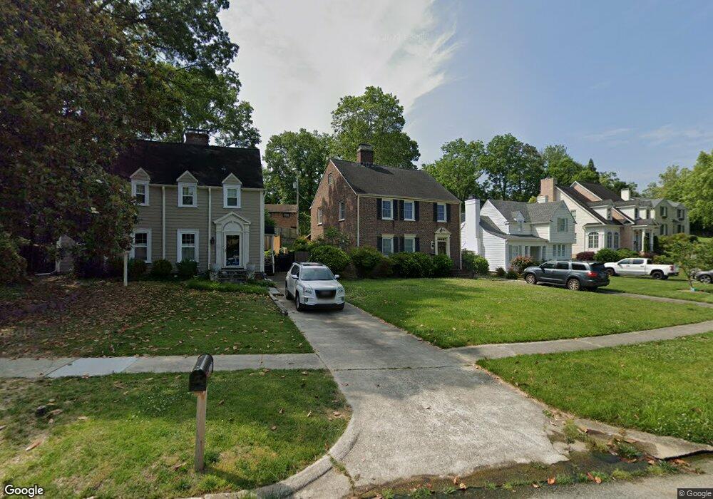
1111 Greenway Dr High Point, NC 27262
Greater High Point NeighborhoodEstimated Value: $363,000 - $462,000
4
Beds
3
Baths
2,378
Sq Ft
$167/Sq Ft
Est. Value
About This Home
This home is located at 1111 Greenway Dr, High Point, NC 27262 and is currently estimated at $397,994, approximately $167 per square foot. 1111 Greenway Dr is a home located in Guilford County with nearby schools including Northwood Elementary School, Ferndale Middle School, and High Point Central High School.
Ownership History
Date
Name
Owned For
Owner Type
Purchase Details
Closed on
Jan 7, 2025
Sold by
Barrineau Jane Lindsay and Barrineau Leon
Bought by
Barrineau Jane Lindsay and Brule Martha Lindsay
Current Estimated Value
Purchase Details
Closed on
Mar 12, 2018
Sold by
Lindsay Mary Jane
Bought by
Lindsay Mary Jane and Barrineau Jane Lindsay
Create a Home Valuation Report for This Property
The Home Valuation Report is an in-depth analysis detailing your home's value as well as a comparison with similar homes in the area
Home Values in the Area
Average Home Value in this Area
Purchase History
| Date | Buyer | Sale Price | Title Company |
|---|---|---|---|
| Barrineau Jane Lindsay | -- | None Listed On Document | |
| Barrineau Jane Lindsay | -- | None Listed On Document | |
| Lindsay Mary Jane | $2,000 | None Available |
Source: Public Records
Tax History
| Year | Tax Paid | Tax Assessment Tax Assessment Total Assessment is a certain percentage of the fair market value that is determined by local assessors to be the total taxable value of land and additions on the property. | Land | Improvement |
|---|---|---|---|---|
| 2025 | $3,216 | $233,400 | $70,000 | $163,400 |
| 2024 | $3,216 | $233,400 | $70,000 | $163,400 |
| 2023 | $3,216 | $233,400 | $70,000 | $163,400 |
| 2022 | $3,146 | $233,400 | $70,000 | $163,400 |
| 2021 | $2,807 | $203,700 | $60,000 | $143,700 |
| 2020 | $2,807 | $203,700 | $60,000 | $143,700 |
| 2019 | $2,807 | $203,700 | $0 | $0 |
| 2018 | $2,793 | $203,700 | $0 | $0 |
| 2017 | $2,807 | $203,700 | $0 | $0 |
| 2016 | $2,717 | $193,700 | $0 | $0 |
| 2015 | $2,731 | $193,700 | $0 | $0 |
| 2014 | $2,778 | $193,700 | $0 | $0 |
Source: Public Records
Map
Nearby Homes
- 1101 Robin Hood Rd
- 427 Woodbrook Dr
- 607 Rockspring Rd
- 443 W Lexington Ave
- 417 Hillcrest Dr
- 510 Otteray Ave
- 708 Rockspring Rd
- 900 W Lexington Ave
- 1311 Prescott Place
- 1508 Wendover Dr
- 1122 Kensington Dr
- 630 Colonial Dr
- 1283 Westminster Dr
- 803 Sunset Dr
- 1700 Long St
- 207 Hillcrest Dr
- 914 Flicker Ln
- 1113 Clyde Place
- 1312 Gilbrook Ct
- 1616 Heathcliff Rd
- 1134 Forest Hill Dr
- 1109 Greenway Dr
- 1132 Forest Hill Dr
- 1105 Greenway Dr
- 1130 Forest Hill Dr
- 1107 Greenway Dr
- 1103 Greenway Dr
- 1106 Forest Hill Dr
- 1301 Greenway Dr
- 1108 Forest Hill Dr
- 1208 Greenway Dr
- 1210 Greenway Dr
- 1104 Forest Hill Dr
- 1206 Greenway Dr
- 1300 Greenway Dr
- 1101 Greenway Dr
- 1309 Greenway Dr
- 1110 Forest Hill Dr
- 1102 Greenway Dr
- 1104 Greenway Dr
Your Personal Tour Guide
Ask me questions while you tour the home.