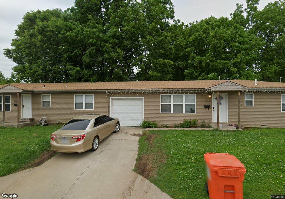
1111 N Newton Ave Springfield, MO 65802
Grant Beach NeighborhoodEstimated Value: $122,000
6
Beds
2
Baths
2,052
Sq Ft
$59/Sq Ft
Est. Value
About This Home
This home is located at 1111 N Newton Ave, Springfield, MO 65802 and is currently priced at $122,000, approximately $59 per square foot. 1111 N Newton Ave is a home located in Greene County with nearby schools including Weaver Elementary School, Pipkin Middle School, and Central High School.
Ownership History
Date
Name
Owned For
Owner Type
Purchase Details
Closed on
May 19, 2017
Sold by
2Tb Holdings Llc
Bought by
Literature Recovery
Current Estimated Value
Purchase Details
Closed on
Mar 15, 2012
Sold by
Liberty Bank
Bought by
2Tb Holding Llc
Home Financials for this Owner
Home Financials are based on the most recent Mortgage that was taken out on this home.
Original Mortgage
$65,000
Interest Rate
3.91%
Mortgage Type
New Conventional
Purchase Details
Closed on
Jul 29, 2005
Sold by
Harris Johnny
Bought by
Whw Investments Inc
Create a Home Valuation Report for This Property
The Home Valuation Report is an in-depth analysis detailing your home's value as well as a comparison with similar homes in the area
Home Values in the Area
Average Home Value in this Area
Purchase History
| Date | Buyer | Sale Price | Title Company |
|---|---|---|---|
| Literature Recovery | -- | None Available | |
| 2Tb Holding Llc | -- | None Available | |
| Whw Investments Inc | -- | None Available |
Source: Public Records
Mortgage History
| Date | Status | Borrower | Loan Amount |
|---|---|---|---|
| Previous Owner | 2Tb Holding Llc | $65,000 |
Source: Public Records
Tax History
| Year | Tax Paid | Tax Assessment Tax Assessment Total Assessment is a certain percentage of the fair market value that is determined by local assessors to be the total taxable value of land and additions on the property. | Land | Improvement |
|---|---|---|---|---|
| 2025 | -- | $0 | $0 | $0 |
| 2024 | -- | $0 | $0 | $0 |
| 2023 | $0 | $0 | $0 | $0 |
| 2022 | $0 | $0 | $0 | $0 |
| 2021 | $0 | $690 | $20 | $670 |
| 2020 | $824 | $0 | $0 | $0 |
| 2019 | $824 | $0 | $0 | $0 |
| 2018 | $0 | $14,910 | $1,690 | $13,220 |
| 2017 | $819 | $15,030 | $1,690 | $13,340 |
| 2016 | $824 | $15,030 | $1,690 | $13,340 |
| 2015 | $816 | $15,030 | $1,690 | $13,340 |
| 2014 | $822 | $15,030 | $1,690 | $13,340 |
Source: Public Records
Map
Nearby Homes
- 918 N Nettleton Ave
- 1129 W Scott St
- 1500 W Hamilton St
- 1521 W Hamilton St
- 1120 W Hamilton St
- 1232 N Farmer Ave
- 1520 W Lynn St
- 1411 W Lynn St
- 1711 W Webster St
- 1139 W Lynn St
- 1735 W Webster St
- 1621 W Chestnut St
- 903 N Lexington Ave
- 920 N Broadway Ave
- 1305 N Irving Ave
- 1447 N Broadway Ave
- 832 W Calhoun St
- 1321 N Wabash Ave
- 1026 W Division St
- 1816 W Chestnut St
- 1109 N Newton Ave
- 1407 W Scott St
- 1411 W Scott St
- 1415 W Scott St
- 1400 W Webster St
- 1406 W Webster St
- 1410 W Webster St
- 1419 W Scott St
- 1416 W Webster St
- 1034 N Newton Ave
- 1027 N Newton Ave
- 1425 W Scott St
- 1425 W Scott St Unit A
- 1412 W Scott St
- 1028 N Newton Ave
- 1420 W Webster St
- 1416 W Scott St
- 1429 W Scott St
- 1021 N Newton Ave
- 1426 W Scott St
Your Personal Tour Guide
Ask me questions while you tour the home.